Thursday, November 14, 2013

Autumn Tree Strategies, I

Lucy of Loose and Leafy has returned to blogging after a summer sabbatical, reminding me that I haven’t posted any news of my two trees this year.  Lucy kindly hosts and encourages a loose-knit group of tree-followers.  She explains, “I've been observing several trees over the last few years, following their progress through the seasons ... an affection grows, an awareness of small things - the presence of lichen, the sudden absence of familiar twigs and branches.”

I like following trees for the same reasons.  I look more closely, point my camera, always learn something.  I joined the group a year ago October, when I introduced a weeping birch (Betula pendula) in my yard.  It’s often very photogenic but that was not its finest moment.
Last October the birch's leaves were few and ragged.
A month later I decided to follow a second tree, a mighty limber pine (Pinus flexilis) growing among huge granite outcrops in the Laramie Mountains.   Its size and rugged form are impressive.
Looks like this limber pine has been through a lot, given all its scars and dead branches.
What have these trees been doing since then?  Let’s start with the birch.


Winter

All winter the birch stood dormant, resting and waiting as it always does.  The branchlets were covered with buds grown last summer, each containing tiny shoots and leaves ready to expand when conditions were right.
The birch's white peeling bark is attractive even in winter.  Note the prominent lenticels, pores for gas exchange.  All trees have them but usually they're not so showy.

Spring

By mid-May, young leaves had emerged from the buds and were expanding, ready to go to work.
What kind of work do leaves do?  They collect sunshine and carbon dioxide, and make carbohydrates for the growing tree.
Leaves are green not for beauty but to capture sunshine via chlorophyll, a green pigment.
Solar-powered tree ramping up production.
Summer

Weeping birch is native to Europe and Asia, and is popular in the USA for landscaping.  It’s very attractive with its white bark and elegant serrated leaves on long drooping branchlets.  Unfortunately this makes it hard to photograph here in windy Wyoming.  Too often it looks like this:
Otto Wilhelm Thomé’s illustration below shows what’s on the flying windblown branchlets:  serrated leaves and young female catkin (flower cluster) top center; male catkin lower right; tiny female flowers with reddish stigmas lower left; male flower with yellow anthers to right of female flowers.  Click on illustration to view details.
Flora von Deutschland, Österreich und der Schweiz, 1885. 

Autumn
Birch prepares to rid itself of potentially-dangerous leaves.
Deciduous trees are famous for their gorgeous leaf colors in fall, but there’s a sordid tale behind the beauty.  In winter a dormant tree won’t need leaves so resources shouldn’t be wasted on them.  Furthermore they’re a liability.  They could trap heavy wet snow and cause branches to break.  So it’s best to get rid of the leaves ... by starving them until they die and fall off!

When nights get sufficiently short, a change comes about in specialized cells at the base of leaf petioles (leaf stems).  Cells in the abscission layer start to thicken and block the flow of nutrients to the leaf.  Chlorophyll can’t be replenished and the green color fades, revealing yellow and orange pigments that have been there all along but obscured by showy chlorophyll.
Green chlorophyll beaks down, revealing yellow xanthophylls and orange carotenoids.
Red fall leaves are puzzling (quaking aspen).
Some fall leaves are red, due to production of anthocyanins.  Why a tree preparing for dormancy would convert valuable carbohydrates to showy red pigments is not clear.  For more, see the US National Arboretum’s excellent webpage on what we know and guess about fall colors:  Science of Color in Autumn Leaves.
Eventually the yellow and orange pigments fade as well, leaving birch leaves in various shades of dull brown.  By now the thickened cells of the abscission layer have lost their cohesiveness.  The leaves break off in wind, rain and snow.  Fortunately there’s also a protective layer in the abscission zone that has developed into a seal against invasion of pests or disease (see diagram above).
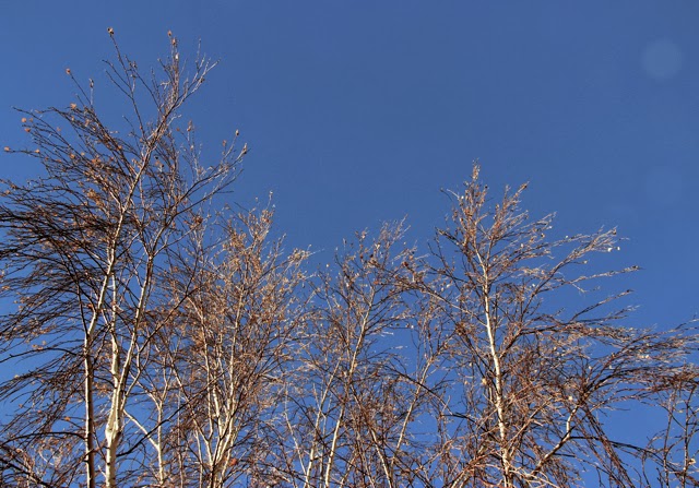
By mid-November the leaves are dead, waiting to fall to the ground or blow away.
Dead birch leaf but also buds -- promise of another spring.

Meanwhile, up in the Laramie Mountains where winter will be even colder and snowier than here in town, the mighty limber pine appears unconcerned.  What's its strategy? We'll look into that in the next post.

I'm following a tree ... are you?
This is the first post in a short series about autumn tree strategies.

Friday, November 8, 2013

Ginkgos and Rhythmites

Our vacation in the flood-ravaged landscapes of the Pacific Northwest came to an end where Interstate Highway 90 crosses Lake Wanapum on the Columbia River.  We had covered only about a third of the distance that the great Ice Age floods had traveled.  But we had no choice, we were out of time.
Route of the Ice Age Floods; red arrow marks the end of our vacation.  Map from the Ice Age Floods Institute; click on photo for closer view.
On the way home we managed to squeeze in two more quick geo-stops.  In hindsight, I see they nicely bracketed the range of time and events underlying the landscapes we had enjoyed so much.

Miocene Trees
From displays at Dry Falls Visitor Center.
It’s fascinating to imagine what a place was like far in the past, when our continent was somewhere else on Earth and the topography was not what it is today (e.g. no Cascade Range).  Of course the climate was very different, as was the vegetation.  Twenty thousand years ago there were lush forests in eastern Washington instead of today’s steppe/grasslands and wheat fields.

Then three million years later came the period of massive volcanism that would cover 64,000 square miles of the Pacific Northwest in lava flows (Columbia River Basalt Group).  It’s thought that some of these flows dammed lakes where dead trees accumulated, or perhaps lahars (mudflows) associated with volcanic eruptions deposited huge piles of dead trees.  In any case, the accumulations were then buried in basalt.  Instead of rotting, the wood was replaced with silica.  Millions of years later erosion exposed the petrified wood for travelers like us to enjoy, as we did during a short visit to Ginkgo Petrified Forest State Park near Vantage, Washington.
Some of the petrified logs look quite real, like this one with its "peeling bark" ...
Here's a nicely-preserved knothole:
We made only a brief stop and didn't take advantage of the trail through petrified logs of many species.  Forty kinds of trees grew in the Miocene Forests here, not just ginkgos.
Ginkgo Petrified Forest State Park --  46.969417° -119.982646°

Interlude

Most of the basalt was produced 17 to 15 million years ago, but activity continued until about six million years ago.  Fast-forward five million years and one would find much of eastern Washington covered in dunes of loess -- fine windblown sediments.  Today the fertile loess-derived soils are highly-productive, and are covered in wheat and irrigated crops.  But among the wheat fields are weird intriguing dark rocky sparsely-vegetated landscapes called scablands.  Something happened here ...
Huge fallen chunks of basalt, ripped out and carried by floods.

Late Pleistocene Lakebeds

If you’ve been following this series of posts, you know that near the end of the last glacial advance there were floods of tremendous proportions that raced from an immense lake in northwest Montana all the way to the Pacific coast, arriving in perhaps just a few days.  That much water traveling at those speeds was hugely destructive.  The floods scraped off the blanket of loess over large areas and carved the underlying basalt as well, forming the scablands of eastern Washington.  That's where we spent most of our vacation.
Above, Dry Falls 15,000 years ago (Montana Natural History Center); below, Dry Falls on a hot September day in 2013.
Our final Pleistocene flood stop was a short distance south of Spokane at Campion Park on Latah Creek.  It didn’t really look like a park -- we saw no sign nor facilities.  But thanks to Bruce Bjornstad’s handy guidebook (see Resources below), we found it easily in spite of the road construction.  We pulled off, parked among the weeds and walked along the creek a short distance.
Photo by DM.
Across the creek from the park are Pleistocene rhythmites exposed in eroding slopes below nice houses.  Rhythmites are repeated deposits, in this case due to repeated flooding.  The current interpretation is that water from Glacial Lake Missoula flowed into another huge ice age lake -- Glacial Lake Columbia (see map near top of post).  The Latah Creek drainage was once an arm of the flooded lake. When the waters dropped and calmed after the flood went by, sediments settled out -- coarse first, then finer.  Likewise, the rhythmite bands are graded from coarse to fine from bottom to top.  Within the top part of some bands are much thinner layers interpreted as varves, annually-deposited rhythmites.   These at Latah Creek may represent summer runoff from melting glaciers.  JG Rigby recognized 20 separate flood events on Latah Creek (se Allen et al. 2009, Bjornstad 2006 below).
Note holes in rhythmites.  Something finds the old lake bed sediments useful ... ??
Campion Park,  47.607821° -117.379168°

What’s Next?

Of course this isn’t the end of the scablands story -- it’s just all that’s been written so far.  What will happen next?

Some say we’re currently in an interglacial period.  The climate will eventually cool and ice sheets will advance south again.  If so, sea level would drop, providing abundant seaside real estate.  But lobes of the great ice sheets may again impound immense lakes, and the dams may periodically fail.  It might be best to move south instead.  How about the scablands?  Will they expand, and be sculpted into even more fantastic forms?  Will Dry Falls flow again and continue to move upstream as kolks tear at the basalt?
The Dry Falls Visitor Center may have to be moved upstream if there are more Ice Age Floods.
Unfortunately, looking far into the future is a less-than-satisfying exercise.  My brief life on Earth, though informed by geology, keeps me from realistically imagining such worlds.  The scenes I try to envision are hardly vidid, just flat dull inanimate landscapes.

The near future is much easier to conjure up.  I foresee another trip ... we’ll cross the southern scablands, pass through the Columbia River Gorge, gawk at the Willamette Valley, and then happily find ourselves among the Miocene basalt headlands of the Oregon coast.
Source.

Resources for Travelers

Geo-tripping in Pleistocene flood country is wonderful in part because there are so many good resources to help travelers understand the landscapes.  In fact, there now is an Ice Age Floods National Geologic Trail.  It’s not a single route, but rather a collection of tours and stops from northwest Montana to the Pacific coast.  The IAFNGT is still under development.

Some useful websites (I'm sure there are many more)


Books and articles:

Allen, JE, Burns, M, and Burns, S.  2009.  Cataclysms on the Columbia.  Portland State University, Ooligan Press.  [I especially enjoyed MB’s contributions -- how geologists do their investigations, the saga of J Harlan Bretz and his radical flood scenario, and descriptions of what it might have been like to witness the events.]

Ault, D.  2001.  Glacial Lake Missoula and its Humongous Floods.  Missoula, MT:  Mountain Press Publ. Co.  [This book planted the seed that grew into a geo-trip through the scablands.  What a story -- and true!]

Baker, VR.  2009.  The channeled scabland:  a retrospective.  Ann Rev Earth Planet Sci 37:393-411.  PDF available.

Bjornstad, B.  2006.  On the trail of the ice age floods.  Sandpoint, ID:  Keokee Books.  [The second of two guides, this one on the northern part of the scablands.  Bjornstad provides detailed descriptions of trails, drives, and things to see along the way ... a great resource.]

Soennichsen, J.  2012.  Washington’s Channeled Scablands Guide.  Seattle:  Mountaineers Books.  [This proved to be a useful guide for first-time visitors, with recommended hikes, drives and camping].

On the ground

Early on we stopped at the Montana Natural History Center in Missoula and found maps and illustrations that gave us a good overall picture of where we were going and what had happened there.
Missoula, Montana 15,000 years ago.
At the Dry Falls Visitor Center, we took in the interpretive displays and bookstore, and enjoyed great scabland views.
Perch Lake in the coulee below Dry Falls.
The Montana Department of Transportation has put together a network of informative roadside geo-stops, and a website to go with it.  That’s a very cool Department of Transportation!
Vacationing geo-geek in Clark Fork Canyon, Montana.  Photo by DM.

This is the final post in a series about the Ice Age Mega-floods of the Pacific Northwest.