Showing posts with label Washington geology. Show all posts

Friday, November 8, 2013

Ginkgos and Rhythmites

Our vacation in the flood-ravaged landscapes of the Pacific Northwest came to an end where Interstate Highway 90 crosses Lake Wanapum on the Columbia River.  We had covered only about a third of the distance that the great Ice Age floods had traveled.  But we had no choice, we were out of time.
Route of the Ice Age Floods; red arrow marks the end of our vacation.  Map from the Ice Age Floods Institute; click on photo for closer view.
On the way home we managed to squeeze in two more quick geo-stops.  In hindsight, I see they nicely bracketed the range of time and events underlying the landscapes we had enjoyed so much.

Miocene Trees
From displays at Dry Falls Visitor Center.
It’s fascinating to imagine what a place was like far in the past, when our continent was somewhere else on Earth and the topography was not what it is today (e.g. no Cascade Range).  Of course the climate was very different, as was the vegetation.  Twenty thousand years ago there were lush forests in eastern Washington instead of today’s steppe/grasslands and wheat fields.

Then three million years later came the period of massive volcanism that would cover 64,000 square miles of the Pacific Northwest in lava flows (Columbia River Basalt Group).  It’s thought that some of these flows dammed lakes where dead trees accumulated, or perhaps lahars (mudflows) associated with volcanic eruptions deposited huge piles of dead trees.  In any case, the accumulations were then buried in basalt.  Instead of rotting, the wood was replaced with silica.  Millions of years later erosion exposed the petrified wood for travelers like us to enjoy, as we did during a short visit to Ginkgo Petrified Forest State Park near Vantage, Washington.
Some of the petrified logs look quite real, like this one with its "peeling bark" ...
Here's a nicely-preserved knothole:
We made only a brief stop and didn't take advantage of the trail through petrified logs of many species.  Forty kinds of trees grew in the Miocene Forests here, not just ginkgos.
Ginkgo Petrified Forest State Park --  46.969417° -119.982646°

Interlude

Most of the basalt was produced 17 to 15 million years ago, but activity continued until about six million years ago.  Fast-forward five million years and one would find much of eastern Washington covered in dunes of loess -- fine windblown sediments.  Today the fertile loess-derived soils are highly-productive, and are covered in wheat and irrigated crops.  But among the wheat fields are weird intriguing dark rocky sparsely-vegetated landscapes called scablands.  Something happened here ...
Huge fallen chunks of basalt, ripped out and carried by floods.

Late Pleistocene Lakebeds

If you’ve been following this series of posts, you know that near the end of the last glacial advance there were floods of tremendous proportions that raced from an immense lake in northwest Montana all the way to the Pacific coast, arriving in perhaps just a few days.  That much water traveling at those speeds was hugely destructive.  The floods scraped off the blanket of loess over large areas and carved the underlying basalt as well, forming the scablands of eastern Washington.  That's where we spent most of our vacation.
Above, Dry Falls 15,000 years ago (Montana Natural History Center); below, Dry Falls on a hot September day in 2013.
Our final Pleistocene flood stop was a short distance south of Spokane at Campion Park on Latah Creek.  It didn’t really look like a park -- we saw no sign nor facilities.  But thanks to Bruce Bjornstad’s handy guidebook (see Resources below), we found it easily in spite of the road construction.  We pulled off, parked among the weeds and walked along the creek a short distance.
Photo by DM.
Across the creek from the park are Pleistocene rhythmites exposed in eroding slopes below nice houses.  Rhythmites are repeated deposits, in this case due to repeated flooding.  The current interpretation is that water from Glacial Lake Missoula flowed into another huge ice age lake -- Glacial Lake Columbia (see map near top of post).  The Latah Creek drainage was once an arm of the flooded lake. When the waters dropped and calmed after the flood went by, sediments settled out -- coarse first, then finer.  Likewise, the rhythmite bands are graded from coarse to fine from bottom to top.  Within the top part of some bands are much thinner layers interpreted as varves, annually-deposited rhythmites.   These at Latah Creek may represent summer runoff from melting glaciers.  JG Rigby recognized 20 separate flood events on Latah Creek (se Allen et al. 2009, Bjornstad 2006 below).
Note holes in rhythmites.  Something finds the old lake bed sediments useful ... ??
Campion Park,  47.607821° -117.379168°

What’s Next?

Of course this isn’t the end of the scablands story -- it’s just all that’s been written so far.  What will happen next?

Some say we’re currently in an interglacial period.  The climate will eventually cool and ice sheets will advance south again.  If so, sea level would drop, providing abundant seaside real estate.  But lobes of the great ice sheets may again impound immense lakes, and the dams may periodically fail.  It might be best to move south instead.  How about the scablands?  Will they expand, and be sculpted into even more fantastic forms?  Will Dry Falls flow again and continue to move upstream as kolks tear at the basalt?
The Dry Falls Visitor Center may have to be moved upstream if there are more Ice Age Floods.
Unfortunately, looking far into the future is a less-than-satisfying exercise.  My brief life on Earth, though informed by geology, keeps me from realistically imagining such worlds.  The scenes I try to envision are hardly vidid, just flat dull inanimate landscapes.

The near future is much easier to conjure up.  I foresee another trip ... we’ll cross the southern scablands, pass through the Columbia River Gorge, gawk at the Willamette Valley, and then happily find ourselves among the Miocene basalt headlands of the Oregon coast.
Source.

Resources for Travelers

Geo-tripping in Pleistocene flood country is wonderful in part because there are so many good resources to help travelers understand the landscapes.  In fact, there now is an Ice Age Floods National Geologic Trail.  It’s not a single route, but rather a collection of tours and stops from northwest Montana to the Pacific coast.  The IAFNGT is still under development.

Some useful websites (I'm sure there are many more)


Books and articles:

Allen, JE, Burns, M, and Burns, S.  2009.  Cataclysms on the Columbia.  Portland State University, Ooligan Press.  [I especially enjoyed MB’s contributions -- how geologists do their investigations, the saga of J Harlan Bretz and his radical flood scenario, and descriptions of what it might have been like to witness the events.]

Ault, D.  2001.  Glacial Lake Missoula and its Humongous Floods.  Missoula, MT:  Mountain Press Publ. Co.  [This book planted the seed that grew into a geo-trip through the scablands.  What a story -- and true!]

Baker, VR.  2009.  The channeled scabland:  a retrospective.  Ann Rev Earth Planet Sci 37:393-411.  PDF available.

Bjornstad, B.  2006.  On the trail of the ice age floods.  Sandpoint, ID:  Keokee Books.  [The second of two guides, this one on the northern part of the scablands.  Bjornstad provides detailed descriptions of trails, drives, and things to see along the way ... a great resource.]

Soennichsen, J.  2012.  Washington’s Channeled Scablands Guide.  Seattle:  Mountaineers Books.  [This proved to be a useful guide for first-time visitors, with recommended hikes, drives and camping].

On the ground

Early on we stopped at the Montana Natural History Center in Missoula and found maps and illustrations that gave us a good overall picture of where we were going and what had happened there.
Missoula, Montana 15,000 years ago.
At the Dry Falls Visitor Center, we took in the interpretive displays and bookstore, and enjoyed great scabland views.
Perch Lake in the coulee below Dry Falls.
The Montana Department of Transportation has put together a network of informative roadside geo-stops, and a website to go with it.  That’s a very cool Department of Transportation!
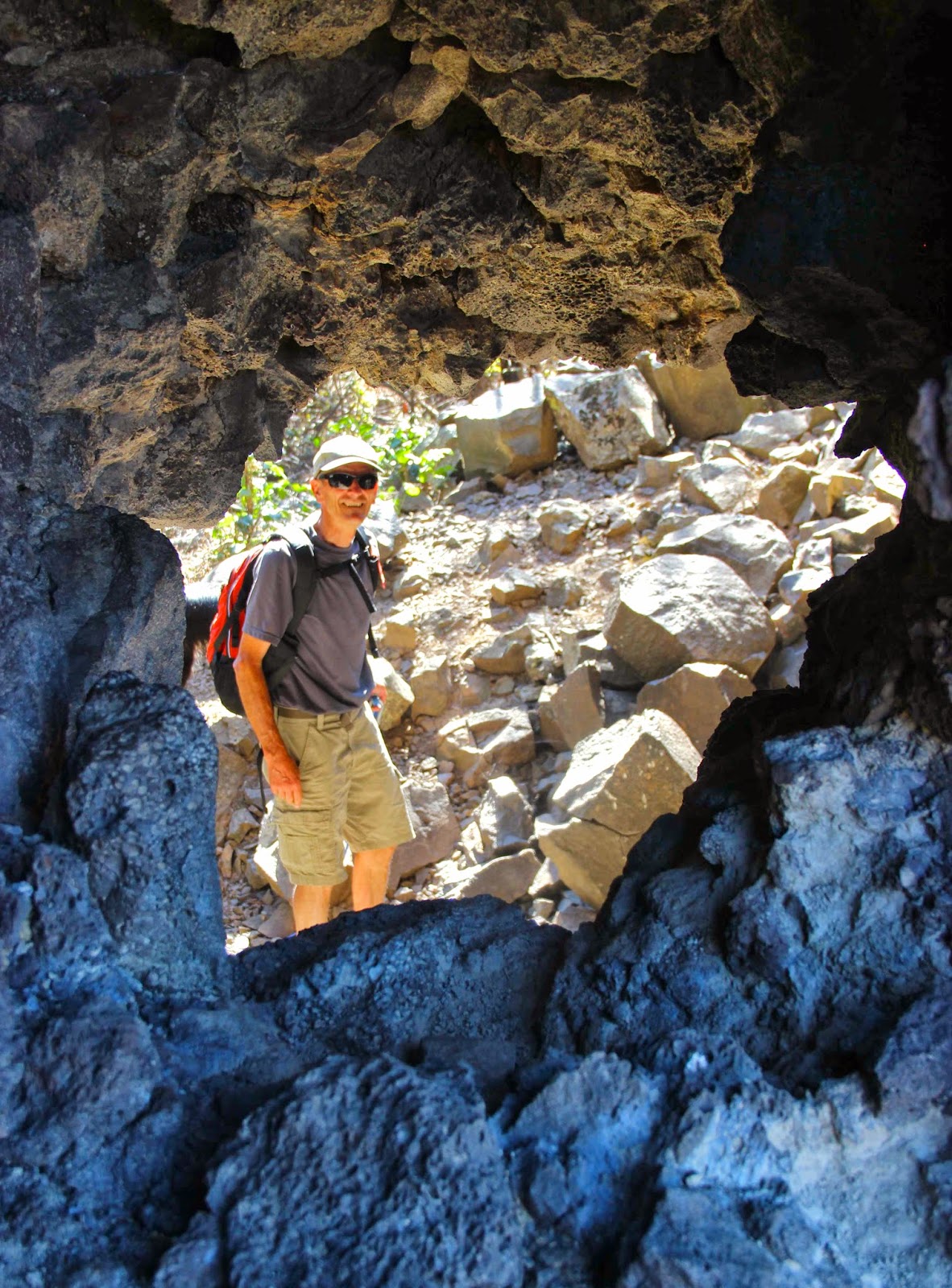
Vacationing geo-geek in Clark Fork Canyon, Montana.  Photo by DM.

This is the final post in a series about the Ice Age Mega-floods of the Pacific Northwest.

Thursday, October 31, 2013

Ghosts in the Rocks

See them?  (click on photo for a better view)
The forecast for the day was hot -- 100º F -- but we didn’t bother with an early start.  After all, we were on vacation.  Then we were side-tracked by books and displays at the Visitor Center and fish-and-chips at the stand next-door (very tasty).  By the time we began hiking, it was noon.

From the trailhead below Dry Falls we headed up the west slope of Umatilla Rock, which separates two channels once filled with water hundreds of feet deep that roared along at speeds hard to imagine -- 30, 60, maybe even 80 miles per hour!  Now the channels are dry, rocky and sparsely vegetated.  We were in the scablands of eastern Washington -- land that still hasn’t healed after catastrophic Ice Age Mega-floods scraped off soil and sediment down to bare rock.
It was hard to imagine this being a cold snowy place just 15,000 years ago.
We climbed to a notch and headed down the other side of the ridge into the coulee (above).  There were no trees and no shade ... just rock, rock and more rock, all basalt.  Cliffs of layered basalt stood above slopes of fractured column pieces.  On the coulee floor were massive chunks of basalt entablature that had tumbled when columns were plucked out by floods.  Fortunately, some were large enough to provide a little shade to sit in, which we did.

That’s when I saw them ... ghostly figures standing quite still among the huge dark fallen rocks!
But then maybe it was just the heat ...
Sure enough, a closer look revealed that these were not ghosts at all but rather wild buckwheat plants (Eriogonum sp.).  Wild buckwheats are distinctive and obvious to a western North American field botanist, even when semi-delirious.  The flowers are tiny, with parts in threes, broadly bell-shaped, and arranged in little clusters in cup-like structures called involucres.  But mainly they have the wild-buckwheat vibe -- a set of visual cues that are hard to articulate but easy to recognize once you get to know the group.
These particular buckwheats are covered with fine white hairs -- hence their ghostly appearance.
Above, branched inflorescence with clusters of flowers subtended by involucres.  Below, closeup of tiny flowers (3-6 mm long) in a cup-like involucre.  Photos by Gerald D. Carr; available for non-commercial use at Flora of Eastern Washington and adjacent Idaho.
While I knew this was a wild buckwheat, I didn’t recognize the species.  There are many -- 250 species and 450+ taxa in all (including subspecies and varieties; see Eriogonum in FNA).  They are especially common in arid regions of the western USA, in a wide variety of habitats.  Some are rare and restricted in distribution; quite a few are tough to tell apart and perhaps of questionable taxonomic validity.  All these things suggest that wild buckwheats are a dynamic evolving group, or as we like to say, “actively speciating.”

I decided to name this one “ghost buckwheat” and that’s what we called it whenever we saw it, which was often.  Ghost buckwheat somehow thrives on harsh sites in the scablands, perhaps because it’s clever about where it tries to grow.  Often the sites were more hospitable than they first appeared.  Most provided more runoff or moisture in some way.  Plants were sometimes quite common on talus slopes below cliffs, where runoff might accumulate (below, click on photo for better view).
We saw them on the walls of potholes -- more runoff there too.
Ghost buckwheat on back wall of pothole near Deep Lake.
The healthy plant below is on a gently-sloping field of talus.  Maybe water accumulates among the rocks.
Even where it looked like ghost buckwheat was growing on bare rock, the actual microsites proved to be a bit less harsh, for example a crevice or soil pocket of some kind.
It was always a pleasure to see the ghost buckwheat.  It was in full bloom on those hot dry late summer days when most other plants were done with flowering.  The pale-colored elegantly-arranged stems, leaves and flowers were beautiful against the coarse dark basalt.  So you can imagine my surprise when I tracked it down in some of my botany books and read that 1) it is Eriogonum niveum, the snow buckwheat (I understand, but I think “snow” is not nearly as fitting as “ghost”); and 2) at least one expert considers it to be a “rather unattractive species.”  Here I have to disagree!  It’s lovely in its elegance and pale color, and admirable for its ability to thrive in hot dry rugged environments.  It's certainly a memorable species.  I hope to see it again (I won't be scared next time).
Distribution of Eriogonum niveum, from USDA Plants Database.  “The species is found mainly on the grassy plains east of the Cascade Range in southern British Columbia, west-central Idaho, northeastern Oregon, and eastern Washington” on “sandy to gravelly flats, slopes, bluffs, and rocky, often volcanic outcrops” (FNA).
My music of choice for communing with ghost buckwheat in the scablands would be Chopin’s Etude Op. 10  No. 2 -- also lovely, elegant and mildly terrifying.  This old recording is a bit scratchy, but I like Cortot’s haunting interpretation very much.


P.S. ... Happy Halloween!

This post is part of a series about the Ice Age Mega-floods of the Pacific Northwest.

Monday, October 28, 2013

More vacation fun: kolk lakes & pothole swarms

Might this be the way to Wonderland?
In my most recent post about Ice Age Mega-floods in the Pacific Northwest, I wrote that there were kolks dancing in the torrents.  Of course this was a bit of artistic license.  Kolks hardly dance.  Rather they hammer, gouge, rip, tear, grind, scour, auger and hurl.  Kolks are destructive underwater vortices -- tornado-like currents that can pluck and carry rocks weighing several tons or more!
Whirling kolks plucking and hurling basalt columns; modified from Baker 2009.
The name originated with the Dutch, who observed kolks carrying huge blocks of rock when levees were breached.  Unfortunately the term is sometimes used instead for the holes the vortices make (e.g. in Allen 2009 and the German wikipedia).  In this post, kolks are the powerful swirling flows that do the damage.
"Kolk" sometimes refers to the hole rather than the vortex that drilled it.  Source.
Kolks are thought to be responsible for some of the curious landforms of the scablands of eastern Washington.  When ice dams impounding Glacial Lake Missoula gave way, masses of water hundreds of feet deep sped westward, probably reaching the Pacific coast in just a few days.  The scale of destruction is hard to conceive.  Extensive areas were stripped of vegetation, soil and sediment, exposing basalt bedrock below.  The rock was then sculpted into bizarre and spectacular forms.  These are the scablands.
Scabland buttes in distance; "pinnacles" on left fell from cliff just out of sight.
Colonnade layer in basalt flow.
Columnar basalt is easy pickings for kolks -- quite literally.  Columns readily break into pieces that are plucked and carried off.  The kolk-filled floods dug oodles of holes in scabland basalt.  Some grew and coalesced to make the distinctive butte-and-basin topography of the region.  Smaller ones form the many kolk lakes and potholes.

Kolk lakes

Most of the closed depressions carved out by kolks aren't fed by streams, yet kolk lakes are common in the scablands.  Some are deep enough to reach aquifers, or are fed by springs.
Looking down on Thompson Lake (mid photo) from Steamboat Rock in the Upper Grand Coulee.  Note State Park sewage lagoons nearby.
Deep Lake fills a closed depression almost 2 miles long and as much as 120 feet deep.
Perch Lake below Dry Falls.  Note basalt rubble strewn across bottom of coulee.
Kolk lakes near south end of Lower Grand Coulee.  ArcGIS online; click on photo to view.
At the southern end of the Lower Grand Coulee is a string of lakes, each in its own depression.  They’re connected by an aquifer, and are increasingly saline going downstream due to minerals dissolved from basalt.  The final one is Soap Lake, named for the foam that sometimes develops along the shore, or perhaps for the soapy feel of the water rich in minerals (23 different ones, said to be the most of any body of water on Earth).  It also contains oily ichthyols, probably due to decomposition of tiny shrimp that grow profusely from late spring into summer.
Pacific Apartments, a hotel-sanitarium on the shores of Soap Lake; photo ca 1928.
It’s also possible that the lake's name comes from the Indian word “Smokiam," meaning “healing waters.”  Soap Lake was a popular health resort in the early twentieth century, and while popularity has declined, it's still a destination for health enthusiasts.
Soap Lake is special for another reason -- it’s meromictic.  Unlike most lakes, the warmer surface waters never mix with the cold waters below.  The deep stagnant layer is especially mineral-rich and is inhabited by extremophiles  -- microorganisms able to live in this unusual environment (Bjornstad 2006).

Potholes

Potholes are smaller, dry depressions.  They’re very common in some of the coulees (old flood channels).  The aerial photo below shows a pothole swarm near Deep Lake; click on the image for details.  Don’t let your eyes fool you -- the round green objects aren’t bumps, they’re vegetated holes in the basalt bench above the lake.  Some are on the order of 50 feet deep.
Deep Lake potholes at Sun Lakes-Dry Falls State Park.  From ArcGIS online.
We took two hikes to explore the Deep Lake potholes.  First we went up on the south coulee rim for views of the lake and pockmarked bench.  Early on, we passed a pothole filled with vegetation (below).  The potholes are more hospitable to plants than the surrounding scabland, I suspect because more water accumulates.
  Note the curious ghost-like clumps on the far wall -- more about these later.
Looking down from the coulee rim at pothole topography on the bench above Deep Lake.
Many potholes are lined with colonnades (columnar basalt layers) -- a nice touch.
Next we took a trail from the Deep Lake parking lot along the south side of the lake looking for a special hole in the basalt cliffs that supposedly would lead us to the bottom of a cavernous pothole, a member of the swarm in the photos above.
Could this be the secret entrance?
Yes!
Scrambling through the rock tunnel down into the pothole I found ...
... a healthy stand of poison ivy.
In the photo below you can see the fortuitous tunnel that formed in a weak rubbly layer beneath the columns.  Note overhanging entablature above, stronger than the regularly-fractured colonnade and more resistant to erosion.
We carefully walked around the poison ivy, hiked up the opposite slope, and then wandered through the pothole swarm to find our way back to the parking lot.
Where to now?
This fun hike is clearly described in Bruce Bjornstad’s On the Trail of the Ice Age Floods (2006).  It’s short and not strenuous.  A few easy climbing moves are needed to get down into the pothole.  We returned to the trailhead at Deep Lake by way of ridges between potholes ... some exploring required but not difficult, and definitely a fascinating walk!

This post is part of a series about the Ice Age Mega-floods of the Pacific Northwest.

Sources

Allen, JE, Burns, M, and Burns, S.  2009.  Cataclysms on the Columbia.  Portland State University, Ooligan Press.

Baker, VR.  2009.  The channeled scabland:  a retrospective.  Ann Rev Earth Planet Sci 37:393-411.  PDF available.

Bjornstad, B.  2006.  On the trail of the ice age floods.  Sandpoint, ID:  Keokee Books.