Showing posts with label hydrology. Show all posts

Monday, March 2, 2020

Stink Lake in a Sink Hole & other marvels of gypsum

“Laramie from the air – 1932”, looking roughly north. Arrow points to today’s LaBonte Lake; the smaller lake to the west is now filled. Courtesy Laramie Plains Museum.
If you've lived in Laramie long, you must know LaBonte Lake—the pretty little pond in LaBonte Park, west of 9th St. between Canby and Shields. On fine summer days it sparkles in the sun, a blue gem set in green grass. But have you ever noticed that no stream flows in or out? Have you ever wondered why there’s a lake there at all?

The explanation lies well below the sparkling surface, below the haunts of the salamanders that migrate to and from the lake in spring and fall, even below the lake-bottom muck, rich in tiny creatures whose heady breath gives the pond its other name—Stink Lake. The explanation resides deeper still, in the convoluted tunnels and chambers that wind through Laramie’s gypsum-rich dirt.

Ancient seas to toothpaste and pyramids

Most of us are familiar with gypsum. It surrounds us in plaster and sheet rock, and is an important component of toothpaste and concrete (portland cement). It forms casts for broken body parts, and is widely-used as a soil amendment. Builders of Egyptian pyramids filled gaps between their rough-hewn stones with gypsum plaster.

Gypsum is a mineral so soft that it can be scratched with a fingernail, occurring in forms ranging from powder to rock. It starts as calcium and sulfur dissolved in saltwater. These chemicals react to form gypsum if the saline water undergoes enough evaporation—that’s why gypsum is said to be an evaporite.

Wyoming was a great place for evaporites 200-300 million years ago. A shallow sea repeatedly covered the region, and sea level rose and fell many times. Often when the sea dropped, it left behind mineral-charged isolated bodies of water. Apparently there was plenty of evaporation, for gypsum crystallized out forming thick deposits on the sea floor.

During the millions of years that followed, these gypsum deposits were buried and became rock under the pressure of hundreds of feet of sandstone, limestone and shale. Later, when the Rocky Mountains were uplifted, erosion removed enough of the rock cover to the expose gypsum in places, for example on the west flank of the Laramie Mountains. This was noted by newspaperman Leigh Freeman in 1868.

“Observe the splendid beds of gypsum”

That spring, the Union Pacific Railroad reached the Laramie Plains on its race west to complete the great Transcontinental Railroad. Construction crews arrived in April, accompanied by their entourage of merchants, saloon operators, gamblers, prostitutes, and a “press on wheels”—The Frontier Index. The Index was Laramie’s first newspaper, but only until July, when it relocated to Green River.

In the April 21 issue, editor Freeman extolled the virtues of Laramie in an article titled The City on the Plains: “The railroad towns between Omaha and the Rocky Mountains … are alive and flourishing, but none of them have one-hundredth part of the natural advantages that Laramie boasts of. Look yonder at those heavy bodies of timber; take a glimpse of the iron and copper graves that dot the whole country over, see the coal cropping out from one end of the plains to the other; observe the splendid beds of gypsum …”

Rock gypsum at Red Butte

Uncharacteristically, Freeman was accurate about Laramie’s gypsum. It truly was “splendid” and would serve Laramie well for some fifty years. The first quarry opened in 1890, its significance later noted by State Geologist W.C. Knight: “Gypsum was first developed in Wyoming 10 to 15 years ago at Red Butte station, on the Union Pacific Railroad, about 9 or 10 miles south of Laramie … the only [place in the state] where the known, gypsum-bearing beds were crossed by a railroad.”
Rock gypsum quarry at Red Butte south of Laramie, Wyoming, May 1891.
Courtesy American Heritage Center, University of Wyoming (AHC).
The gypsum at Red Butte is rock gypsum—lithified deposits from Wyoming’s ancient seas. Though hard enough to be called ‘rock’, it’s easily ground into a powder, the first step in processing. This rock gypsum also underlies much of Laramie, but hundreds of feet underground where it causes little trouble.

Gypsite fine enough to plow

In the mid 1890s, a more valuable form of gypsum was discovered just south of Laramie, in the Spring Creek drainage. It was gypsite—a crumbly material produced by weathering of rock gypsum, probably by water or wind.

Unlike rock gypsum, the gypsite did not have to be ground, which made plaster production more profitable. “The Laramie gypsite … is as fine as powder, requiring no grinding or even sifting. It is plowed, harrowed and scraped up, calcined [heated to make plaster], and loaded on the [railroad] cars,” reported the Laramie Republican in 1920.
“Plowing stucco” (mining gypsite) near Laramie, December 24, 1906. Courtesy AHC.
Plaster mill near Laramie, ca. 1890-1910. Courtesy AHC.
From Laramie Republican newspaper, February 26, 1921.
At that time, gypsite plaster manufacturing was one of Laramie’s bigger industries. Two mills produced 310 tons daily, and plaster was shipped to 20 states in the western U.S. But with the discovery of larger deposits elsewhere in the country, Laramie’s gypsite plaster industry came to an end; the last mill closed in 1948. Even so, gypsite is still very much with us.

Gypsite made LaBonte Lake … & more

Two extensive gypsite deposits underlie Laramie (see aerial photo near end of post). One is north of the University, the other in the Spring Creek drainage (site of the old quarry and plaster mill). Sometimes gypsite is visible at the surface, as patches of whitish soil associated with stands of greasewood, a salt-tolerant shrub. More often it’s several feet below ground, out-of-sight. But with enough water, gypsite will reveal itself.

Gypsite is water-soluble, not surprising given its origins. Flowing groundwater easily dissolves gypsite, creating tunnels and chambers—a topography called ‘karst’ (cavers know this word). Well-developed karst can be completely hidden, with no indicators at the surface. But if enough gypsite is dissolved and removed, the ground will collapse to form a sinkhole—like the one containing Stink Lake.

Some claim LaBonte’s basin is an old gypsum quarry, but studies point to gypsite-caused collapse. In 1983, borings were taken from the lake bottom to evaluate stability (a plan was afoot to build an island for picnicking). Six years later, more cores were taken from the lake west to 4th St., to assess hydrocarbon pollution. Both studies showed downwarped strata forming a concave structure, consistent with sinkhole formation. However, aerial photography from 1947 shows what might be a gypsum stockpile just northeast of the pond. Perhaps the sinkhole was enlarged with quarrying.
LaBonte is not the only sinkhole in the neighborhood. Early maps and a 1932 aerial photo (see beginning of post) show a second pond to the west. By the 1940s, it was being filled with trash—the city dump. When the dump was moved to its current location, more fill was added. The old pond is now overlain by softball fields and City buildings.

Living with gypsite

Not all sinkholes in Laramie are as charming as the one that holds LaBonte Lake. More often, they pose significant risk to people and property, especially when they develop abruptly: a cavernous pit that opens in the backyard, a car that breaks through the garage floor overnight, roads and buildings that suddenly collapse when the ground beneath sinks.
Sudden collapse in a Laramie alley underlain by gypsite. Foster White photo, date unknown.
Gypsite tunnel in Laramie, with Foster White for scale. Todd Jarvis photo, 1994.
Rotting basement foundations, buckled sidewalks, ruptured utility lines, and blistered potholed streets are other signs that devilish gypsite karst lurks below. Problems often grow with investigation. A shovel can reveal cavities 10 feet deep or more, tunnels big enough for a person to crawl through, and dense networks of water-saturated passageways suggesting imminent collapse.

We can’t blame natural groundwater alone for these problems. Often we’re the ones that introduce water to gypsite, for example by watering our yards (tree roots deliver water to karst quite effectively). Stormwater draining off our streets can rapidly enlarge karst features, as can leaking old or inadequate pipes.

Gypsite’s impact on Laramie is significant. For example, in 2008 the City repaired 140 emergency pipeline breaks, whereas the regional annual average was 50 to 80 repairs according to the American Water Works Association. And consider Palmer St.: Since 1988, when record-keeping began, gypsite corrosion of cast iron pipes has caused 15 mainline breaks in just two blocks. The City now requires cast-iron-equivalent PVC pipe in gypsite areas, but does not otherwise factor gypsite into planning.

For more information about Laramie’s gypsite, get the Wyoming State Geological Survey’s 2016 publication, Evaporite Karst Features in the Southern Laramie Basin (free online). Our two gypsite areas are indicated on the aerial photo in Figure 6 (below).
From Ver Ploeg et al. 2016 (color/symbol key added). Olive green areas have gypsite deposits.
If you haven’t already experienced Laramie’s gypsite dirt and would like to, then explore the Spring Creek floodplain west of 9th St., or drive Bill Nye Ave. west of 15th (gravel). Look for spindly greasewood shrubs and white-crusted dirt. But tread carefully, for karst may lurk just below your feet! Your fate could be similar to that of the Laramie boy who fell off his bike into gypsite mud. He was stuck waist-deep for hours until the fire department finally got him out.

Credit where credit is due

Thanks to former longtime Laramie resident and geologist Dr. Todd Jarvis, who suggested this topic and provided much of the information. Jarvis is a sinkhole sleuth and water folklorist now practicing in Oregon. Thanks also to Foster White of the South of Laramie Water and Sewer District, for sharing his stories about the marvels of gypsite.

[This blog post is a modified version of an article published in the Laramie Boomerang on March 1, 2020. The post includes sources and many more images.]

Sources

Jarvis, T., and Huntoon, P.W., 2003, A stinking lake and perpetual potholes: living with gypsite karst in Laramie, Wyoming, in Johnson, K.S., and Neal, J.J. (eds.), Evaporite karst and engineering/environmental problems in the United States: Oklahoma Geological Survey Circular 109, p. 263-269.

Knight, W.C., 1904, Gypsum deposits in Wyoming, in Adams, G.I. et al., Gypsum Deposits of the United States. USGS Bull. 223.

Ver Ploeg, A.J., Larsen, M.C., and Taboga, K.G., 2016, Characterization of evaporite karst features in the southern Laramie Basin, Wyoming: Wyoming State Geological Survey Report of Investigations 70, 33 p. (free download)

Old newspapers provided by Wyoming Newspapers (Wyoming State Library).


Tuesday, May 3, 2016

The Great Aquifer is Leaking

“Visit Nebraska. Visit Nice.” (more here)

Nebraska is nice, as the Nebraska Tourism Commission says, but why are they so modest? It’s more than nice—spectacular even. I especially like the immense vistas—maybe to the edge of the world! Maybe if I keep going I’ll float off to join the birds and the clouds, and we can sail across the beautiful blue Nebraska sky. Such thoughts cross my mind as I drive through open rolling country for miles and miles and miles.
It was Willa Cather who suggested that the Great Plains lead to the edge of the earth.
And something equally remarkable lies hidden from view. Cross Nebraska and you cross miles and miles of water-soaked consolidated sand just a few hundred feet below the surface—one of the most important aquifers in the world. Two-thirds of the water in this great aquifer—650 trillion gallons**—lies under Nebraska.
“Saturated thickness of the Ogallala Aquifer in 1997 after several decades of intensive withdrawals.” Note that the aquifer is most extensive and thickest (dark blue) in Nebraska (USGS via Wikimedia).
The Ogallala Aquifer is so-named because most of the water-bearing rocks belong to the Ogallala Group—named by geologist NH Darton after the town of Ogallala, Nebraska. It’s often called the High Plains Aquifer because it includes other rocks in addition to the Ogallala, but not many. Darton described the value of Ogallala rocks in his 1905 report about the central Great Plains:
“These great sand deposits, constituting the surface of the High Plains, contain a large volume of excellent water, which usually accumulates in the lower beds, where it is available for pump wells, generally at depths of about 200 to 300 feet. Such wells are numerous in the upland region of west Kansas, west Nebraska, and east Colorado, where they are the principal sources of supply.”
Rocks of the Ogallala Group consist of debris that was eroded off the Rocky Mountains during the Miocene Epoch (roughly 19 million to 5 million years ago), carried eastward by streams and wind, and deposited as far east as eastern Nebraska and south into Texas (Maher 2003). The coarse loosely-cemented sediments—mainly sand—make for porous rock that holds lots of water.

The Ogallala Aquifer underlies 111.4 million acres or 174,000 square miles. Often the water is just a few hundred feet down and easily accessible by wells, which is why it’s so important. It provides about 27% of the ground water used for irrigation in the United States (source). But as huge as it is, it’s being sucked down, mainly by agriculture. Replenishment can’t keep up with use. McGuire (2007) estimated that as of 2005, Ogallala water storage had declined by 9% since pre-development—on average. Locally the impact can be much greater. The need to conserve the Ogallala is now widely-recognized, but far from being achieved. For more, see the NRCS’s Ogallala Aquifer Initiative, and this interesting article from Scientific American about Ogallala depletion, and related changes and innovations in agriculture.
Water-level changes in the High Plains aquifer, predevelopment to 2005; modified from McGuire, 2007 (USGS). Red areas are most severe.

Back to Ogallala rocks … there’s another reason why they hold so much water. Not only are they porous, they sit atop older rocks that are rich in clay and volcanic ash and thus largely impermeable, thereby “sealing” the bottom of the aquifer. But sometimes it leaks.
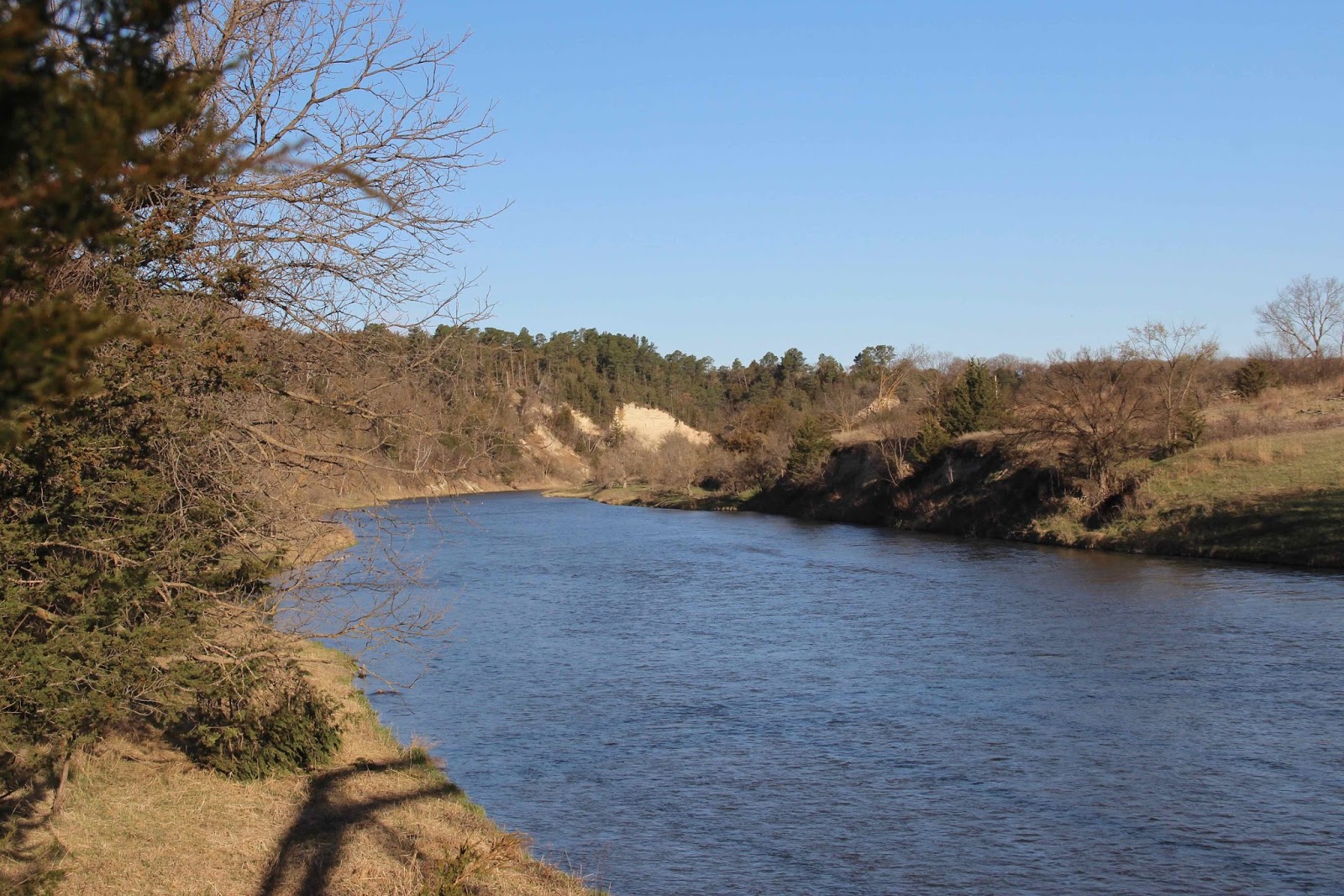
Morning on the Niobrara River. Pale slope center of photo is the Valentine formation, the porous water-bearing basal unit of the Ogallala Group.
In carving their valleys, several Nebraska rivers have exposed the base of the Ogallala. Last month, I visited the Niobrara River to see the great aquifer. East of Valentine, the Niobrara flows through an unexpectedly deep narrow valley, revealing the contact between the porous Ogallala and underlying impermeable strata. Seeps and springs—“leaks”—mark the juncture.

Just east of Valentine, I stopped at the Fort Falls overlook on the Fort Niobrara National Wildlife Refuge, where there’s a clear view of the Ogallala base. Water seeps out at the contact between the water-rich Valentine formation and the impermeable Rosebud formation below, turning the Rosebud reddish-brown.
Shaded slope on a bright day makes for lousy photos, but still cool to see the Ogallala Aquifer!
Valentine formation (Ogallala Group) at top of slope, with grass and scattered trees; reddish brown layer in center of photo is the Rosebud formation (White River Group).
About 15 miles east of Valentine on Highway 12, a narrow road turns south, crosses rolling prairie for awhile, and then suddenly descends into the valley of the Niobrara, ending at a state park designated for the most spectacular leak in the Ogallala Aquifer—Smith Falls. At 70 feet, it’s the highest waterfall in Nebraska.
The substantial footbridge across the Niobrara is in its third reincarnation as a bridge. It was built in 1910 to cross Verdigre Creek; disassembled and moved in 1917; reassembled in 1922 as part of Nebraska Highway 14; disassembled and stored in 1993; and finally reassembled, renovated, and installed at Smith Falls State Park, opening in 1996.
A wooden walkway above the narrow canyon bottom leads to the falls.
This is the Rosebud formation, reddish brown when wet. Water comes from the Valentine above, out of view.

**McGuire (2007) reported 2.925 billion acre feet of water stored in the High Plains Aquifer in 2005. Roughly two-thirds of this lies under Nebraska (source)—on the order of 2 billion acre feet or 650 trillion gallons.


Sources (in addition to links in post)

Joeckel, RM et al. 2014. Architecture, heterogeneity, and origin of late Miocene fluvial deposits hosting the most important aquifer in the Great Plains, USA. Sedimentary Geology 311:75-95 http://dx.doi.org/10.1016/j.sedgeo.2014.07.002

Maher, HD, Jr., Egelmann, GF, and Shuster, RD.  2003.  Roadside geology of Nebraska.  Mountain Press Publishing Company.

Sunday, February 8, 2015

Of Anchor Ice & Cottonwood Flowers

It was the first of February, 8:30 AM, and 17º F after a cloudy night with light snow.  When I reached the river, I saw two men with poles standing in the water as ice floated by.  What were they doing?!  Fishing? hunting crawdads? collecting garbage? maybe playing ice golf, an ancient Scandinavian sport?
Will this be the final putt?
The men intently studied the river as my lanceleaf cottonwood tree stood by.
This month’s tree-following post was to be about my search for a new tree, but the cottonwood I've followed for a year now led me to two unexpected and interesting things. First there were the men who were taking photos of ice on the river bed.
They used a GoPro action camera – the kind folks wear to record adrenalin-inducing activities.
Ice on the river bed?  How can that be?  Ice floats, being less dense than water.  True ... but as I now know, under the right conditions a special kind of ice forms – anchor ice.  It’s really interesting and worth keeping an eye out for.  I’m glad I asked those guys what they were doing.

Cold nights are best, well below freezing.  Where the river is fast-moving and shallow, water may become super-cooled and stay liquid below its normal freezing temperature.  The sand, gravel, rocks, etc. that it’s flowing over also cool to that temperature.  The water is moving right along so surface ice doesn't form, but floating crystals (frazil) freeze out.  They stick to material on the river bed and to each other, making gray-green soft slushy ice.  When the day begins to warm, anchor ice begins to break free and float downstream.  Soon it’s all gone.  [Here’s a summary with clear explanations, and another in PDF format.]


Top: gravel and small rocks on bottom of anchor ice removed from river bed

Middle: anchor ice anchored to river bed

Bottom: anchor ice breaking free from river bed 

(modified from Kempema et al. 2008; click on image to see more detail)


Gray-green detached anchor ice floating downstream.
For years I’ve watched murky globs of ice float down the river on cold mornings.  I always thought they had broken off from ice along the river margins.  Now I know better.  The things you learn when you follow a tree!

Anchor ice was pretty minimal that day and has been for most of this unusually-mild winter.  But it can be dramatic with significant impacts, like creating dams and scouring river beds.  “Seeing is believing” so have a look at this anchor ice video – a “nature treat for the day” from the northeast USA.

--- ✿ ✿ ✿ ✿ ✿ ✿ ✿ ---

The second thing of interest is actually quite amazing ... my tree is blooming in February!
Cottonwood in full bloom; click on image to see fringed bracts, young ovaries and stigmas as in diagram below.

Suspicious?  You should be.  It is blooming ... but in my kitchen.
Last month when I was wondering if my cottonwood was the bitter kind, I collected twigs with buds to examine at home.  The true bitter cottonwood, the narrowleaf, has very resinous buds, but those on my tree aren’t – this suggests it's a hybrid.  When I was done, I put the twigs in a small container with water to see if maybe something interesting would happened.

Something did.  Now there are two female catkins (flower clusters), other buds have tiny bits of green at the tips – leaves? – and little twigs have grown roots!  Of course now I will put them in a pot.  Maybe something interesting will happen ...
I’m not surprised to find flowers out of season and roots growing from tiny twigs.  Cottonwoods are notoriously opportunistic.  They produce prodigious amounts of cottony seeds and cast them to the wind.  Maybe – just maybe – one  will land in a suitable place and grow.  Some species sucker and spread readily, as does mine.  Fallen live branches can root and grow.  And they grow fast.  My tree may look majestic, with all the noble characteristics we associate with trees – strength, great stature, longevity, steadfastness.  But it’s really more like a scrappy nine-lived alley-cat, resigned to (and ignoring) the capricious hand of fate.  Try anything and everything ... be ready ... live fast and die young ... wotthehell, wotthehell
Mehitabel (by Don Marquis).


More about anchor ice in the Laramie River:

Kempema, E, Ettema, R, and McGee, B.  2008.  Insights from anchor ice formation in the Laramie River, Wyoming.  19th IAHR International Symposium on Ice.

Kempema, E, and Ettema, R.  2010.  Anchor ice rafting:  observations from the Laramie River.  River Research and Applications 27:1126-1135.

Saturday, December 13, 2014

Lost Water Found

Precious water flows from vertically-tilted limestone at Big Spring.
Much of the American West is dry country, where farmers and ranchers lust after and fight over water.  It's easy to understand their frustration when it flows down a hole, never to be seen again.  Sometimes dams or ditches will reduce water loss to the netherworld, but often nothing can be done.  Place names tell the story: Sinks Canyon, Dry Valley, Lost Creek.
The Sinks on the east side of the Wind River Mountains.  Hundreds of gallons of water flow down this limestone hole every second.  The creek reappears about a quarter-mile down the canyon.  Photo by Brian Harms.
Sinking streams usually are symptomatic of karst, “a landscape formed from the dissolution of soluble rocks including limestone, dolomite and gypsum ... characterized by sinkholes, caves, and underground drainage systems” (source).  Rainwater is slightly acidic, enough to dissolve rock such as limestone.  If it can enter soluble bedrock via fractures or faults, dissolution will create a network of enlarging passageways, accommodating more water, leading to more dissolution and surface collapse.
"What is Karst?" – from the University of Texas at Austin.
Water also exits the karst underworld, as springs.  An underground drainage system may intersect the surface, perhaps at a fault, or meet fractures in overlying rock that provide routes to the surface.
Modified from Karst in Indiana; Indiana Geological Survey.
In the Uinta Mountains in northeastern Utah, limestone bedrock, outcrops and karst features occur on both flanks of the range.
“Another peculiarity of topographic structure is observed at the head of the side ravines ... when they occur in limestone formations.  In the midst of a remarkably well watered region, these ravines have no running water, and in their basin-like heads are many minor depressions without outlet” Samuel F. Emmons, Uinta Mountains (1906)
Uinta streams head in the high country, which is underlain by Precambrian sandstones of the Uinta Mountain Group.  They flow above ground until they meet the Madison limestone, where many of the smaller ones disappear, joining underground drainages that feed springs at lower elevations.
North flank Uinta Mountains west of Flaming Gorge.  Darker turquoise unit is the Madison limestone.
Cross-section through north flank Uinta Mountains at Sheep Creek Canyon.  Near the Uinta Mountain fault zone, strata are tilted to vertical or even overhanging.  Yu - Uinta Mountain Group; Mm – Madison limestone.  Modified from Sprinkel et al. (2000).
Spectacularly deformed strata in the Sheep Creek Canyon Geological Area.  Mississippian Madison limestone on right and Precambrian Uinta Mountain Group on left; southwest branch Uinta Mountain fault zone in-between.
Madison limestone (Mississippian).
Big Spring gurgles out of a spectacular limestone ridge cut through by Sheep Creek, near the Uinta Mountain fault zone.  In October I walked up the short-but-steep trail to the springhead – a small talus slope.
Water first appears near the base of a small talus slope – just a tiny quiet leafy pool.
In less than ten feet, it becomes a healthy flowing stream.
I was there during the low-flow season, but the stream still was quite loud ... just listen:
Discharge from Big Spring ranges from 5 to 36 cubic feet per second.  Like most springs in the area, its flow is variable and highest in spring during snowmelt.  Turbidity increases too, with higher flows stirring up sediments in the underground drainage system.

Years ago, Big Spring’s flow suddenly increased and became more turbid ... but it was the wrong time of year.  Just a week before, an earthen dam 14 miles to the west had failed, sending precious water into the Lost Creek Sink a short distance downstream.  Ranchers were unhappy.  Hydrologists were suspicious.

Sometimes underground drainage routes can be inferred from coincident events – like a breached dam and an unexpected pulse in a spring.  They can be verified with dye tracers.  In 1979 researchers dumped dye into Lost Creek Sink and watched Big Spring.  Dye emerged, confirming the connection.  Another dye release at low water in September 2001 also showed a link between sink and spring, with maximum groundwater travel time of 14 days (Spangler 2005).

Lost Creek Sink is 14 miles west of Big Spring; both are within the north-dipping Madison limestone.  Other sinks and springs in the northeastern Uinta Mountains show similar configurations, suggesting underground drainages follow strike (along limestone layers rather than across them).  In contrast, springs on the less-steep south side of the range tend to be artesian, flowing from the Madison up through fractures in overlying rocks to the surface (Spangler 2005).

The map below shows general direction of flow from sink to spring (the actual route probably is far more tortuous).  Straight-line distance is 14.4 miles, with 2100 feet vertical drop.  As of 2005, Lost Creek - Big Spring was “one of the longest documented (dye-traced) underground flow systems in Utah.”  The length suggests there may be an extensive cave system below (Spangler 2005).
Based on Spangler 2005; map from ArcGIS Online.
“Hence the explanation that suggested itself was that, in the easily soluble limestones, surface waters had eaten their way along cracks and small faults, finding their run-off in such springs, and had thus eroded increasingly large caves that had finally collapsed, producing something analogous to the sink-holes of the western Appalachian region. ... The structure is developed on so large a scale in this region that it deserves a special name, for which sink-hole or karst topography is suggested.” Samuel F. EmmonsUinta Mountains (1906)

Sources

Emmons, SF.  1906.  Uinta Mountains.  Bulletin of the Geological Society of America 18:287-302.

Spangler, LE.  2005.  Geology and karst hydrology of the eastern Uinta Mountains – an overview.  in Dehler, CM, Pederson, JL, Sprinkel, DA, and Kowallis, BJ, eds.  2005.  Uinta Mountain geology.  Utah Geological Association Publication 33.

Sprinkel, DA, Park, B and Stevens, M.  2000.  Geologic road guide to Sheep Creek Canyon Geological Area, northeastern Utah, in Anderson, PB and Sprinkel, DA, eds., Geologic road, trail and lake guides to Utah's parks and monuments.  UGA Publ 29.  PDF

Thursday, January 17, 2013

Wonder of the Week: what happened here?!

A mysteriously-transformed river.
I had no intention of writing three posts in a row featuring the Laramie River, but some amazing things have been going on there.  Three days ago it was cold enough for the first walk of the season on the frozen snow-covered surface (below).
Frozen river with thin blanket of snow.
That night it was very cold, -20º F (-29º C).  The next morning I intended to take a long walk downstream but when I got to the river I found ... no snow ... just smooth milky ice.  At the margins the ice was very thin, with water below.  How could this be?  The temperature had not been above 0º F for almost 30 hours.  Then another surprise -- about a quarter of a mile downstream a blanket of snow still covered the river, no more bare ice.  [You will just have to believe me.  It was too cold for photos, I had no camera.]

The next morning (with camera) I found the river had changed again, to milky green ice with large patches of hoar frost here and there.
Patch of hoar frost in distance.  Anchored stumps on right are habitat for fish.
Clear area on left is ice, not open water.
There were wonderful patterns and textures to photograph, especially the swirls.
What a mix -- lobes and swirls of clear ice, translucent ice, hoar frost-covered ice.
Lobe of smooth ice surrounded by ice with fine hoar frost.
A bit of symmetry.  This reflected forest is green, even in winter!
The next day the river was different again -- less green, maybe because the sun was out.
What a mystery!  Any ideas as to how the river surface was transformed?  It was too cold for the snow to melt -- maybe wind? (I don’t remember any), or sublimation?  And why was there still snow on the river downstream?

Lucky for me I called the right friend, who knew the answer -- flood!  Water moved over the frozen surface, melting snow, freezing to form milky ice.  The swirls were shallow flood fronts.  The first day, flooding had made it downstream only to where the snow blanket still covered the river (it's gone now).
These once were swirling lobes of shallow water flowing over ice, now frozen in place.
How the river “flooded” was another question.  Maybe an ice dam upstream broke.  Maybe freezing expanding ice forced water onto the surface.  What do you think?
Small shallow flood fronts along the river margin -- water forced out by freezing expanding ice?
I’ve written quite a few posts involving the Laramie River (aggregated here), probably just because it’s close to my house.  But it is a treasure!  It's a strip of riparian and wetland habitat that winds through an equally-interesting collection of past and present human industry -- the old WyoColo and modern-day Union Pacific railroads, a ranch supply warehouse, old packing sheds, a sawmill, the railroad tie plant that became a superfund site transformed into open space.  Interstate 80 is less than a quarter mile to the west and always audible.  But step off the paved path and most days you will discover something of interest.  Nature thrives even in the midst of Civilization.
Sparky suffers through yet another photo expedition along the Laramie River.