Showing posts with label Laramie Mountains. Show all posts

Friday, May 12, 2023

Tree-following: What to do on a windy Wyoming day?

Mid-photo are the two Rocky Mountain Junipers I'm following, at the base of the Laramie Mountains.

The approach was not a problem.
A few days ago I made a short excursion to visit the junipers I'm following this year. Average wind speed was 28 miles per hour, with gusts to 40. From a distance this wasn't a problem. But up close the trees were frantically waving in the blustery southeasterly wind, portent of an approaching storm system. Indeed it rained buckets the next two days!
Photo at highest shutter speed allowed.
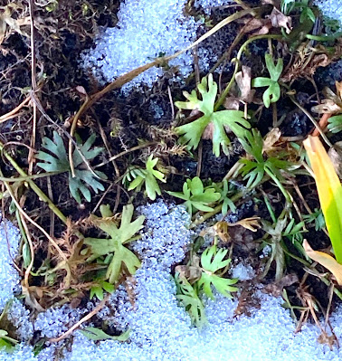
So I took photos of a neighboring plant instead. It was less than 2 cm tall and not much bothered by the wind.
Even after wandering out here all these years, I'm still impressed and astonished that plants can become established and survive in a tiny crevice or depression in bare rock, exposed to the desiccating Wyoming wind. I wonder how old this one is?
The leaves are covered in silky hairs.
The scientific name of this plant is Tetraneuris acaulis (Pursh) Greene var. caespitosa A. Nels. There's an interesting bit of history encoded here. F.T. Pursh was the first to name the species (Gaillardia acaulis), in 1814. Then in 1898, E.L. Green moved it to the genus Tetraneuris. In the meantime our very own Aven Nelson, Father of Wyoming Botany, found populations in the Laramie area that were different enough to be be recognized as a new variety. "Its matted habit, silky-lanate leaves and very short scapes [flowering stems] easily separate it." he wrote in 1899. Nelson's 1898 collection from the "Laramie Hills" was the type specimen (basis for description) for the new variety.
From the Rocky Mountain Herbarium, U. Wyoming. Click image to view labels.
Zooming in (below), we see this is a member of the daisy or aster family (Asteraceae). What some would interpret as a single flower is actually many tiny ones: a round cluster of disc flowers surrounded by ray flowers with strap-like united petals.
Nelson provided no common name, so I checked the Integrated Taxonomic Information System, supported and used by many North American governmental agencies. Officially, this is the Caespitose Four-nerve Daisy, a translation of the Latin. But there's gotta be something better! I suggest Nelson's Silky Stemless Daisy :)

Sources
Information about taxonomic and nomenclatural history of plant species is available at Tropicos, often with links to historical literature, including the wonderful offerings of the Biodiversity Heritage Library. That's where I found Aven Nelson's 1899 article about the genus Tetraneuris.

This is my rather tangential contribution to news from the tree-followers who gather monthly. More here. Thanks to The Squirrelbasket for continuing to host!

Saturday, November 12, 2022

Tree-following Therapy

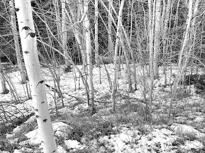
Quaking aspen near Pole Creek, Laramie Mountains, November.
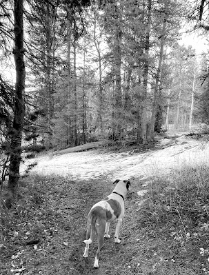
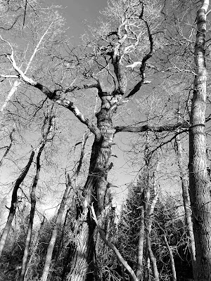
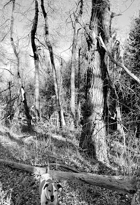
It's November, and in the Laramie Mountains much of the color is gone. We're left with black, brown, gray, white, dark green (needles), and blue (sky). Somehow photos look better in black-and-white.

Off to see the poplar tree :)
Not pleased with short days, and especially not pleased with so much time needed indoors lately, I felt much better after visiting the old balsam poplar I've gotten to know this year. We're lucky to have the Happy Jack Trailhead just 15 minutes from town!


And of course we visited the Carboniferous Pond, for meditation and exploration. Along the margin I spotted some color—green buttercup leaves, still making carbohydrates before winter sets in.
 Ranunculus gmelinii, the lesser yellow water-buttercup; leaves are 0.5–1 inch across.

This is my monthly contribution to the gathering of tree-followers kindly hosted by The Squirrelbasket. More news here. For more about tree-following, see this post. Consider joining us—it can be very therapeutic!

Friday, September 9, 2022

Trees are our silent partners ... (tree-following)


"Trees are our silent partners, sensing us as we move about, providing shelter, offering us beauty, and nurturing and protecting the earth." —the Tree Library

It was another unseasonably warm day—a good time to visit the balsam poplars along Pole Creek in the Laramie Mountains. But it was 80º F even at 8200 ft elevation! So we hiked in and out via the shady trail instead of doing the usual loop. En route I heard crashing in the drainage bottom and spotted a moose ... or rather parts of a moose running off through trees and brush. Sorry, no photos.

Among the poplars it was quite pleasant—shady and cool enough to hang out with the tree I'm following.

Balsam poplar—Populus balsamifera.
This is obviously the oldest tree in the stand. Its canopy is much reduced and the large branches below are dead and leafless. The trunk is twisted, not straight like those of its companions (or offspring?).
(this photo is from last month)
Neighboring poplars are smaller, straight, and often clustered.
In my readings (US Forest Service), I learned that balsam poplar is an early seral species, adept at establishing after disturbance. For one thing, it's very good at vegetative reproduction, "capable of regenerating from root suckers, stump sprouts, stem sprouts, and buried branches". And the root suckers are large and vigorous, more vigorous than those of aspen even.
Vigorous stem and root suckers at base of the old poplar.
Balsam poplar bark is smooth and light gray to grayish brown on young trees, becoming furrowed with age. The old poplar's bark is much more furrowed than that of its neighbors.
Once established, young balsam poplars grow rapidly; this is one of the fastest growing trees in North America at temperate latitudes. But in the absence of disturbance, balsam poplars eventually are shaded out by other trees. This is a problem in protected areas where we prevent disturbances. Stands become senescent.

Dare I speculate about the history of this stand? Currently we see one old balsam poplar with branches sawn off even high up on the trunk (more about this here), surrounded by younger trees that look roughly similar in age. The stand is expanding—young poplars are invading the meadow to the west (photo below), where there is an old well box. The sunny trail immediately north of the stand is the old Happy Jack Road. So ... was this a nice flat area next to the road, with water, where people camped and collected wood for their fires? Or maybe Happy Jack himself lived here. More research needed.
(another photo from last month)

Before returning to the trailhead, we took a short side trip to "Carboniferous Pond" to cool off. There are no cycads, giant horsetails, seed ferns, and such. But dragonflies are so abundant that it feels carboniferous.

This is my September contribution to the gathering of tree-followers kindly hosted by The Squirrelbasket.  Sound intriguing? Learn more here.

Monday, September 20, 2021

Mysterious Stones of the Laramie Mountains

A story of granite, grus, and tors.
If you wander the summit of the Laramie Mountains as dusk falls, chances are you will spot mysterious creatures silhouetted against the evening sky—giants forever waiting by their castles, life-like but never moving. But if you get too close, they disappear, no matter how stealthily you approach. In their place are peculiar stacked stones and huge rounded masses of rock.

These are our tors (from the Old Welsh "twr" meaning pile or cluster). In shapes ranging from rounded blocks to dancers, turtles, beehives, and potato chips, they inhabit magical places like Vedauwoo, Blair, and the Devils Playground. But why? How and when did such fantastical beings appear?

Pioneering geologist Ferdinand Vandeveer Hayden once admonished humanity for not asking such questions. "Like the ripe fruits which so many pluck from the tree, and enjoy without a further thought, [landscapes] are accepted by mankind, and how few are thoughtful enough to inquire from whence they come!"

But not us, Professor Hayden. We are among the thoughtful few!


Monuments left by erosion, pleasing in their variety

Hayden's complaint appeared in his 1871 Preliminary report of the U.S. Geological Survey of Wyoming, specifically in the section about the Laramie Mountains, which he had crossed by train the previous year. At the crest, he came upon "scenery which is quite unique and remarkable, differing in many of its features from that at any other point along the [rail]road."

It was a landscape dominated by granite, as Hayden explained. The plateau-like summit was "literally paved with small fragments", and "massive piles, like the ruins of old castles, are scattered all over ... the difference in texture of the rock is such as to give a most pleasing variety, hardly any of these piles being alike."

Hayden then turned to the difficult question—from whence they come. "There is an interesting thought just here as to the real origin of these granitic, ruin-like piles that give the peculiar distinction to the plateau surface of the Laramie Mountains. I believe it is entirely due to erosive forces, which have operated here on a gigantic scale, and these cones and natural temples are the monuments that are left to tell the tale."

"I am convinced that the surface was at one time at least on a level with the highest of [the granite piles]." he continued. "How much more has been removed it is now impossible to tell, but I am convinced that comparatively few geologists have fairly estimated the immensity of the time required and the vastness of the amount of material removed from the surface by erosion."

Broadly-speaking, Hayden was correct. The tors of the Laramie Mountains were created by erosion. But there's much more to the story. It seems that erosion played multiple roles—shaping, revelation, and now destruction.

"Skull Rock ... has been peeled off, coat by coat, by the fingers of Time ..." wrote Hayden in 1871. (LOC).

A granite named Sherman

In early August 1907, the Laramie Republican (newspaper) announced the arrival of a "geological savant"—Professor Eliot Blackwelder, of the University of Wisconsin and the U.S. Geological Survey. He would study the surface geology of the southern Laramie Mountains, specifically the oldest rocks of the range.

For regular readers of this blog, "Eliot Blackwelder" may ring a bell. He appeared in a recent post about the Snowy Range, where he also studied ancient rocks. In fact, Precambrian rocks—the oldest on Earth—were Blackwelder's specialty.

Shortly after arriving, Blackwelder recruited an assistant—Herbert Kennedy, of the Republican's business department (he was replaced by his brother, Leon). Two days later, they left to set up their field camp near Tie Siding. They would work into late September, when Blackwelder returned to Wisconsin and Herbert Kennedy returned to his studies at the University of Wyoming.

In 1908, Blackwelder published "Pre-Cambrian rocks in southeastern Wyoming". He named the granite at the crest of the Laramie Mountains the Sherman granite, after the now-defunct Sherman railroad stop. The next year, in text accompanying geologic maps for the area, he described what he considered "the most important event of pre-Cambrian time in this district ... the intrusion of a vast mass of coarse-grained granite."

Rapakivi and grus—killer conversation starters

Like Hayden, Blackwelder was impressed by the small fragments that covered the ground to great thickness. "Although hard in its unaltered condition the Sherman granite disintegrates readily under the influence of descending surface waters and produces a coarse gravelly soil ... In excavations at Buford the granite has been found to be decayed to a depth of 40 to 50 feet ...".

This would greatly benefit the Union Pacific Railroad. The Buford quarry furnished trackbed ballast for 800+ miles of track, from Omaha to Rock Springs. From 1900 to 1914, an estimated 10,000 railcar loads were produced each year. Furthermore, Sherman ballast was cheap—a ton for just 6¢! —while average cost for the region was 49¢ per ton.

UPRR track builders approaching crest of Laramie Mountains on a bed of Sherman grus; 1867-68; Beinecke Library (cropped).

Because it breaks down so readily, geologists classify the Sherman granite as "rapakivi" ("mud rock" in Finnish). If wetted, mica in the granite expands, breaking the rock to create gravel, mainly crystals of feldspar and quartz. Geologists call this kind of decomposed granite "grus" (pr. gruce or sometimes gruss).

Blackwelder all but ignored the other remarkable feature of Sherman granite—the tors. He provided one photo and a single sentence. "Where thus deeply weathered, the outcrops of granite are smoothly rounded and free from visible ledges."

Sherman granite on crest of Laramie Mountains; looking north across "wide rolling plain of the mountain plateau". From Blackwelder's 1909 report (USGS); photographer unknown.

The problem of tors

Tors have long been mysterious and difficult to explain. One of the biggest obstacles is the many kinds, which likely differ in origin. Fortunately, the tors of the Laramie Mountains appear to be very similar to those of England, which have preoccupied humans for millennia. Perhaps their accumulated knowledge will provide some insight into the origins of our tors.

Haytor, perhaps the grandest of Dartmoor tors (southwest England; courtesy Smalljim).
The earliest accounts invoked mysticism and magic. Often tors were said to be living creatures turned to stone during some foolish encounter with a witch or the devil. A magical explanation for our tors would be wonderful, since the geology is complicated and still debated! But it appears there are none available, so we will rely on science.

English antiquarian and naturalist William Borlese of Cornwall may have been the first scientist to study tors. In a 1758 account, he concluded they were human creations, like the obvious constructions at Stonehenge. This was a popular theory for a time, but then geologists intervened.

Early on, geologists suggested that tors were once sea stacks—isolated stone towers just offshore. But sea stacks are angular and jagged, whereas the tors of England (and the Laramie Mountains) are distinctly rounded.

Sea stacks, Victoria, Australia; photo by Sam Abell.

Need to look in surprising places

In the second half of the 19th century, several English geologists made a conceptual leap. They spotted similar forms, not above ground, but in granite quarries! They realized that tors look very much like the quarryman's rounded "corestones" but with the "growan" (grus) removed. These geologists concluded that tors develop underground, where they wait to be revealed, whether by quarrymen or erosion.

In spite of the remarkable similarity of tors and corestones, this theory was largely ignored until 1955. That year, an English specialist in landforms, geomorphologist David Linton, published a paper explaining a process that could sculpt tors underground—"profound rock rotting." Groundwater flowing through fractured granite can break down narrow zones of rock, creating rounded blocks and filling the cracks with grus.

Profound rock rotting seems a likely explanation for our tors, made as they are from rapakivi granite!

Stages in the evolution of tors, by subsurface rock rotting (Linton 1955).

From birth to emergence

By now, readers surely are at the edge of their seats, eager to learn how our tors made it from their subterranean birthplace to the surface. But first we must backtrack 1.43 billion years. That is the estimated age of the Sherman granite, the time when it crystalized from molten magma, the actual birth of our tors. 

They may have remained in their infant form for hundreds of millions of years. Geologists still debate when shaping of the tors took place. The granite may have fractured when it solidified. Or maybe it happened later when erosion at the surface reduced pressure on the granite underground. Or maybe both! Nor is it clear when groundwater reached the fractured granite and began breaking it down. And there may have been several episodes.

We have a better understanding of how and when the tors were finally revealed at the surface. Their emergence is related to the Laramide Orogeny—the great mountain building episode that started 80 million years ago, lasted almost 40 million years, and created mountain ranges from Mexico to Canada—the Rocky Mountains.

It was during creation of the Rockies that the Laramie Mountains were uplifted. Like all mountains, as soon as they began to rise, erosion set in. This was erosion on a grand scale, just as Hayden suspected. After about 35 million years, enough overlying rock had been removed to expose the ancient Sherman granite. Grus in the joints was washed away, leaving behind our remarkable tors.


Visit our aging tors

Erosion hasn't stopped. It continues to slowly expose more tors, but it also destroys the ones we know and love. Wind, rain, and freezing remove a bit more rock every year. Occasionally a block falls! But from our perspective, ephemeral beings that we are, this destruction is incredibly slow. We still have time to enjoy our tors, so let's go!

From Interstate 80 about 15 miles east of Laramie, take the Vedauwoo Road east. Drive a quarter mile beyond the entrance to Vedauwoo Glen (fee area) to a grus-covered parking area on the left (free, with bathrooms). Follow the grus-covered trail past an interpretive sign and Pedestal Rock. Look for low mounds of granite—are these young tors emerging from below? or fallen blocks buried in grus? Curve left uphill and through a gate. Wander to the right across a large slab of Sherman granite. Note crystals of pink and white feldspar, sparkly quartz, and black biotite mica between the patches of lichen. Take in terrific views of tors, pleasing in their variety, just as Hayden said. Explore cracks and gullies to see decomposing rapakivi granite.

The best time to visit is during the golden hour before sunset—the magic hour when the light is warm and soft. You will be tempted to stay longer. But if dusk falls, do take care, lest you too be turned to stone!

Vedauwoo tors during the golden hour, not long before dusk.

This post is based on an article I wrote recently for the Laramie Boomerang's "History" column. In case you're wondering, I don't believe in magic ... under normal circumstances.

Thursday, August 24, 2017

Why we’re here (geology is destiny)

Laramie, Wyoming (Territory) circa 1868: Union Pacific Railroad machine shops (USGS).
[In 1881, an unhappy Bill Nye quit his job with the Laramie Daily Sentinel—the first and only paper in town—and started a competitor, naming it the Laramie Boomerang after his mule, who “always came back.” Sure enough, while the Sentinel folded in 1895, the Boomerang still shows up daily. One of its more popular features is the monthly column, Laramie’s Living History. I’ve contributed several articles, about the role of botany and geology in local history. Here’s the most recent (with a few additional photos).]

[August 12, 2017]

Anyone who has lived in Laramie long knows why we’re here: 150 years ago, the Union Pacific (UP) passed through the Laramie Valley (southeast Wyoming) during construction of the nation’s first transcontinental railroad. But that’s only part of the story. The full explanation begins much earlier, back when a fortuitous combination of mountain-building and erosion created an easy route over the Laramie Mountains—the Gangplank.

One hundred million years ago, much of Wyoming was underwater, covered by the Western Interior Seaway, which split the continent from north to south. But it was not to last. Thirty million years later the land began to rise, forcing the sea to retreat. This was when the Laramie Mountains were born, part of a long and widespread episode of mountain-building that created most of the Rockies.

For the next 10-15 million years the Laramie Mountains rose, while at the same time erosion wore them down. Such is the fate of mountains—as soon as uplift starts, erosion sets in. As much as 20,000 feet of material is thought to have been removed from the crest of the range. Streams and wind carried down the debris, depositing it on the flanks and eventually burying the Laramie Mountains in their own rubble.

It’s hard to imagine such huge changes: a sea disappearing, mountains rising, mountains worn down and buried.  But at the scale of geologic time, the Earth’s surface is dynamic, always changing. This we know, though we can’t always explain why. Many mysteries remain … for example, today’s Laramie Mountains.

Ten million years ago, when the range was mostly buried beneath a thick covering of sedimentary rocks, the east flank was a broad gently-sloping plain. That’s not the case today (think Sybille Canyon!); obviously something happened. We know that erosion resumed, but why? Perhaps the entire region was uplifted, invigorating streams. Maybe climate change brought greater precipitation. Whatever the reason, the sedimentary cover was removed during what geologists call the Great Exhumation. The Laramie Mountains were disinterred … almost.

Due to a serendipitous evolution of topography, the Great Exhumation left intact a gently-sloping wedge of sedimentary rocks in the southeast part of the range. Several million years later, on September 21, 1865, General Grenville M. Dodge, soon-to-be chief engineer of the UP, scrambled up the ridge south of Crow Creek and found himself on this wedge. He was ecstatic. Here was an easy route up the Laramie Mountains, later christened “the Gangplank.”
Looking east along the Gangplank, traversed by I-80 and the UP Railroad; added star marks contact of ancient granite in foreground and much younger sedimentary rocks behind. RD Miller photo (USGS).
Just two years after Dodge’s lucky find, on the evening of October 21, 1867, UP tracklayers entered today’s Wyoming. They barely paused at Cheyenne, pushed west up the Gangplank, wound down into the Laramie Valley, and in early May of 1868, reached Laramie City, where eager new residents had been throwing up buildings the week before. Then the tracklayers raced west, laying another 350 miles of track and establishing numerous “instant towns” before leaving Wyoming in early 1869.
Union Pacific Railroad (1905); added arrow points to the Laramie Mountains (American Heritage Center).
The Gangplank is most striking at its western tip where the younger sedimentary rocks meet the ancient Sherman Granite. Only a few hundred feet separate the drainages of Crow and Lone Tree Creeks, and, though imperceptible to us, these streams are hard at work. Every year they erode a bit more rock and soil, sending it down to the North Platte River, the Missouri, and eventually the Gulf of Mexico. In other words, the Gangplank won’t be here forever. You might want to take a look at it while you still can!


From Laramie, follow Interstate 80 east to the Summit and the Sherman Granite, which forms the crest of the range. This is ancient rock—formed from magma 1.7 billion years ago. It was exposed much later during uplift of the Laramie Mountains. I-80 stays on Sherman Granite past Blair, Vedauwoo, Tree-in-the-Rock, and Buford. Here the terrain is relatively flat, and it’s tempting to think this is the Gangplank. But road cuts and occasional blobs of granite show otherwise.

Continue past Remount Road (Exit 339) and Harriman Road (Exit 342, large quarry). Just a short distance further, before the Wyoming Department of Transportation sand/salt storage structure, is the transition to the Gangplank. But don’t slow down!! I-80 traffic is too heavy and fast for gawking. Instead, continue about three miles to Exit 345; drive to the truck parking area on the Gangplank.

At the east end of the parking area is a sign illustrating the Gangplank rising from the Great Plains onto the Laramie Mountains. The text makes more sense when you realize the sign originally stood at the west end of the Gangplank (you’ll be there soon). The slope next to the parking area reveals some of the sedimentary rocks that covered the range ten million years ago, before the Great Exhumation.
Block diagram inspired by SH “Doc” Knight, Mr. Geology of Wyoming; from sign at truck parking area.
Rocks exposed on slope are part of the Tertiary Ogallala Group.
After mastering the diagram on the sign, find the westbound frontage road at the opposite end of the parking area. Set your trip meter to zero and drive the Gangplank. At 2.0 miles, just past Mile Marker 2 (green) and near the top of the hill, you will leave the ten-million-year-old sedimentary rocks and return to the ancient Sherman Granite. Here, at the tip of the Gangplank, you can straddle more than a billion years of Earth history.

From the hilltop, the view east toward Cheyenne gives a good feel for how narrow this end of the Gangplank is. The north side (left) drops steeply down to the South Fork of Crow Creek. Lone Tree Creek is off to the south (not visible here). In the distance, the Gangplank widens and merges with the Great Plains in Nebraska.
Looking east from the west end of the Gangplank; South Fork Crow Creek on left.
More points of interest on the Gangplank, and additional driving tours of railroads past and present, are included in Railroads of Albany County—Tracking the Past. This free brochure is available at the Laramie Area Visitor Center and the Historic Railroad Depot. A scanned version is available online: http://www.laramiedepot.org/about/railroadsofalbanycounty/tabid/76/default.aspx


Editor’s Note:  This is one in a series written for the Albany County Museum Coalition that promotes interest in local cultural and natural history.  Hollis Marriott came to Wyoming in 1977 to work at Devils Tower National Monument, fell in love with the wildness of the state, and stayed. She received a master’s degree in botany from UW in 1985. Now retired, she indulges her passions for botany, geology, and the great outdoors in general.


[Blogger’s Note: It’s always a pleasure to write for the Boomerang, for I’m guaranteed an enthusiastic audience. Many residents rightfully take a great interest in local history, both human and natural. Thanks to the following for help with content and editing: Judy Knight, editor of Laramie's Living History; Albany County Railroad Historian Jerry Hansen; botanist and railroad buff Dennis Knight; and Mike Nelson of CSMS Geology Post (see link for more about Gangplank geology).


Friday, April 21, 2017

Pseudoflowers—Trick or Treat?

A flower-less rockcress.

Every spring some of our rockcresses forego flowering, and instead grow terminal clusters of fragrant yellow leaves dotted with sugary goo. But why? Generally plants produce color, fragrance and nectar to lure pollinators, which carry male gametes (pollen) off to where female gametes (ovules) await fertilization. But the yellow-leaved rockcresses have no flowers, no pollen, no ovules. And yet these plants are all about sex—fungal sex that is.

Rockcresses (Boechera spp.; formerly Arabis) are members of the mustard family. Most are perennials, with a few biennials. They usually produce white to pale pink or purple flowers, but the yellow-leaved versions are common enough to frequently confuse wild-flower enthusiasts.
“Almost every spring, someone brings me a picture or a plant of a strange little flower they’ve never seen before, and can’t key out or even begin to guess the family for.” Irene Shonle
“Strange little flower” (source).
Normal rockcress, and infected rockcress with pseudoflowers (Cano et al. 2013).

The yellowed rockcresses are infected with Puccinia monoica—mustard flower rust. Rust fungi are obligate plant pathogens, and include some of the most destructive agricultural pests (e.g. wheatstem rust, coffee rust). Some have extremely complex life cycles, involving five spore types and multiple host species in a single life cycle! (details here)

The life of the mustard flower rust is simpler, requiring three spore types and one or two hosts (full story here). If a wind-blown basidospore (which has a single haploid nucleus) is lucky enough to land on a suitable host plant, it germinates. Hyphae grow into the stem, tapping into the plant’s nutrient supply. But living happily ever after on a rockcress is not part of the rust's plan. Sex is its goal. Mustard flower rust is heterothallic, meaning opposite mating types are produced by separate “individuals” (rust infections) on separate rockcress plants. Opposite mating types need to get together somehow.

Puccinia monoica solves this problem by creating pseudoflowers. Like real flowers, they attract pollinators (mostly insects) by way of fragrance and the promise of sweet reward. How impressive that a simple little fungus has evolved to to grow such features! … except that’s not what happens, at least not directly. The real story is even more amazing. The plant grows these novel features … under the direction of the rust!
In addition to siphoning off nutrients, the rust reprograms the host plant, somehow changing which genes are expressed when. As a result, the infected rockcress never makes the transition from vegetative growth to flowering. Instead it elongates, grows extra leaves, and produces yellow pigment, fragrant compounds, sugary liquid, and wax. The resulting structure looks, smells and tastes enough like a flower that foraging insects show up, partake of a bit of sugar, and hopefully carry off the spore-like spermatia to receptive hypha on other rockcresses.
Bumps are spermagonia, which contain spores waiting to be dispersed and super-sweet liquid.
Pseudoflowers may mimic other wildflowers, like this nearby sagebrush buttercup (speculation for now).
With today’s molecular analysis techniques and model organisms (Arabidopsis thaliana, the thale cress, is a close relative of rockcresses), it’s possible to delve deeply into pseudoflower biology. In 2013, Liliana Cano and her colleagues looked at developmental changes in rockcresses infected with mustard flower rust. They found that for at least 31 genes, activity was significantly altered (enhanced or reduced), affecting leaf, stem and flower development; metabolism and transport of sugars and lipids; synthesis of volatiles (fragrant compounds); and wax production.

These changes can be interpreted as beneficial to the mustard flower rust. For example, consider wax production. Cano and colleagues suggest that the waxy leaves induced by rust infection serve to reduce water stress. Water-stressed plants often have shorter stems and fewer leaves—not what the rust needs. Perhaps the waxy leaves of infected plants allow taller leafier growth.
Gravelly soil drains rapidly, making for dry habitat. Looks like waxy leaves weren't enough to compensate.

Whatever the mechanisms, by enabling fungal sex, infection clearly benefits the rust. And the rockcress clearly suffers—no flowers, no sex. But what about pollinators? Are they beneficiaries or unsuspecting dupes? Some botanists consider pseudoflowers to be tricksters, luring insects into service with little reward. However in a 1998 paper, Robert Raguso and Bitty Roy pointed out that the super sweet liquid of rockcress pseudoflowers is popular with many kinds of insects, including bees, ants, butterflies and flies. And given how many sugar-oozing spermagonia there are on each yellow leaf, infected rockcresses may actually produce more yummy calories than uninfected plants. If so, then for pollinators, pseudoflowers are not a trick but a treat.
Foraging ant (in a hurry).

Puccinia monoica on Boechera sp. is the latest addition to my iNaturalist project, Plants of the Southern Laramie Mountains (two observations—one for the rust, one for the plant). To identify the rockcress to species, I have to wait until uninfected individuals are in fruit.
I found infected rockcresses scattered through this sagebrush grassland.
It’s still early spring at Blair (8000 feet elevation)—not much flower action.

Sources

Thanks to Elio Schaechter of Small Things Considered who recently blogged about Boechera pseudoflowers, which I’ve long ignored.

Caro, LM, et al. 2013. Major transcriptome reprogramming underlies floral mimicry induced by the rust fungus Puccinia monoica in Boechera stricta. PLoS ONE 8(9): e75293. http://journals.plos.org/plosone/article?id=10.1371/journal.pone.0075293 (free).

Raguso, RA, and Roy, BA. 1998. ‘Floral’ scent production by Puccinia rust fungi that mimic flowers. Molecular Ecology (1998) 7, 1127-1136.
http://onlinelibrary.wiley.com/doi/10.1046/j.1365-294x.1998.00426.x/abstract