 |
| Where on Earth (WOE) are we? |
 |
| Open with care. |
I hate flying. It’s a stress scene. As always, I couldn't take everything I wanted to. My e-passes didn’t arrive, snow was forecast, I had to be at the airport at 5:15 am, etc. Security’s always a puzzle (infrequent flier) so I imitate the people in line ahead. It went well until TSA discovered a Swiss Army knife in my pack. (I forgot, really!) Stuff spilled all over when they inspected the pack, it was crammed so full. I could barely lift my carry-on bag into the overhead compartment.
The plane was packed full. No one smiled, few chatted. Somebody coughed and sneezed regularly. A baby wailed behind me. We waited, then waited, taxied a little and waited again -- for de-icing. Finally we took off. It was getting light and through the clouds were glimpses of mountains, frozen lakes, broad white meadows, high snowy peaks with tree-lines far below and glacial cirques. It was beautiful. I relaxed, even dozed off. When I awoke, the clouds were gone.
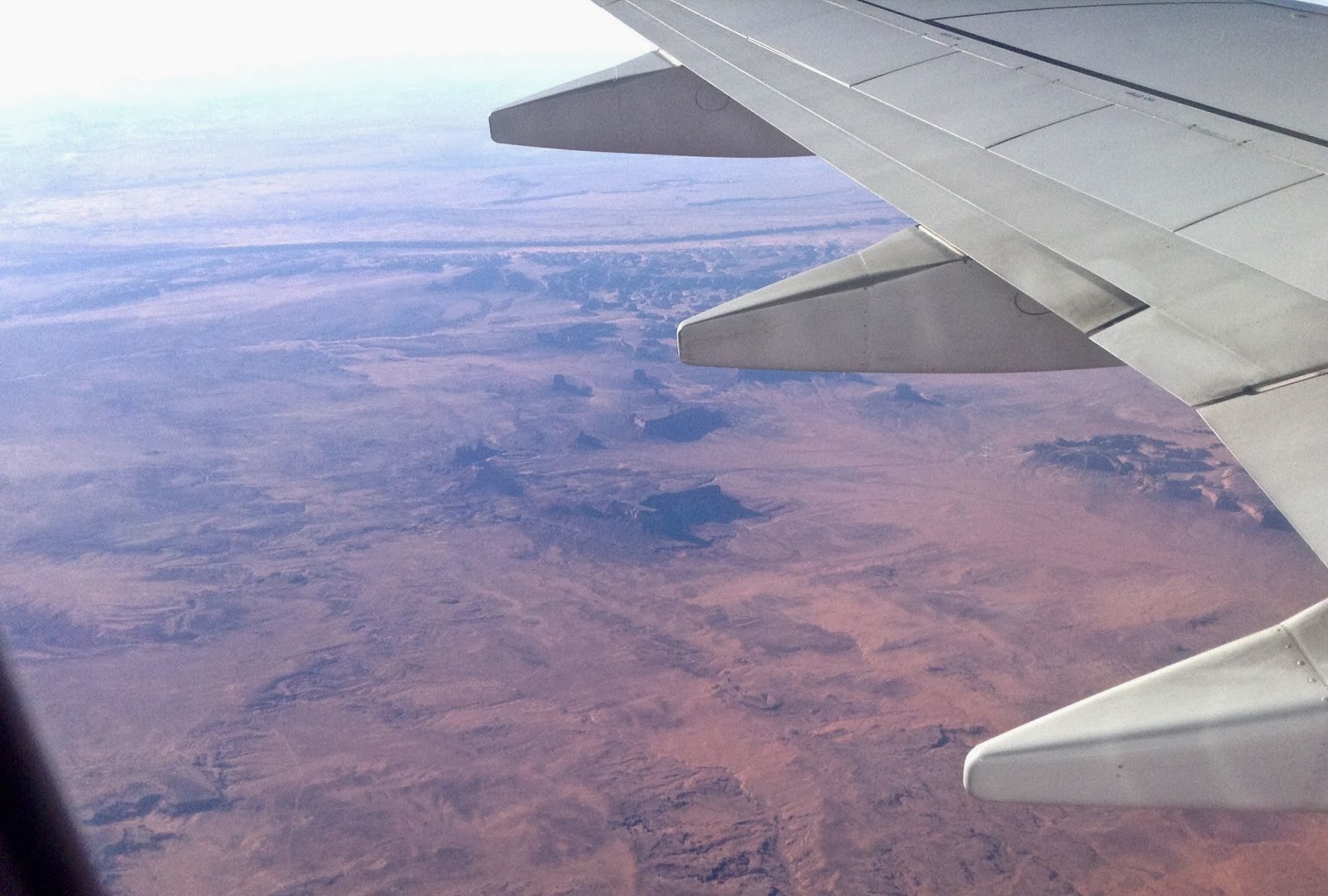
But where on Earth were we? It was a harsh country -- brown, yellow-brown, reddish-brown, ochre, burnt-ochre -- with almost no vegetation to obscure the landscape. The landforms were clear and striking. [Click on images to view.]
WOE? #1: Entrenched drainages in foreground and distance, “confined to a canyon or gorge ... with little or no flood plain ... often with meanders.” The CLUE is a prominent landform.

WOE? #3 Another entrenched drainage.

WOE? #4 Linear structure extending from lower right to center top includes (left to right): steep sandstone hogback dipping to left, reddish strike valley with dry drainage and highway, more gentle hogback.

WOE? #5 Entrenched meanders and prominent gooseneck -- "an extremely bowed meander."

WOE? #6 Leaving the desolate country to cross a high forested plateau.

Where on Earth were we? ... over the Colorado Plateau, where all these landforms are common. I’ve spent a lot of time among them on the ground, and it was really cool to see to see them from the air. I love flying!
 |
| One of the many wonderlands of the western USA; source. |

Above: Where on Google Earth, coordinates below. Note: photos in post are “upside down” as I was shooting roughly south.
#1 611873.00 m E 4119824.00 m N; this is the location of the CLUE, an abandoned meander of the San Jan River
#2 580157.12 m E 4101810.81 m N (approximate); looking toward Monument Valley
#3 488244.77 m E 4064986.78 m N; one of many entrenched drainages on the Plateau
#4 448807.42 m E 4038890.32 m N; this strike valley is traversed by US Hwy 89
#5 422814.73 m E 4027471.85 m N; Colorado River not far upstream from Grand Canyon
#6 408229.18 m E 4022493.52 m N (approximate); starting across the Kaibab Plateau
