 |
“Visit Nebraska. Visit Nice.” (more here)
|
Nebraska is nice, as the Nebraska Tourism Commission says, but why are they so modest? It’s more than nice—spectacular even. I especially like the immense vistas—maybe to the edge of the world! Maybe if I keep going I’ll float off to join the birds and the clouds, and we can sail across the beautiful blue Nebraska sky. Such thoughts cross my mind as I drive through open rolling country for miles and miles and miles.
 |
It was Willa Cather who suggested that the Great Plains lead to the edge of the earth.
|
And something equally remarkable lies hidden from view. Cross Nebraska and you cross miles and miles of water-soaked consolidated sand just a few hundred feet below the surface—one of the most important aquifers in the world. Two-thirds of the water in this great aquifer—650 trillion gallons**—lies under Nebraska.
 |
“Saturated thickness of the Ogallala Aquifer in 1997 after several decades of intensive withdrawals.” Note that the aquifer is most extensive and thickest (dark blue) in Nebraska (USGS via Wikimedia).
|
The Ogallala Aquifer is so-named because most of the water-bearing rocks belong to the Ogallala Group—named by geologist NH Darton after the town of Ogallala, Nebraska. It’s often called the High Plains Aquifer because it includes other rocks in addition to the Ogallala, but not many. Darton described the value of Ogallala rocks in his 1905 report about the central Great Plains:
“These great sand deposits, constituting the surface of the High Plains, contain a large volume of excellent water, which usually accumulates in the lower beds, where it is available for pump wells, generally at depths of about 200 to 300 feet. Such wells are numerous in the upland region of west Kansas, west Nebraska, and east Colorado, where they are the principal sources of supply.”Rocks of the Ogallala Group consist of debris that was eroded off the Rocky Mountains during the Miocene Epoch (roughly 19 million to 5 million years ago), carried eastward by streams and wind, and deposited as far east as eastern Nebraska and south into Texas (Maher 2003). The coarse loosely-cemented sediments—mainly sand—make for porous rock that holds lots of water.
The Ogallala Aquifer underlies 111.4 million acres or 174,000 square miles. Often the water is just a few hundred feet down and easily accessible by wells, which is why it’s so important. It provides about 27% of the ground water used for irrigation in the United States (source). But as huge as it is, it’s being sucked down, mainly by agriculture. Replenishment can’t keep up with use. McGuire (2007) estimated that as of 2005, Ogallala water storage had declined by 9% since pre-development—on average. Locally the impact can be much greater. The need to conserve the Ogallala is now widely-recognized, but far from being achieved. For more, see the NRCS’s Ogallala Aquifer Initiative, and this interesting article from Scientific American about Ogallala depletion, and related changes and innovations in agriculture.
 |
Water-level changes in the High Plains aquifer, predevelopment to 2005; modified from McGuire, 2007 (USGS). Red areas are most severe.
|
Back to Ogallala rocks … there’s another reason why they hold so much water. Not only are they porous, they sit atop older rocks that are rich in clay and volcanic ash and thus largely impermeable, thereby “sealing” the bottom of the aquifer. But sometimes it leaks.
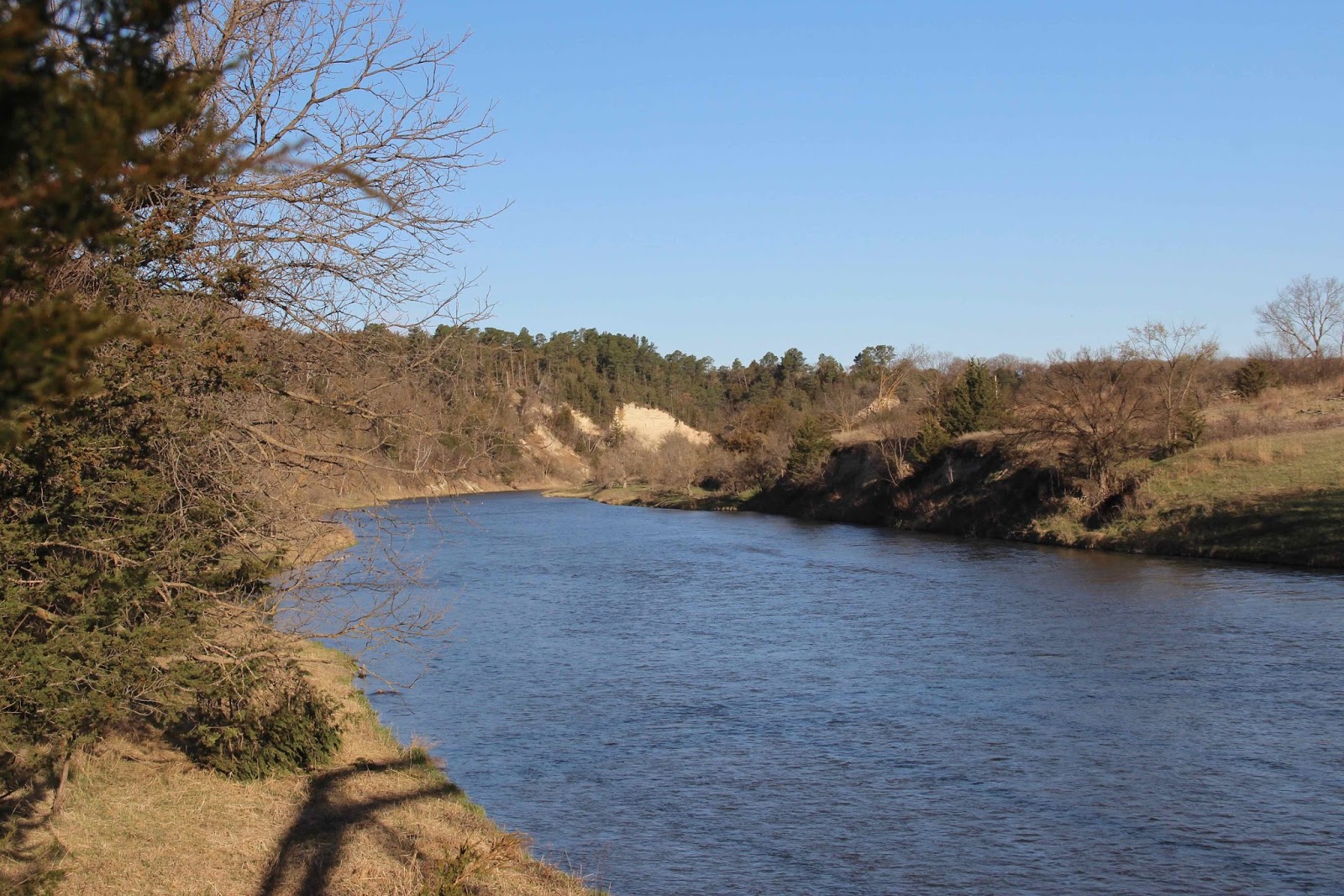 |
Morning on the Niobrara River. Pale slope center of photo is the Valentine formation, the porous water-bearing basal unit of the Ogallala Group.
|
In carving their valleys, several Nebraska rivers have exposed the base of the Ogallala. Last month, I visited the Niobrara River to see the great aquifer. East of Valentine, the Niobrara flows through an unexpectedly deep narrow valley, revealing the contact between the porous Ogallala and underlying impermeable strata. Seeps and springs—“leaks”—mark the juncture.
Just east of Valentine, I stopped at the Fort Falls overlook on the Fort Niobrara National Wildlife Refuge, where there’s a clear view of the Ogallala base. Water seeps out at the contact between the water-rich Valentine formation and the impermeable Rosebud formation below, turning the Rosebud reddish-brown.
 |
Shaded slope on a bright day makes for lousy photos, but still cool to see the Ogallala Aquifer!
|
 |
Valentine formation (Ogallala Group) at top of slope, with grass and scattered trees; reddish brown layer in center of photo is the Rosebud formation (White River Group).
|
About 15 miles east of Valentine on Highway 12, a narrow road turns south, crosses rolling prairie for awhile, and then suddenly descends into the valley of the Niobrara, ending at a state park designated for the most spectacular leak in the Ogallala Aquifer—Smith Falls. At 70 feet, it’s the highest waterfall in Nebraska.

The substantial footbridge across the Niobrara is in its third reincarnation as a bridge. It was built in 1910 to cross Verdigre Creek; disassembled and moved in 1917; reassembled in 1922 as part of Nebraska Highway 14; disassembled and stored in 1993; and finally reassembled, renovated, and installed at Smith Falls State Park, opening in 1996.

 |
A wooden walkway above the narrow canyon bottom leads to the falls.
|
 |
This is the Rosebud formation, reddish brown when wet. Water comes from the Valentine above, out of view.
|


**McGuire (2007) reported 2.925 billion acre feet of water stored in the High Plains Aquifer in 2005. Roughly two-thirds of this lies under Nebraska (source)—on the order of 2 billion acre feet or 650 trillion gallons.
Sources (in addition to links in post)
Joeckel, RM et al. 2014. Architecture, heterogeneity, and origin of late Miocene fluvial deposits hosting the most important aquifer in the Great Plains, USA. Sedimentary Geology 311:75-95 http://dx.doi.org/10.1016/j.sedgeo.2014.07.002
Maher, HD, Jr., Egelmann, GF, and Shuster, RD. 2003. Roadside geology of Nebraska. Mountain Press Publishing Company.


