 |
| Jesse Ewing Canyon down to Browns Park; highly recommended! |
I knew there was a problem when I saw a sign warning of a 14% grade—it should have been 17%. And there was pavement where there should have been gravel. The road had changed. The drop in grade meant it was longer and mileages in the guidebook no longer applied. How would I know what I was looking at?! Even worse, the new road might bypass the ancient rocks of Jesse Ewing Canyon altogether.
But my fears were unfounded. The Browns Park Road had indeed been rerouted, but as a result, Jesse Ewing Canyon is now a great geo-hike. Instead of trying to pull off a steep narrow road, we strolled down the canyon, stopping to ponder the remains of the ancient Red Creek mountain range, a substantial unconformity, and the magnificent conglomerate at the base of the Uinta Mountain Group.
The Uinta Mountains are part of the Rocky Mountains, having been uplifted during the Laramide Orogeny around 70-40 million years ago. The western half is known as the High Uintas—there are 26 peaks 13,000+ feet in elevation, including the high point of Utah, Kings Peak. Pleistocene glacial features are common. Late Precambrian sandstones and quartzites dominate the high country.
 |
|
Uinta Mountains (from Atwood 1909, labels added).
|
The eastern Uintas are different. They max out at only 9710 feet (Diamond Peak), were not glaciated, and are more complex structurally. And Precambrian rocks are older—in a few places much older, for example in Jesse Ewing Canyon.
I drove up the new paved road on a giant switchback, which explained the reduction in grade. Several road cuts displayed contorted multi-colored rocks, but there was no place to stop. At the top of the climb, I parked in a gravel pullout which turned out to be the old road, now closed. This was the start of the Jesse Ewing Canyon Geo-hike.
 |
| Start of geo-hike. Browns Park and more of the Uinta Mountains in the distance. |


 |
| Early geologists were puzzled as to why these rocks occur only here. |
Great geologists though they were, they found the Precambrian rocks of the Uinta Mountains puzzling. Ironically, it was Hayden—a physician with no formal training in geology, and looked down upon for his too-cursory surveys—who came up with the most modern explanation: [“white quartz” is Red Creek Quartzite; “red quartzites” are rocks of the Uinta Mountain Group]
“I find it difficult to account for this tremendous development of quartz[ite] with gneiss at the eastern end of the Uinta range. The white quartz[ite] beds rise abruptly from beneath the red quartzites, occupying a belt five to nine miles in width, and end as abruptly as they commence. I do not know why they should appear at this locality, when further to the west, at the sources of Black's Fork and Bear River, where the rocks rise to an elevation of over 13,000 feet, no trace of them can be seen … I am inclined to believe that the immense thickness of quartz[ite] was thrust up beneath the red quartzites, carrying the latter so high up that they have been swept away by erosion, except the remnant now remaining.”Just a half page later, Hayden revealed his naiveté:
“The geology of this portion of the Uinta range is very complicated and interesting. To have solved the problem to my entire satisfaction would have required a week or two [italics added].”
A bit further down the canyon, the Red Creek Quartzite gave way to younger rocks. As usual, I had to pause to clear the confusion in my head. In an undeformed series of rocks, the youngest layer is on top and the oldest at the bottom; in other words, a rock layer is younger than the one below and older than the one above. So whenever I make a counterintuitive descent through progressively younger rocks, as we often do in the Rockies, I have to draw a picture in my head explaining why. It’s because the rock layers were tilted when the mountains were uplifted …
 |
|
Orderly rocks, following Steno’s Law of Superposition.
|
 |
|
Same rocks, after uplift (tilting) and erosion.
|
 |
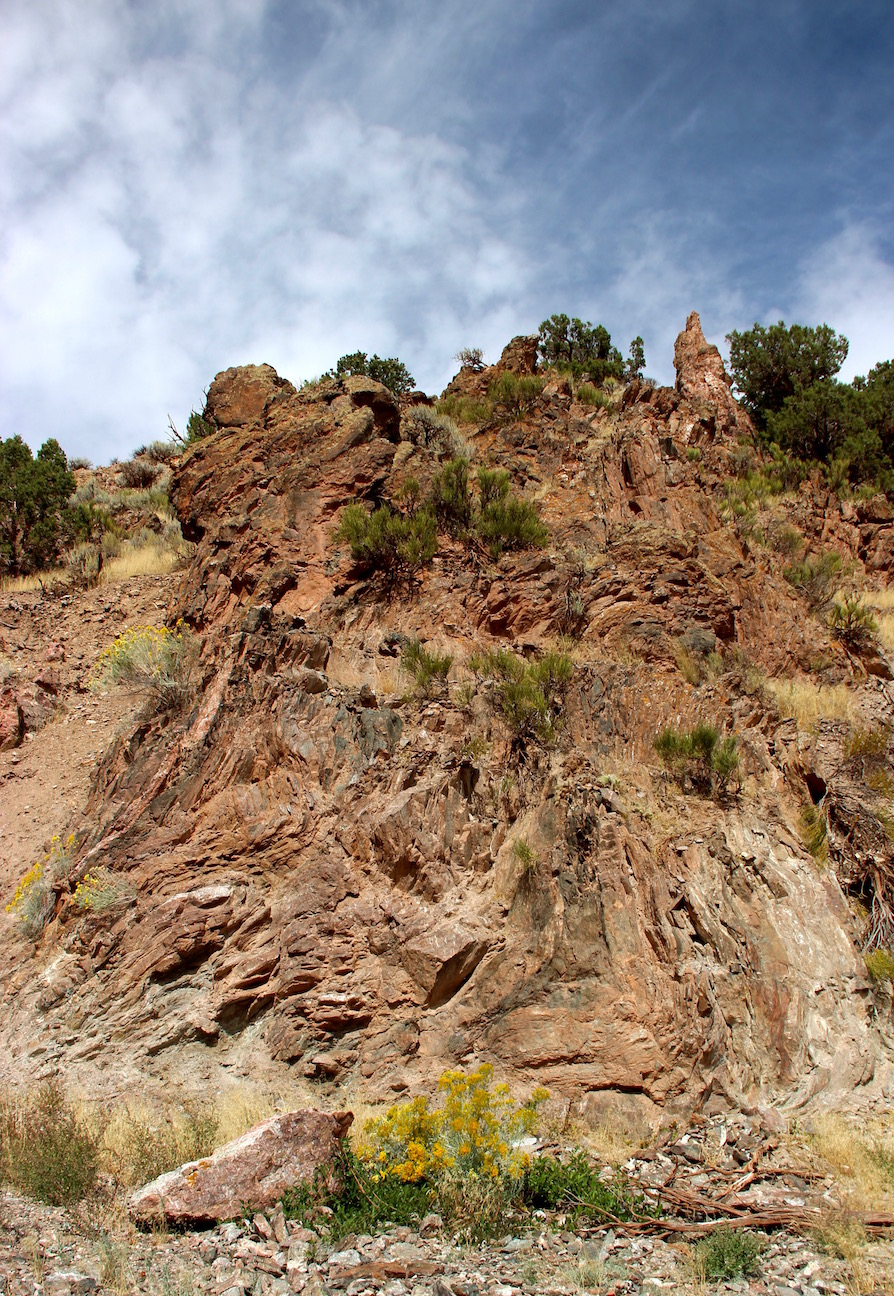
| Darker rocks beyond the Red Creek Quartzite are much younger, but still Precambrian. |
 |
|
Geologic clock showing Red Creek Quartzite and much younger UMG (source; labels added).
|
 |
| This draw marks a 1.5-year gap in the record. Feels like a Great Unconformity to me! |
Like the Red Creek Quartzite, the oldest (basal) rocks of the UMG crop out only in the eastern Uintas. They are beautifully exposed in Jesse Ewing Canyon—large pale quartzite clasts are set in a dark red to maroon matrix. The first debris to wash into the developing continental rift was dominated by large angular fragments from the Red Creek mountain range. Size and shape indicate they didn’t travel far.
 |
| The distinctive conglomerate has been designated the Jesse Ewing Canyon Formation. |

 |
| Conglomerate, with virgin's bower (Clematis). |
 |
| The conglomerate itself has been fragmented. Here's a piece in the old roadbed. |
Down the road, the conglomerate gave way to younger finer-grained rocks, mainly reddish-purple sandstones. They continued to the lower end of the canyon—all part of the UMG.

Like the Red Creek Quartzite, the UMG fooled the great geologists. None of them assigned it to Precambrian time; they all thought it was younger. Thirty-five years after his pioneering work, Frank Emmons returned to the Uintas, at age 65. This time he concluded that the UMG was Precambrian. He didn’t apologize for his earlier error. Instead, he prefaced his presentation to the Geological Society of America with this timeless explanation:
“A generation has passed away since these maps were made, during which time the advance in geological knowledge of the West has been so great and the change in methods of work so radical that it is difficult for the younger generation of geologists to appreciate the conditions under which geological work was then done.” (Frank Emmons, 1907)
At the lower end of the canyon, the UMG suddenly disappeared at a fault bordering Browns Park, the broad valley of the Green River. Suddenly we were strolling among Tertiary rocks—fine sediments and volcanic ash that filled the valley just 10-20 million years ago. Since then, erosion has set the debris moving once again … down the Green to the Colorado River and points beyond.
 |
| Pale outcrops against dark red slope behind mark Browns Park fault. Boulders are Jesse Ewing Canyon conglomerate. |
Fittingly, Jesse Ewing Canyon memorializes a geologist … of sorts. Prospector Jesse Ewing lived in a cabin near the head of the canyon. He had a bad reputation, with at least one murder to his name. He himself was murdered in 1885, “ambushed by Frank Duncan in dispute over the affections of Madam Forrestal,” a former resident of the Rock Springs red-light district. Ewing was buried at the Jarvie Ranch by John Jarvie and Albert Speck Williams. Twenty-four years later, Jarvie was murdered, by drifters from Rock Springs. Far from civilization, Browns Park was a rough place to live (more here).

Directions
Start the Jesse Ewing Canyon Geo-hike from either the top or bottom of the canyon (do you prefer to go forward or back in time?). Or maybe do a loop if you want to look at cuts along the paved road—it’s not heavily-traveled.
Top of canyon: 40°56'8.23"N, 109° 8’45.74"W
Top of canyon: 40°56'8.23"N, 109° 8’45.74"W
|
| Numbered signs mark a pipeline route. Note Paleoproterozoic road cut right of center. |
Bottom of canyon: 40°54'49.72"N, 109° 8'44.91"W
 |
| Another view of the Browns Park fault. New road visible on left. |
Sources (in addition to links in post)
Aalto, KA. 2005. Pioneering geologic studies of the Uinta Mountains by the great post-Civil War surveys of King, Hayden and Powell, in Dehler, CM, Pederson, JL, Sprinkel, DA, and Kowallis, BJ, eds. 2005. Uinta Mountain geology. Utah Geological Association Publication 33.
Atwood, WW. 1909. Glaciation of the Uinta and Wasatch Mountains. USGS Prof. Paper 61.
Dehler, CM, and Sprinkel, DA. 2005. Revised stratigraphy and correlation of the Neoproterozoic Uinta Mountain Group, in Dehler, CM, Pederson, JL, Sprinkel, DA, and Kowallis, BJ, eds. 2005. Uinta Mountain geology. Utah Geological Association Publication 33.
Emmons, SF. 1907. Uinta Mountains. Geological Society of America Bulletin. 18:287-302.
Hansen, W. 1969. The geologic story of the Uinta Mountains. US Geological Survey Bulletin 1291. PDF
Hayden, FV. 1871. Preliminary report of the United State Geological Survey of Wyoming, and portions of contiguous territories. Washington: Government Printing Office.
Tennent, WL. 1981. John Jarvie of Brown’s Park. Bureau of Land Management - Utah; Cultural Resources Series No. 7. Available here.
Fabulous! Thanks for the diagrams--they really helped with understanding the formations and the geological composition. I was going to ask you about the red soil/rock, and then you explained it--thanks. I also appreciated the directions, as I just might find myself taking that hike someday. :)
ReplyDeleteThanks, Beth. I would be really happy if someone made this hike because of this post :-) Hopefully the scenery and cool geology would make up for strolling along a CO2 pipeline! (more on this later)
Deletenice story of the two quartzites.. and love the conglomerates..
ReplyDeletethanks, Suvrat, glad you enjoyed it. The conglomerates were truly beautiful ... my photos don't do them justice!
Delete