Showing posts with label Laramie history. Show all posts

Wednesday, February 23, 2022

So long Jerry Hansen, it's been good to know yuh

Never too old to play with trains.
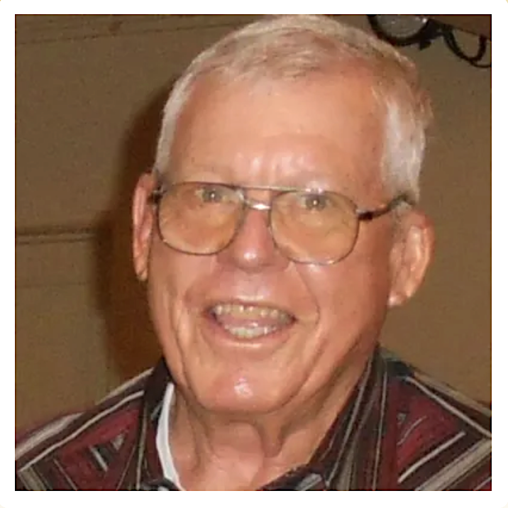
I didn't know Jerry Hansen well. But I knew him well enough to know that he loved railroads. He also loved Laramie history and conversation filled with good stories—a fine tradition that may be fading. I will miss his cheerful presence and bright smile.

We met five years ago when I was writing an article about the Gangplank, the erosional remnant that provided an easy route up to the crest of the Laramie Mountains for the Transcontinental Railroad. Someone gave me Jerry's number, I called, and was soon immersed in local railroad history. He suggested we drive around to see remnants of the original line, but life interfered and we never did.

Looking east down the Gangplank; note railroad left of Interstate 80. Courtesy USGS.
Laying track for the UP in 1868. From Wyoming Tales & Trails, original source not given.
Jerry's great great granddad, Hans Hansen, worked for the Union Pacific during the first days of the Transcontinental Railroad. For reasons now lost, he settled in Laramie, where Jerry was born about 70 years later. Hans' son, grandson, and great grandson all worked for the UP, but great great grandson Jerry fell in love with trucking when he was 14 and working at the Laramie Safeway. One day they let him back a truck into the loading shed (pause smile), and he was hooked. He lied about his age, got a license (this was the good old days), and drove until he retired at 70 because it was taking him ten minutes just to climb up into the cab (chuckle).

Jerry considered himself a self-taught historian. He first got interested through his fascination with trains. When he was a kid, growing up in a family of railroaders, he tried to learn as much about trains as he could, and stumbled upon history in the process. He also spent a good deal of time in the railroad yard checking out everything and everybody, and climbing on the trains rolling around the yard. He gave up jumping on trains as he got older, but his reading and research expanded to include books, old newspapers, old photos, and more. In 2014, Jerry and the late Larry Ostresh, another leading local historian, wrote their own book—Laramie Railroads.

Brand new Union Pacific Passenger Station in Laramie, 1924. In 1985, local citizens saved it from destruction by the UP. It's now a museum (American Heritage Center).
If I had a question for an article I was writing, or because it would be fun to discuss my subject with Jerry, I would stop at the Laramie Plains Museum where he spent four afternoons a week digitizing historical photos, slowly making his way through thousands stashed in a museum closet. I learned not to be in a hurry. After finishing with my topic, we would continue on, ranging far and wide with our story-telling.

The last time I visited, it was to ask about the mysterious Right Hand Fork of the Laramie River, which appeared on a map published in 1845 by explorer John Fremont. Jerry was immediately interested; this was news to him. He gave me ideas, sources to investigate, and places to visit after the weather warmed. I'm sorry I didn't get it figured out before he passed.

After we were done dissecting Fremont, Jerry told me about his recent third heart attack. It was a classic Jerry story, with clear highlights, and punctuated with pauses, smiles, and chuckles. It happened while he was driving to Cheyenne to see his cardiologist (pause chuckle). He didn't remember going off the highway, but when he came to, he saw his truck had been stopped by an old railroad embankment (pause smile). He spent four days in the Cheyenne hospital where he was treated like a king, and after surgery he felt much better (a happy ending). It may have been a bad experience, but what a great story!

That was so Jerry. During our visits, it seemed the world was mostly a good place (except when "they" tore down old Laramie buildings). Sometimes I think of Jerry and try to be more like him. Sometimes it works.

Tuesday, August 17, 2021

Frank Tweedy's Traveling Plants: WY to NYC & back

Frank Tweedy. Union College Special Collections (used with permission); date unknown.
Readers of this blog may remember Frank Tweedy of the US Geological Survey, who surveyed the Laramie Plains in 1892 (Mapping the Laramie Plains, 3rd dimension captured). In August of that year, the Laramie Boomerang announced that Tweedy and assistant James McFarland would "commence work upon the topography of this section of the country." Three years later, the "Laramie Sheet" was published—one of the first topographic maps for Wyoming.

In January of 1903, there again was a Frank Tweedy in the Laramie news. "Prof. Nelson [University of Wyoming] has received a rare collection of plants from Mr. Frank Tweedy ... a botanist of considerable distinction" reported the Republican. Were USGS surveyor Frank Tweedy and distinguished botanist Frank Tweedy one and the same? And how did 700 plants survive a trip to Laramie in January?!

Dead, flat, & dry

Actually, survival was not an issue, for these plants were already dead. But they still were of great value. All were collected in 1900 in the wilds of the northern Bighorn Mountains. There they were carefully arranged in paper folders so that parts needed for identification were visible, and placed in a plant press with absorbent felt sheets until dry (several days to several weeks, depending on weather).

After the field season, they made their way east, ending up at the New York Botanical Garden where the great botanist, Per Axel Rydberg, either identified them, or, if they were new to science, named them himself. Then in 1903, "upward of 700" traveled west to Laramie, each accompanied by a label with the plant's name, collection location, date, and collector—Frank Tweedy.

At the university there was more processing, for dried plants are fragile, and won't last long if left loose in paper folders. They were mounted on 11" x 18" sheets of durable paper, preserving them for centuries to come, and properly filed in the university herbarium.

Pleated gentian, Gentiana affinis, collected by Frank Tweedy in 1900. Rocky Mountain Herbarium.

Herbarium?

If you don't know what a herbarium is, you're not alone. Few people do. Many think it's some kind of greenhouse, but actually it's the opposite—a collection of pressed dried plants. The first, called a "hortus siccus" (dry garden), was created in the 1520s by Italian botany professor Luca Ghini. He wanted a way to teach plant identification in the winter, so he pressed and dried plants, and glued them to paper sheets. Fed up with their ancient textbooks, Ghini's students loved him for it.

Today, students still use herbarium specimens to learn to identify plants. But they took on a much bigger role during the golden era of global exploration (16th–19th centuries)—documentation of the world's flora. Herbaria proliferated and flourished. Now there are at least 3300, holding nearly 400 million pressed dried plants!

New herbarium grows fast

By 1892, the University of Wyoming had been operating for five years with a botany professor (Aven Nelson) but no herbarium! This was unacceptable for the state's only university. Fortunately, Experimental Station Supervisor Burt C. Buffum had collected Wyoming plants for several years, accumulating on the order of 500. Several hundred were set aside for an exhibit at the 1893 World's Columbian Exposition in Chicago. As for the rest, University President Albinus Johnson directed Nelson to use them to start a herbarium.

Nelson knew little about plant identification and herbarium management, but that didn't slow him down. In 1899, he launched an ambitious project. For 14 weeks, he traveled Yellowstone Park by horse-drawn wagon, with his wife, two daughters, and two students. They collected zealously, returning to Laramie with 30,000 specimens! Most were duplicates, to be sold or traded to fund and expand the UW herbarium.

Collecting plants in Yellowstone, 1899. Photo by Aven Nelson; American Heritage Center (AHC).
Before the trip, Nelson wrote to his esteemed colleague Per Axel Rydberg at the NY Botanical Garden, asking where in Yellowstone he should collect. Rydberg replied: "The flora of the park is, however, well worked up as several collectors have been in there ... The one that has done the most, however, is Frank Tweedy of US Geological Survey. He spent two whole summers in the park."

Indeed, surveyor Frank Tweedy and botanist Frank Tweedy were one and the same!

An eye for novelty

Frank Tweedy was born, raised, and educated in New York, graduating from Union College in 1875 with a degree in civil engineering. He began his surveying career the next year in the Adirondacks, followed by a stint as a sanitation engineer in Rhode Island. All the while, he collected plants.

If we follow Tweedy's trail of herbarium specimens (accessible online), we go from New York to New Jersey to Rhode Island. But then we make a huge leap west. In 1882, Tweedy went to work as a topographer on the Northern Transcontinental Survey in Washington Territory. And he collected plants.

For Tweedy, this was a very different kind of botanical world, largely unexplored and rich in novelties—species new to science. He collected his first that summer, a grass from the Wenatchee Mountains. It was named Tweedy's reedgrass (Calamagrostis tweedyi) by grass expert FL Scribner, who wrote: "Mr. Tweedy has been a careful and zealous collector of the plants of the various sections of our country which he has visited, and it is with pleasure that I dedicate this species to him."
Calamagrostis tweedyi, Tweedy's reedgrass, from American Grasses (FL Scribner 1897).
This was the first of more than 100 plant species discovered by Tweedy, and the first of at least 35 named in his honor. By the time his specimens arrived in Laramie in 1903, he was a highly-regarded pioneering botanist of the American West.
Erigeron tweedyi, Tweedy's fleabane. Photo by Matt Lavin (Flickr).

Herbarium in the news

Meanwhile the UW herbarium had grown rapidly, thanks to collecting by Nelson and his students, and acquisitions through purchase and trade. In 1899, he convinced the University Trustees to make it a separate institution—the Rocky Mountain Herbarium (as it is today), with Nelson as curator.

Within a few years, Nelson and the Rocky Mountain Herbarium had become newsworthy. In May of 1902, the Rawlins Republican reported "[a set] of 800 Wyoming plants has just been forwarded to the Carnegie museum (Pittsburg) by Professor Nelson" who also "received an interesting collection of plants, some 300 in number, from Dr. Riser of Rawlins ...". Even more notable, Nelson shipped a collection of potentillas (cinquefoils) to Germany, to "Dr. Theodore Wolf, a German botanist, who is preparing a monograph of all the species of the genus in the world." In exchange, German potentilla specimens would be sent to the Rocky Mountain Herbarium.

In July, the Cheyenne Daily Leader had exciting news. "12,000 Specimens of Rare Herbs and Plants for the State University" had been collected in Nevada, New Mexico, Utah, and Wyoming by Leslie Goodding, one of Nelson's students. About 800 species were represented, including every botanist's dream—species new to science (several were named in Goodding's honor).
University of Wyoming, 1901. AHC, SH Knight Collection.
According to the Laramie Boomerang, by September of 1902, UW's herbarium contained 36,000 specimens—impressive given there were still just three buildings on campus (not counting barns and greenhouses). At the end of the year, when Nelson's articles about saltbushes and hawthorns were published in the University of Chicago's Botanical Gazette, the Laramie Republican proudly and rightly declared, "Prof. Nelson is a recognized authority on Rocky Mountain and western plants."

Thus we shouldn't be surprised that a botanist of Tweedy's caliber would contribute a "rare collection of plants" to the Rocky Mountain Herbarium.

Imagining the past

During my research, I often imagined Tweedy and Nelson in conversation—the renowned western botanist encouraging Nelson's ambitions. Did they meet when Tweedy was surveying the Laramie Plains in 1892? Or maybe they made arrangements in May of 1901, when the Personals section of the Boomerang reported that "Frank Tweedy of Washington is in the city" (no further details).

I searched and searched for correspondence between the two men, eager to find a climax for this story. Instead, I discovered that the Republican, or perhaps Nelson, had led me astray.

In examining Tweedy's specimens at the Rocky Mountain Herbarium, I discovered a puzzling label on the lower left corner of each: "Received from A.A. Heller, 1903". As I would learn, Nelson didn't receive the specimens directly from Tweedy. He bought them from Amos Arthur Heller. (Heller probably got them through a trade, but we can't be sure.)

A fantastic bargain just the same

Heller was an American botanist active from 1892 to 1940. The standard botanical sources include his professorships in Minnesota, California, and Nevada, as well as work for prominent botanical institutions. But I knew nothing of his stint as a freelance plant dealer until I visited UW's American Heritage Center, where I found a folder of letters from Heller to Nelson. 

On December 3, 1902, Heller wrote Nelson from Puerto Rico: "If you care for them, I have a collection of 700 Wyoming plants collected by Frank Tweedy, which I will sell for $45.00. There are a lot of new species among them [named] by Rydberg, and I understand he [identified] the whole collection. I am giving you the first chance at these, as I know they will be of more value to you than any one else." He then advised, "If you want the Wyoming plants, Mrs. Heller [in Pennsylvania] will attend to sending them."

Apparently Nelson jumped at the opportunity. In a letter dated December 29, E. Gertrude Heller wrote: "I will ship you the plants at once ...", which she must have done since they arrived sometime before January 14, when their story appeared in the Laramie news.

Surely Nelson was happy with his purchase—nearly 700 specimens representing 500+ species, collected by a highly-respected botanist. And, as the Republican explained, "As not more than three of these sets of plants are in existence this herbarium is fortunate in securing one" (the others went to the National Herbarium and the NY Botanical Garden).

Furthermore, "since [Tweedy's] work carries him into many places, inaccessible to the ordinary collector, his plants are unusual and interesting." Here the Republican was correct. A dozen of the specimens were species new to science! Obviously Frank Tweedy was very good at spotting botanical novelties, even while surveying.
Tweedy's gilia (Gilia tweedyi), collected by Frank Tweedy in the Bighorn Mountains. Dried plant is about 8 in tall. H. Marriott photo; added flower photo by Matt Lavin, 2012 (Flickr).

🌺🌼🌾

This post is based a recent contribution to the History column of the Laramie Boomerang, which features articles by volunteers eager to share our local history. We also hope to relieve the dismal monotony of pandemic news, and support our flagging local newspaper! Articles are archived at the Albany County Historical Society website.

For more about Frank Tweedy, perhaps our most under-appreciated pioneering botanist, see his Wikipedia page. It was created just last year by this author (herself a botanist), and Noel Sherry, who is exploring Tweedy's mapping, plant collecting, and more.

Friday, April 9, 2021

Mapping the Laramie Plains II: 3rd dimension captured

Two views of Sheep Mountain[s]: 1895 USGS map and 2011 photo looking northwest from Sodergreen Lake.

To refresh your memory, and for you who missed Mapping the Laramie Plains I: in pursuit of the 3rd dimension, this story began with the promise of a map of the Laramie area on which "almost every hill and cañon [sic] can be determined at a glance!" according to the Laramie Boomerang in 1893. Yet the post ended before we could share in the reporter's excitement. That's because the back story was so long—three millennia.

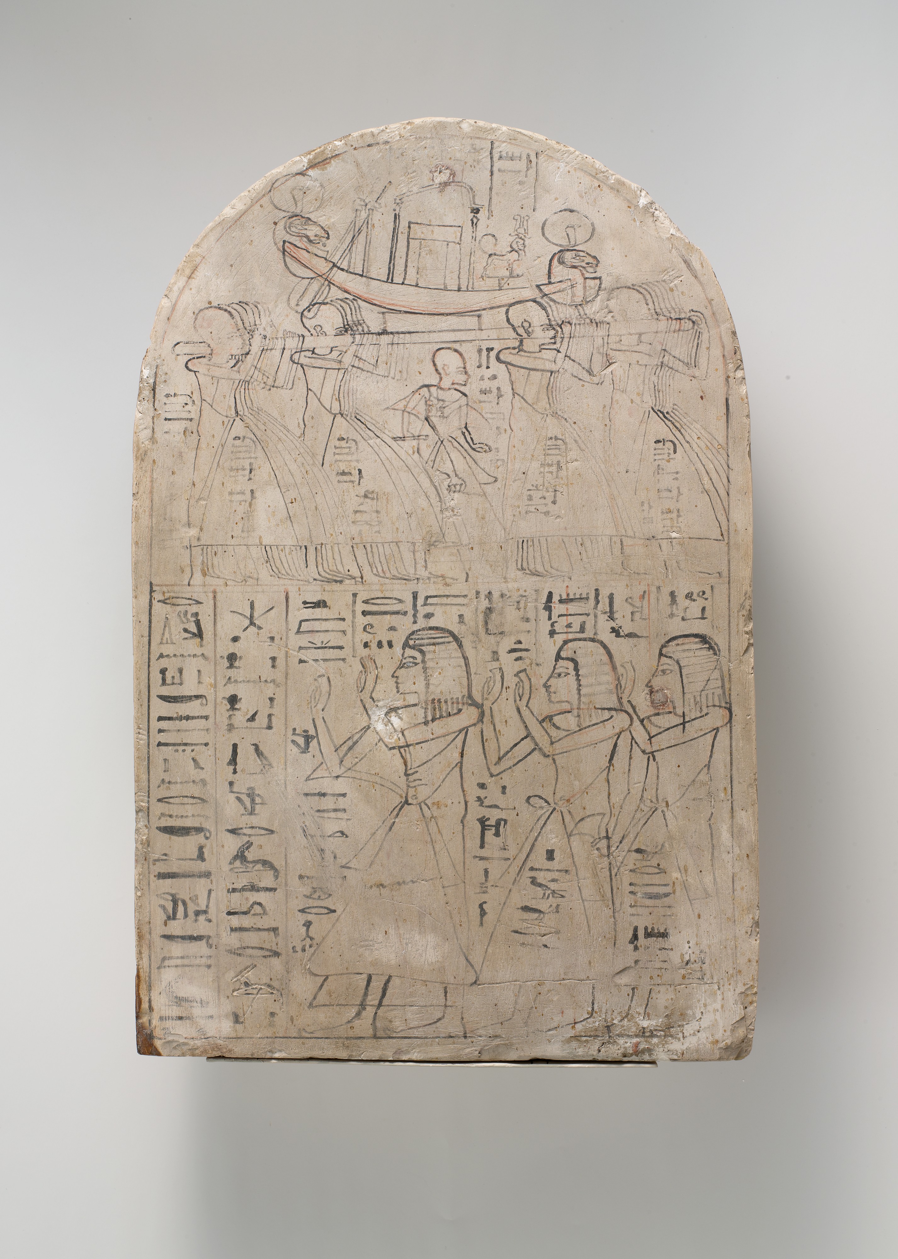
It began in the 12th century B.C., when Egyptian scribe Amennakhte drew the earliest surviving topographic map—a map which shows the shape of the land. It featured a winding line with large flat cones on either side—a valley bottom between hills. Maps would be similarly crude for the next three thousand years, with hills and mountains drawn as simple pictures, and approximately located at best.

But by the early 1800s, techniques were  much improved. Maps by William Clark of the Lewis and Clark expedition, and Charles Preuss, John C. Frémont's cartographer, added significantly to our geological knowledge. But they weren't perfect. Clark put today's Colorado too far north, thereby eliminating the Laramie Plains. Preuss's map was accurate for major features, but finer details could be unreliable. And on both maps, mountains were shown using hachures—short parallel lines suggesting relief but with little specific information. The third dimension remained elusive.

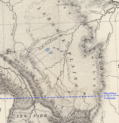
Excerpt from Preuss's map, showing the Laramie Plains crossed by the mysterious Right Hand Fork of the Laramie River (state line added). David Rumsey Map Collection.

After a grim hiatus, mapping resumes

Through the 1850s, the Army Corps of Topographical Engineers continued to explore and map the American West. The emphasis was route-finding, exemplified by the Pacific Railroad Survey—four concurrent expeditions looking for a way across the Rocky Mountains. But mapping came to a halt with the start of the Civil War, except as needed by the Union Army.

About five years after the War's end, the government began to invest again in maps. They were badly needed, for while France and England were putting final touches on national maps, and a dozen more countries had surveys in progress, the United States lagged far behind.

In 1870, a young US Army Lieutenant, George Montague Wheeler, presented a detailed proposal to map the United States west of 100º longitude (which roughly bisects the Dakotas). In need of post-war work, the Corps of Topographic Engineers jumped at the opportunity, and in 1871, Wheeler launched his "Survey West of the One-Hundredth Meridian."

George Montague Wheeler ca. 1872; National Portrait Gallery (SI)

Where on Earth are we?

Just a year later, on November 30, 1872, James H. Hayford of the Laramie Daily Sentinel reported, "Some parties are putting up some aparatus [sic] and a temporary observatory near our office today, under the supervision of Lieut. Wheeler [it's unlikely Wheeler himself was present], for the purpose of taking some astronomical observations to determine the latitude and longitude of this place."

Wheeler's men, John H. Clark and F.R. Simonton, had already made astronomical observations at two other locations in Wyoming Territory: Fort Fred Steele and Cheyenne, where they came up with a handy improvement to standard procedure. "A large wall-tent drawn over a framework formed the observatory. ... it was found to be an improvement to retain the ridge-pole [during observations] as a support against the violent winds so prevalent."

All in all though, working conditions were luxurious compared to those of the Frémont expedition 30 years earlier. Clark and Simonton could partake in the conveniences offered by the Laramie City, just four years old. Furthermore, their tent "was furnished with all the appliances of a field and temporary observatory, such as stools, stands, tables, and the like, and nothing was wanting as to equipment for first-class field-work. The [local] telegraph company furnished the line."

Longitude by wire

However, one thing hadn't changed since Frémont's time—longitude remained the greater challenge. There was no way to measure it directly. Instead, it was calculated based on the difference in time of specific celestial events in Laramie, and in Salt Lake City where longitude had been determined in 1869. [If you are thinking Laramie and SLC are in the same time zone, you're correct. But for this procedure, the surveyors used local time, also called solar time.]

To determine time difference, Clark and Simonton relied on the near-instantaneous communication of telegraphy. Time was recorded by chronograph—a combination of chronometer (clock) and paper-covered cylinder. Powered by a small battery, the cylinder turned exactly once per minute, as a pen marked a chronometer tick every second. After each minute, the pen-holder advanced slightly. The result was a piece of paper covered in parallel lines of tick-marks, a printed record of time.

As the chronometer clicked and the cylinder turned, the men added astronomical observations to the chronograph record, in real time. One man kept an eye on the heavens while also recording meteorological conditions and other notes on a paper form. When a star to be tracked approached, he notified the Observer at the telescope. At the moment the star entered the telescope's field of view, the Observer tapped a key wired to the chronograph, thereby leaving a mark on the paper. He did the same when the star passed out of view.

Drum chronograph by William Bond & Son, ca. 1850; "an instrument that touched a pen to a paper-wrapped cylinder to record both the beats of the clock and the instant of a celestial event, signaled when an observer pressed a telegraph key." (courtesy National Museum of American History)

This was only half the project. Each time the Observer in Laramie pressed the key, the signal also was sent via telegraph to a chronograph in Salt Lake City, overseen by their coworker, E.P. Austin. From the two sets of long paper records, they determined that stars passed over Laramie 25 minutes and 12 seconds before passing over Salt Lake City, putting the Laramie observatory at approximately 105º 35' 24" longitude (only about four blocks too far east according to Google Earth, not bad for field data!).

Star-gazing in Laramie, Wyoming in December

Obviously, Clark and Simonton were able to determine longitude much more accurately than Frémont had three decades before. But the work was challenging even so. They had constructed a rigid base for their instruments, but thundering trains shook them out of adjustment, and the metal contracted and expanded with temperature. Ink froze on the coldest nights, and the men's concentration waxed and waned with weather and amount of sleep.

So for accuracy, multiple stars were observed on multiple nights—but only when skies were clear at both ends of the telegraph line. To get enough observations, Clark and Simonton spent most of December in Laramie, "subjected to too much cold and too many wind and dust storms for any human brain and muscle to effect its best work in astronomy," according to Clark.

The future arrives

Wheeler's 1877 Progress Map; published sheets are brown. Laramie is near the east edge of Sheet 43. David Rumsey Map Collection.

In just eight years, Wheeler's crews surveyed 333,000 square miles; 75 topographic atlas sheets were produced (but no Laramie Sheet). The tradition of representing relief using hachures continued, often with the addition of spot elevations (numbers). But there was a revolution afoot. During the same time, John Wesley Powell and Almon Harris Thompson, of the US Geographical and Geological Survey of Territories, were producing topographic maps using contour lines, which connected points of equal elevation. These maps showed the shape of the land in greater detail and more accurately.

Excerpt from Wheeler's hachured "Central Colorado Atlas Sheet # 62a" (1878). Click to view scattered spot elevations. David Rumsey Map Collection.
Excerpt from Powell and Thompson's contour map: "Green River from the Union Pacific Rail Road [WY] to White River [CO]" (1876); green marks irrigable land. David Rumsey Map Collection.

Mapping the Laramie Plains

In 1878, Wheeler's survey and three others were replaced with a single agency, the United States Geological Survey (USGS), tasked with "classification of the public lands, and examination of the geological structure, mineral resources, and products of the national domain." In 1882, its responsibilities were expanded to include preparation of a national map.

A decade later, on August 26, 1892, the Laramie Boomerang had great news. USGS surveyors Frank Tweedy and James McFarland had arrived and would "commence work upon the topography of this section of the country"—part of the national map of the United States already ten years underway. "This vast map will take at least 25 more years to complete [it would be more like a century] ... [and] when completed, would, if spread out, cover a little over 3/4 acre ..."

Obviously impractical, the great map had been divided into sheets, each named for a prominent local feature (for example, the Laramie Sheet). Vertical relief would be shown with contour lines, now recognized as far better than hachures, which cluttered maps, provided limited information, and were expensive to draw and print (almost as costly as fieldwork!).

No need to bother with longitude

The point established 20 years earlier, by Clark and Simonton of the Wheeler survey, did not go to waste. Tweedy and McFarland used it as the starting point for their survey. From it, they ran a baseline along the bed of the Union Pacific Railroad north of Laramie for 2.5 miles. The ties supported their tape nicely, and there was no brush to clear.

Their methods show how far accuracy had come. The tape was held at 20 lb. tension using a spring balance at one end. After every four lengths, they remeasured and calculated the average. The metal tape was precisely 300 ft long, but that was at 62º F. So they tried to work mainly on cloudy days or at night to minimize expansion and contraction. They also kept a record of air temperature, for later adjustment (0.02289456 inch per degree).

From the baseline, Tweedy and McFarland established points across the Laramie Plains through triangulation—measuring angles. No longitude determinations needed! And no trees obscured their view. They measured distance, direction and height of prominent features—mountain summits, ends of ridges, forks of creeks, and so forth. They also made detailed sketches of landscapes.

After several months, Tweedy boarded a train and transported the data and sketches to Washington DC, where he and others would turn them into a map.

Reading the lines

Six months later, in March of 1893, County Surveyor W.O. Owen  received preliminary sheets for review (Owen had mapped Albany County the decade before, using shading to show relief). According to the excited Boomerang reporter who saw them, "The contour lines are so explicit that almost every cañon and hill can be determined at a glance."

Well, maybe. For many people, contour maps were new and counterintuitive. So the USGS provided an explanation with each map to help users interpret the winding lines. "Each contour [line] passes through points which have the same altitude. One who follows a contour on the ground will go neither uphill nor downhill, but on a level ... a succession of these contour lines far apart on the map indicates a gentle slope; if close together, a steep slope; and if the contours run together in one line, as if each were vertically under the one above it, they indicate a cliff."
Excerpt from first Laramie Sheet (USGS 1895). Increasingly-close lines east of Laramie are foothills of the Laramie Range. Southeast of town, Red Buttes have dense lines on their steep sides, and none on the flat tops. Gentle terrain (lines far apart) stretches west for miles before meeting the dark steep face of Sheep Mountain.

Even the depressions of the Laramie Basin were mapped using contour lines. In fact, they are textbook examples—literally! They appeared as Plate 170B in "The Interpretation of Topographic Maps" (USGS 1908). "In many parts of the country are depressions or hollows with no outlets. The contours, of course, surround these, just as they surround hills. The small hollows known as sinks are usually indicated by hachures, or short dashes, on the inside of the curve."
Excerpt from "Plate 170B: Special types of lakes: part of Laramie Sheet" showing hollows or sinks of the Laramie Plains (USGS 1908).

Sources

These are some of the more interesting sources I found:

David Rumsey Map Collection (kinda like the Hotel California—hard to leave)


Evans, R.T., and Frye, H.M. 2009. History of the topographic branch (division): U.S. Geological Survey Circular 1341, 196 p. (PDF; unfortunately illustrations are missing)

For more about longitude determination, see the great Wikipedia article: History of longitude, especially "Land surveying and telegraphy". True enthusiasts will want to read "Longitude by Wire: Finding North America" by Richard Stachurski (2009).

Cohen, Paul. 2002. Mapping the West; America's Westward Movement 1524-1890. Hardcover. 65 fascinating maps and their stories (plus a very interesting account by David Rumsey of how he got hooked on maps).

This post is an expanded version of the second of two articles about mapping the Laramie Plains, my most recent contribution to the "Laramie History" column in the Laramie Boomerang.

Saturday, March 27, 2021

Mapping the Laramie Plains I: in pursuit of the 3rd dimension

"... almost every hill and cañon can be determined at a glance!" From first Laramie, Wyoming Sheet (USGS 1895; public domain).

In the spring of 1893, Albany County Surveyor W.O. Owen received a set of preliminary maps from the US Geological Survey for review. Owen had known what to expect, but the others who saw them were surprised. "The maps are of a very interesting character ...", wrote a reporter for the Laramie Boomerang, "almost every hill and cañon can be determined at a glance!"

Indeed, the new map was astonishing—mountains and depressions around Laramie had been clearly mapped using squiggly lines! But this achievement was long in coming. For millennia, mappers had struggled to show topographical relief, to capture the third dimension on a two-dimensional sheet of paper.

Line + cones = valley
From Amennakhte's map for pharaoh Ramesses IV. Public domain.
In 1160 B.C. Scribe-of-the-Tomb Amennakhte made a map for Egyptian pharaoh Ramesses IV, who was planning a trip to quarry sandstone suitable for statues. On papyrus, he drew a broad winding line with bumpy cones lying flat on either side. With a bit of imagination, we see this is a valley lined with hills.

Amennakhte's hills look terribly crude to our eyes. Yet they aren't all that different from those appearing on maps for the next two millennia. As late as the 16th century, during early exploration of North America, mountains were shown as oversized cones, though sometimes shaded to suggest depth. Often their locations were based on distant views from sea, or rumors.
Leftmost figure is "Royal Scribe of the Place of Truth" Amennakhte. Carving on limestone, ca. 1184–1070 BC. Metropolitan Museum of Art; public domain.

Lewis & Clark map new territory

The next centuries brought significant improvements in surveying and mapping, fortunately. In the early 1800s, the young United States was in desperate need of good maps. The Louisiana Purchase had doubled the country's size. Little was known about the new territory—not even its size, nor how to traverse it.

In May 1804, the Corps of Discovery Expedition, led by Meriwether Lewis and William Clark, headed up the Missouri River in search of a route to the Pacific Ocean. In preparation for the trip, Lewis was trained in celestial navigation. President Thomas Jefferson personally provided instructions for mapping:
"... you will take observations of latitude & longitude, at all remarkable points on the river [e.g., rapids, river mouths, islands]. The interesting points of the portage between the heads of the Missouri, & of the water offering the best communication with the Pacific ocean, should also be fixed by observation ..." [Jefferson assumed they could reach a west-flowing river by carrying their boats overland.] "Your observations are to be taken with great pains & accuracy, to be entered distinctly & intelligibly for others as well as yourself, to comprehend all the elements necessary, with the aid of the usual tables, to fix the latitude and longitude of the places ..."

Lewis and Clark faithfully executed Jefferson's instructions, for three years, four months, ten days and 8000 miles.

William Clark, explorer, soldier, Indian agent, territorial governor & cartographer; portrait by Charles Peale 1810. Public domain.
Clark's map reveals a multitude of mountains

William Clark took on the job of mapmaker. In addition to the Expedition observations, he used information from explorers, trappers, natives, and earlier maps to include areas not covered by the expedition. His first map showed the Corps’ route in great detail and was necessarily huge—50+ large sheets. He then produced a single map 52 inches long and 31 inches wide, engraved and published in 1814: “A Map of Lewis and Clark's Track, Across the Western Portion of North America ...”

Among the discoveries visible on Clark's map is the structure of the Rocky Mountains. They are not a single long ridge as previously thought, but a complex system of mountain ranges and foothills. In fact, after reaching the headwaters of the Missouri, the Corps of Discovery had to travel for weeks on horseback and foot to reach west-flowing waters. A portage across the Rockies was out of the question (click on image below).
Lewis & Clark's Track. Courtesy David Rumsey Map Collection (available in high resolution).
If you click on these images, you can see that mountains were drawn with hachures—short parallel lines looking something like eyelashes. Length and curvature gave a sense of height and steepness. Hachures were denser and darker on east and south slopes of ranges, suggesting a third dimension.

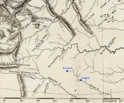
Clark's map was mostly accurate by the standards of the day. But there is a glaring error in the southern part. The Laramie Plains and surrounding mountains are missing! Little was known about the territory that would become southern Wyoming, so future Colorado and Kansas were moved north to fill the gap. This is why the Kanzas [sic] River was shown flowing where Rawlins and Laramie are today.

Today's southern Wyoming, from Lewis & Clark's Track. The Arkansas and Kansas Rivers were mapped hundreds of miles northeast of their true location, putting them in the vicinity of modern-day Rawlins and Laramie (added). Courtesy David Rumsey Map Collection.

The Pathfinder puts the Laramie Plains on the map

John C. Frémont "on the Rocky Mountains"; public domain.

In July 1843, a small contingent of the US Army Corps of Topographical Engineers climbed out of the canyon of the Cache-à-la-Poudre River, where they had hoped to find a route over the Rocky Mountains. Instead, they crossed the broad divide to the north.

In command was a young ambitious lieutenant—John Charles Frémont, the Pathfinder. This was the second of five expeditions he would lead through the American West, each time making significant contributions to geographical knowledge. He also would be court-martialed, lose a presidential election, squander large sums of money in mining schemes, and die in poverty. But all that was far in the future on that lovely summer day when the Laramie Plains came into view.

"The weather was pleasant and cool, we were disturbed by neither musquitoes [sic] nor flies; and the country was certainly extremely beautiful," Frémont would write in his report. "The slopes and broad ravines were absolutely covered with fields of flowers of the most exquisitely beautiful colors. ... As we emerged on a small tributary of the Laramie river, coming in sight of its principal stream, the flora became perfectly magnificent; and we congratulated ourselves, as we rode along our pleasant road, that we had substituted this for the uninteresting country between Laramie hills and the Sweet Water valley."

Challenges: stones, sagebrush, longitude

That evening, they camped on the Main Fork of the Laramie River, where Frémont took astronomical readings to determine latitude and longitude. While latitude seems to have been accurate, his calculation of longitude put them too far west, in the Medicine Bow Mountains near Lake Owen according to Google Earth. But that's not surprising. Estimating longitude was difficult, requiring careful tracking of stars with a precision telescope and a chronometer that kept steady time, or at least lost time at a steady rate.

For three days the party traveled northwest along the Medicine Bow mountain [sic]. The going was easy at first, but near the mountain they were slowed by large round stones in the soil. Equally difficult were ridges "made extremely rough by the stiff tough bushes of artemisia tridentata, in this country commonly called sage" [as it is today].

On August 2, they camped on the Medicine Bow River near "an isolated mountain called the Medicine Butte [Elk Mountain], which appeared to be about 1,800 feet above the plain, from which it rises abruptly, and was still white nearly to its base with a great quantity of snow". Frémont made more astronomical observations, this time including "an immersion [eclipse] of the first satellite of Jupiter." Even so, the calculated longitude again put them too far west.

After passing south of Elk Mountain, the party dropped down to the North Platte River, followed it to the Sweetwater, and continued on to California and Oregon. They would return home in August 1844, after about 15 months and 10,000 miles of travel.

A "meagre and skeleton" but valuable map (Frémont & Preuss 1845). High resolution version here, courtesy David Rumsey Map Collection. 

Dramatic report, spectacular map

Frémont wrote a colorful report about his adventures, with the help of his wife, Jesse, whose father—the powerful Senator Thomas Hart Benton—had secured funding for the expedition. Ten thousand copies were published the following year, to rave reviews. Included was the spectacular “Map Of An Exploring Expedition To The Rocky Mountains” measuring 52 x 30 inches, and stretching from the Missouri River west to the Pacific Ocean and from Los Angeles north to Mt. St. Helens.

However, much of the map was blank—to Frémont's credit. In a Notice to the Reader, he explained: "The map may have a meagre and skeleton appearance to the general eye, but is expected to be more valuable to science on that account, being wholly founded upon positive data and actual operations in the field." Indeed, the map is now considered a milestone, having set a new standard of cartographic accuracy for the American West.

The mapmaker was Charles Preuss, a trained surveyor and topographic artist from Prussia. He would accompany Frémont on three expeditions, making "continuous topographical sketches of the regions through which we passed, and which were never interrupted by any extremity of fatigue or privation" (Frémont's words). The large beautiful maps secured his reputation as a great cartographer.

Cartographer Charles Preuss, date unknown. Source (without attribution).

Laramie Plains up close

In the 30 years since publication of the Lewis and Clark map, techniques for representing relief hadn't changed all that much. Preuss also drew mountains using hachures, though in much greater detail. In the excerpt below (click to view), small narrow drainages are visible on mountains slopes, and low ridges and buttes dot the plains. Preuss varied hachures to show height and steepness. Lower ridges were drawn with shorter lines. Denser darker hachures indicated steeper slopes—for example Laramie Peak (top center of map) and, a short distance southeast, the canyon where the Laramie River crosses the Black Hills (now the Laramie Mountains).

From the 1845 map by Frémont and Preuss. Stars mark points where longitude and latitude were determined. At triangles, they measured the sun's height at noon to estimate latitude.

However, if we continue our examination, we're soon confused. Is that low mountain range paralleling the Medicine Bows Jelm and Sheep Mountains? Doesn't look right. Nor does the ridge east of the Main Fork. Most puzzling is the “Right Hand Fork” which (supposedly) joins the Main Fork of the Laramie River before it enters the canyon. Our history buffs still haven't solved this mystery.

Errors at this scale aren't surprising. With the great expanse of unknown territory ahead, there was little time for finer details, and though Preuss' map was highly accurate in its time, it's a far cry from the "very interesting map” showing every hill and canyon, which would so excite a Boomerang reporter 50 years later ...

[More to come in Part II.]

This post is based on the first of two articles about mapping the Laramie Plains, my most recent contribution to the "Laramie History" column in the Laramie Boomerang.

Thursday, September 3, 2020

Sea Shells in the Church Walls (& other mysteries of the Casper Formation)


For geologist and bishop Nicholaus Steno, science was a way to understand God's work (source).

On the morning of August 13,1894, mason Michael Bergin picked up a stone to add to the new Episcopalian church in Laramie, Wyoming. But upon inspecting it, he spotted a fossil very different from the others he had found.

"CURIOUS FOSSIL. Found in the Sandstone Rock of the Cathedral" announced a headline in the Laramie Boomerang (newspaper) later that day. "It is a shell exactly like a miniature buffalo head ... the solid part corresponding to the head is about an inch in diameter, the horns about an inch long and three inches from tip to tip." Bergin set the stone aside for Professor J.D. Conley, curator of the University of Wyoming Museum.

Stonemasons at St. Matthew’s Cathedral regularly found fossils, saving the better ones for Professor Conley. He had already identified the clam-like allorisma, snail-like bellerophon, and pinna, which resembled a razor shell oyster. "The professor is gathering facts to put into a bulletin on the subject," explained the Boomerang.

But the article ignored the remarkable mystery these creatures implied. They were marine—all inhabitants of oceans. Yet the stones were quarried just east of Laramie. How did sea shells end up so far from a sea, and 7000+ feet above sea level?

A Persistent Question

Four centuries earlier, in the Apennine Mountains of Italy, scientist Nicholaus Steno asked the same question, but in Latin: “Quomodo res marinae in locis a mari remotis derelictae fuere?” How was marine life abandoned in places far from the sea?

No answer was immediately forthcoming. In the 1600s, geology did not exist, and knowledge was strongly shaped by church teachings, which did not address things like sea shells high in the mountains. Steno had to rely on field work and his own clever mind to solve the puzzle.

After examining many specimens, all of which looked like sea shells down to the finest level of detail, he concluded they were sea shells, now entombed in rock. They must have risen from sea level, thousands of vertical feet! This meant the surface of the Earth was dynamic, changing dramatically since the Creation. Steno's findings contradicted strict biblical interpretation—that God had created an immutable Earth—but the Church did not object. Science was increasingly seen as a way to understand and appreciate God's work.

Steno's interpretation of an angular unconformity, from his Prodromus, 1671.

Revelations

How appropriate then that St. Matthew’s Cathedral contributed to our understanding of local geology. Specifically, the fossils revealed when the rock formed. "These specimens all serve to identify and locate more definitely [in time] the geological formation of the sandrock lying east of the city ... This is the carboniferous [Period] in the upper Paleozoic [Era]."

But the Boomerang mentioned none of the immense numbers geologists love—millions, hundreds of millions, billions of years. That's because in 1894 there was no way to determine absolute ages of rocks. We now know the Cathedral sandstone formed sometime between 325 and 300 million years ago, when much of southeast Wyoming was submerged.

For millions of years sand, shells, and limey muck accumulated on the floor of that Paleozoic sea. Then they lay buried for several hundred million years more, gradually changed to sandstone and limestone.

The Rocks Rise

While Nicolaus Steno was convinced that rocks could rise thousands of feet, he never came up with an explanation for how. In fact, how mountains rise proved to be a most persistent question. It wasn't until the mid 20th century that it was answered satisfactorily: The Earth's surface consists of giant shifting plates that collide, sink, override, fuse, and more. The effects can be dramatic.

Between 70 and 30 million years ago, the Pacific plate was diving under the North American plate, compressing and crumpling the interior of the continent, creating among other things the Rocky Mountains. With uplift of the Laramie Range, ancient marine limestones and sandstones, carrying fossil shells, rose thousands of vertical feet. Erosion later exposed these rocks, setting the stage for Laramie's promising building stone industry.

Quarrying stone just east of Laramie; date unknown.
American Heritage Center, University of Wyoming (AHC).

Inexhaustible Supply of Rock

On May 11, 1886, the Boomerang proudly announced "Vast Deposits of Sandstone Only Three Miles from Laramie." This was great news. Planning was underway for the University of Wyoming's first building, to be constructed entirely of sandstone. However the nearest quarries were in Rawlins and Ft. Collins; transportation probably would be too costly.

Ever the civic promoter, the Boomerang declared Laramie's stone to be "equal to any in the world. ... It is useless to send to Colorado at great expense for rock which is not one particle superior, either in strength, beauty, evenness ..." The local quarries were inspected, the stone tested. In August, a contract was signed. The University Building (today's Old Main) rose quickly, completed in time for the first classes in September 1887.

Old Main under construction, University of Wyoming, ca. Dec. 1868 (AHC).
Though the industry never became a booming business, Laramie's dimensional stone was used in local buildings into the 1950s. These included the Albany County Courthouse, Ivinson Mansion (Laramie Plains Museum), Ivinson Home for Ladies, many buildings on campus, and perhaps most spectacularly, St. Matthew's Cathedral.

"One of the Most Beautiful and Complete Churches in the entire Western Country"

In 1892, on September 21 (St. Matthew's Day), the Boomerang gave front-page coverage to the laying of the cornerstone of St. Matthew's Cathedral. In the recently completed basement, hundreds listened to distinguished clergymen speak eloquently and at length. Then three officers from the Grand Lodge of the Free Masons—equipped with square, level, and plumb—set the stone.

St. Matthew’s Cathedral as originally planned; the final was somewhat smaller. Laramie Boomerang, Sep 22, 1892.

It was said that the Cathedral would be completed within a year. But the walls would rise in spurts, as funding waxed and waned. Bishop Ethelbert Talbot traveled far afield in his fund-raising. Big donors included friends in the east, such as Cornelius Vanderbilt ($1500) and J.P. Morgan ($1000), and the Mother Church in England.

By the end of 1896, the grand structure was ready to serve its congregation and was dedicated before a crowd of almost a thousand on December 17. Twenty years later, Edward Ivinson made a large donation in memory of his wife, Jane, to finish the towers.

St. Matthew's Cathedral before towers were completed (in 1916); photo ca. 1910-1915 (AHC).
St. Matt's in 1935 (AHC).

According to common knowledge, the cathedral stones came from the university quarry, nine miles northeast of Laramie. But an 1894 Boomerang article about a proposed railroad building suggests otherwise. Planners noted that cathedral stone was less expensive than university stone, as the cathedral quarry was closer to town. But which of today's abandoned quarries it was remains a mystery.

Adding to the puzzle is confusion regarding rock type. Cathedral descriptions variously refer to limestone, silicious limestone, limey sandstone, or sandstone. The Casper Formation, where Laramie's quarries were developed, contains all of these.

Reading the Casper Formation

To a geologist, a formation is a group of rocks that is both recognizable and extensive enough to map. The Casper Formation extends from Casper Mountain south along both sides of the Laramie Range into Colorado. It's a mix of limestone, sandstone and everything in between. Herein lie important geological clues!

Geologists say they study the past by "reading the rocks." What have they learned by reading the Casper Formation? We already know from its fossilized sea shells that there was an ocean here 300 million years ago. But there's more.

Let's start with limestone, which forms from limey muck deposited in deep water far from shore, out of reach of sediments from land. The northern part of the Casper Formation is dominated by limestone, indicating the area around the towns of Casper and Douglas was submerged in deep water during much of the Paleozoic Era (tour map below shows features mentioned here).

But in the Laramie area, the Casper is mainly sandstone with occasional beds of limestone. Sand, being coarse, doesn't travel far, so sandstone is a sign of shallower water closer to shore. The limestone beds are a bit of a mystery, with geologists still debating the details. Most likely they formed when the sea advanced, perhaps with rising sea level. So Laramie probably was in deep water occasionally, the shoreline farther away.

The Casper Formation also contains clues about the shoreline itself. Not far south of Laramie are outcrops of cross-bedded sandstone (criss-crossed layers). These are remains of sand dunes deposited by wind along the ancient shore.

Just beyond the dune field was the Ancestral Front Range. We know of these ghostly mountains because the Casper sandstone contains abundant feldspar. Feldspar is a soft mineral that breaks down quickly. It must have been carried to the sea by fast-flowing streams from mountains close by.

Tour Paleozoic Laramie

Yellow very roughly outlines the Casper Formation (above and below ground).

With an able imagination, you can tour the Laramie area 300 million years ago. Start in a dune field at the foot of the Ancestral Front Range. Venture into shallow waters of the Paleozoic sea and then to its depths. At the final stop, careful beach combing should turn up some of its ancient inhabitants.

1. Sand Creek National Natural Landmark straddles the state line along Sand Creek Rd. (CR 34; gravel) about 19 mi south of Laramie. Amidst monuments and hoodoos of cross-bedded sandstone, imagine yourself in a field of dunes at the base of a rugged mountain range, looking north across the Paleozoic sea. The Landmark is mostly private with two small parcels of WY state land; an ownership map is needed to explore beyond the road.
"Grotto at Sand Creek"—S.H. Knight photo, 1899 (AHC).

2. Visit Roger Canyon to see the Paleozoic seafloor up close. From Reynolds St. in Laramie, go north on 9th about 0.7 mi to where it becomes Roger Canyon Rd. ZERO YOUR TRIP ODOMETER HERE. At 6.9 mi ("No Winter Maintenance" sign) stop in the tiny turnout right (private land; stay on shoulder). Across the road is the reclaimed university quarry. Here the Casper is limey sandstone (well-cemented). Head up the canyon. At 8.0 mi, you will enter public land and limestone—having traveled back in time to when the water was deeper and the seafloor covered in limey muck. Public land continues for about a mile.
Chris and Ed of Laramie brave the smokey air to ascend lithified seafloor muck in Roger Canyon.

3.  St. Matthew's Cathedral stands on the northeast corner of Ivinson and 3rd. Wander the grounds to admire Laramie's fine dimensional stone in the walls of the highest Cathedral in the US (steeple reaches 7276 feet above sea level). Search for sea shells in the exterior stone, but please don't touch (binoculars are handy).

About that Miniature Buffalo ... any ideas?
Professor Conley reportedly left Laramie in a huff in 1896, having been passed over for department head. The fate of the Cathedral specimens is unknown, and no bulletin was published. Michael Bergin’s curious fossil remains among the mysteries of the Casper Formation ... unless you recognize it. If so, please leave a Comment below!


This is my latest contribution (with extra photos) to the Laramie History series in the Laramie Boomerang (published August 30, 2020).

Thursday, May 21, 2020

Laramie’s Opera Houses—culture on the frontier

Apparently Swain & Little's public brawl didn't hurt their business.
On a chilly February evening in 1874, Laramie grocer A.G. Swain stepped before a large crowd and declared: “There is no public virtue left!” He was forced to shout over the ensuing uproar. “Silence! Your throats offend the quiet of the city!” This so angered Geo. Little, his business partner that Little ordered a sword-brandishing horde to attack Swain. But W.M.C. Wilson, proprietor of the Brunswick Billiard Hall, showed up just in time. With his superb swordsmanship, he defeated the horde and saved his dear friend Swain.

Was this just another confrontation in the rough-and-tumble young town? Were Swain and Little settling a grocery dispute in true frontier style? Not at all! This was the grand opening of the Laramie Opera House.

“Opera” brings respect
By the 1870s, opera houses were common in the West. So great was the desire for decent entertainment that any town near a railroad had one. But most were operatic in name only. “Theater” was more appropriate but “opera house” sounded more respectable—a sign of transition from frontier to civilized society.

On February 23, 1874, just six years after Laramie was established, a large ad appeared in the newspapers: “GRAND OPENING OF THE LARAMIE OPERA HOUSE! Entirely New Scenery and New Costumes!” However, the costumes were still en route from New York, so the date had not been set.
Just four days later, the doors opened to a large crowd eager to witness the “Sublime and Thrilling Drama of Damon and Pythias.” Like many hits of the time, it delivered an uplifting moral message—the power of true friendship. The tyrant Dionysis (played by Judge L.D. Pease) was so impressed by the love and trust between Damon (grocer Swain) and Pythias (billiard hall owner Wilson) that he spared the lives of both.

The audience was enthusiastic and appreciative, as was the case whenever local talent took to the stage. “The universal verdict is that [the performers] succeeded beyond everybody’s most sanguine expectations” according to the Daily Sentinel. The play was far better than expected, or even possible for a company of amateurs.

The location of the Laramie Opera House now seems to be lost. Nor do surviving newspapers reveal who owned it, or how it came to be. But once operational, it was regularly in the news. Laramie sat on a major east-west rail line, and had ready access to traveling entertainment—popular drama, lectures, novelty shows, comedy, concerts, travelogues and more.

Quality was not guaranteed, however. Sometimes the “orchestra” turned out to be a piano player, or the “troupe” a single actor. But that was the exception. “Usually the touring companies had a good voice or two among them, and the melodies alone were worth the price of admission. What good luck for a country child to hear those tuneful old operas sung by people who were doing their best,” recalled author Willa Cather, from her girlhood in Red Cloud, Nebraska.
Opera House in Red Cloud, Nebraska, c. 1903. Nebraska State Historical Society.

Lecturess and martyr
Among the highlights of 1874 was a lecture by Victoria C. Woodhull, well-known suffragette and proponent of ‘free love’ (a woman’s right to divorce). She was freshly out of jail, having been arrested for sending obscene literature through the mails, specifically a widely-read article about the affair between Henry Ward Beecher— popular pastor of a fashionable New York church—and the wife of his good friend Theodore Tilton.
Victoria C. Woodhull was nominated for president by the Equal Rights Party in 1872 (though women could vote only in Wyoming and Utah). Headline from Woodhull & Claflin Weekly, April 22, 1871; added photo by Matthew Brady, c. 1870.
When the charges were dropped six months later, Woodhull promptly hit the lecture circuit, drawing tremendous crowds. “Her subject will be a review of the Beecher-Tilton Scandal, entitled ‘The Naked Truth.’” The Daily Independent was adamant: “Mrs. Woodhull is highly spoken of as a lecturess of fine talents, and also as a martyr who has been sadly traduced by her prosecutors ... We advise our citizens to go and hear the lecture.”

Ireland comes to Laramie
In October, another nationally known act appeared at the Opera House—Healy’s Hibernian Gems. This well-known first-class troupe will present “a magnificent panorama of Ireland, on which is delineated nearly all the cities, towns and splendid ruins” announced the Daily Independent.

Hibernicons—Irish panoramas—were popular novelties of the time. These were early moving pictures, with sound! Healy’s 10,000-foot long canvas was attached to two spools; a hidden operator turned one, causing the other to unwind. As each of the 85 scenes appeared on the stage, the narrator served as tour guide while musicians, actors and comedians provided Irish-themed entertainment.

The Opera House also hosted dances, political and religious meetings, graduation exercises, trials, wrestling matches and more, with events regularly in the news. But after April 1875, they inexplicably disappeared, making the end of the Laramie Opera House as mysterious as its beginning.

High society gathers in a Thespian temple
In May of 1884, the famous German-American actor Daniel E. Bandmann and his troupe arrived in Laramie, shortly after returning from a five-year 700-performance world tour. Though best known as a Shakespearean, Bandmann was equally skilled in other genres. His leading role in the popular drama Narcisse was especially admired. No wonder high society was all aflutter—Bandmann would perform Narcisse in Laramie!
German-American Shakespearian actor Daniel E. Bandmann; date unknown (before 1905). Harvard Theater Collection.
On May 12, Herr Bandmann stepped on stage before “fashionable, cultivated and critical” citizens from Laramie, Cheyenne and Rawlins. The Laramie Boomerang proudly noted that the ladies were dressed “in the latest style and most elegant costumes, while the gentlemen, in many cases, appeared in full evening dress.” They were given delicately perfumed programs, skillfully designed by George Garrett, the Boomerang’s typographer.

The first act was “rather tame” but when Bandmann made his appearance in the second, as Narcisse Rameau, the mood changed entirely. His account of the terrible wrongs inflicted upon him, and “his subsequent bursts of histrionic pathos” brought warm and vigorous applause.

While he was just a young scholar, Narcisse Rameau’s wife had left him to become Madam Pompadour, mistress of Louis XV. But virtue triumphed in the end. Madam P died and fell into the arms of the husband she had abandoned. Narcisse lived happily ever after with his new wife—the young, clever and beautiful actress, Doris Quinault. “Doris” was played by Louise Beaudet, herself a young, clever and beautiful actress. She also was co-owner of the theater company, and, infamously, Bandmann’s mistress.

The occasion for Bandmann & Beaudet’s Narcisse was the grand opening of the Holliday Opera House, above Holliday’s store and offices on the east side of Second, between today’s Garfield and Custer. A successful merchant and builder, W.H. Holliday spent between $20,000 and $55,000 on the project (reports vary).

Only first-class opera house between Omaha & Salt Lake City
The Daily Sentinel declared the new opera house to be “the only building and stage between Omaha and Salt Lake City for the rendering of first class dramas and spectacular scenes.” It was designed and supervised in person by stage architect H.W. Barbour, formerly employed by the Union Square Theater and Grand Opera House in New York, as well as theaters in Colorado, and Central and South America.
Holliday Opera House c. 1885. The building burned to the ground in 1948, in the great Holliday Fire, which destroyed much of downtown Laramie. From 1885 Laramie City map; Laramie Plains Museum.
The Opera House occupied the entire second story of Holliday’s building, with a 36-foot high ceiling, 70 x 36-foot stage, and seating for 700-800. The stage included a drop curtain featuring the Bay of Naples at sunset, and a full set of 12 x 20-foot “flats” [scenes]: Kitchen, Parlor, Prison, Garden, Horizon, Dark Wood, Rocky Pass, Snow Scene and more (18 total). Painted by Sosman & Landis of Chicago, they were “as fine as may be seen anywhere in the world” (Laramie’s press was reliably complimentary).

In marked contrast, the lighting was old tech—kerosene lamps, notoriously hazardous with their open flames. Many large lamps were installed, but even so, the light was dim; nor could it be adjusted once lit. When performing in lamp light, actors resorted to heavy makeup and exaggerated movements to connect with the audience.

But just a year later, a Boomerang reporter watched in amazement as new lights came on in Holliday’s Opera House. “As one row after another of burners were lit overhead and about the walls, the footlights and finally the chandeliers—the hundreds of jets of pure steady flame set burning—the great improvement became manifest.”

Coal or “town” gas moved through a system of pipes controlled with wheels and levers, making the lights easily adjustable. “There was no hitch during the whole evening though several changes of light were made.” But the open flames made gas lights just as risky as kerosene lamps. Though electricity was much safer, Holliday considered gas “better adapted to such a place than electric illumination.” Perhaps electric lights were still too expensive.
Note sewer line running from Holliday's Opera House (pink arrow) to river. A second one starts near the Union Pacific's Round House. They were recent additions, mainly for storm runoff, a serious problem in this part of town. From 1885 Laramie City map; Laramie Plains Museum.

Opera comes to the Opera House
In January of 1886, the Boomerang had exciting news. The Milan Grand Italian Opera Company, with full chorus and orchestra, would present Donizetti’s popular tragedy “Lucia Di Lammermoor”—in the original Italian! “Reserved seats will be on sale Monday morning at 9 o’clock. Carriages may be ordered at 10:30 ... the Company’s Librettos, in English and Italian, will be for sale by the ushers.”

The review the next day underscored the aspirations of small towns with their opera houses: “It is to be hoped that the success of this company will enable us to have a regular season of Italian opera every year, and thus educate the masses to a general appreciation of this style of music.”

Another opera house fades from the limelight
In 1893, the lighting in Holliday’s building was upgraded to electricity. But by then, it had been years since an earnest actor stepped onto the brightly lit stage before an eager audience. Holliday had closed his opera house in 1887. “It was quite a blow,” lamented the Boomerang. Laramie needed an opera house, “both as an advertisement for the [town], and for the pleasure of the citizens.”

Fortunately, Maennerchor Hall also offered many fine performances, and another opera house did open, in the 1890s. But these are stories for another day. Laramie’s long rich ‘operatic’ history can’t be squeezed into a single article!


Postscript: This is my final article in a series for the Laramie Boomerang's "Laramie History" column. We volunteers have been contributing weekly to help the paper during hard economic times, and to provide an alternative to covid news. It has been a pleasure!
Editor Judy always complains about my head shot, so I sent her a this as a joke.
She used it, and readers liked it! Hmmm ...