Saturday, December 31, 2011

Blog Roundup -- yeee haw!!


Traditional American cowboy song, paraphrased slightly.


I just learned about another blogging tradition ... the year-end roundup where folks gather the best of their own posts, most popular, etc.  Being from Wyoming I don't wanna miss a roundup! but unfortunately I haven't been at it long enough to have much stock to gather.


Instead, I'm taking this opportunity to thank my compatriots of the blogosphere for a great time, and I look forward to more fun in the year to come.

Happy New Year -- Felíz Año Nuevo
from In the Company of Plants and Rocks

Friday, December 30, 2011

Happy Birthday Frank!

Little Missouri Buttes and Devils Tower in northeast Wyoming, USA.
Click on photo to see F & H on top.
In 1978 Frank and Hollis hiked from the tipi in Weaver Canyon to the Little Missouri Buttes, scrambled up the highest one, and talked.  That’s when they discovered that they were born ten days apart, and also when they agreed with conviction that “Blessed are those that live out their dreams.”

Thursday, December 29, 2011

Blog Crawl Gems

This Week's Treasures
Sandatlas has a very nice post about blogging.  I have been "seriously" into it for three months and am seriously hooked, for all the reasons noted in the post:  I like to write, blogging is effective practice, I learn things and it's a “great motivator”.  “Is there anything bad also?” asks Sandatlas.  For me that would be the “great motivator” -- blogging sucks time away from work as it is much more interesting, fun, satisfying.  Since I’m self-employed working at home, I have to set limits.  He goes on to encourage others to blog -- I heartily agree.

One thing I personally enjoy is seeing that people from all over the world are reading my essays!  This still amazes me, and is something really wonderful about our online world.

Reading blog posts is as fun and interesting as writing them.  There are soooo many fascinating things in the blogosphere!  This Blog Crawl Gems series features some of my favorite posts each week.


Galileo's Pendulum convinced me that I had no idea how mirrors actually work.  But now I do.  Did you know that "mirrors actually don’t reverse left and right ... The mirror is actually reversing front and back!"  It's true, I tried it.  But that's for flat mirrors, there are concave mirrors and convex mirrors and experiments with spoons!  This is a fun post.


Another neat post from The Artful Amoeba:  the First Book of Photographs.  Published in 1843, this book was authored by a woman (the photographer), surprising for the times.  It is a collection of cyanotypes of algae, specifically British seaweed.  This is one of the "old, rare or valuable" scientific books on display in the current Treasures of the Royal Society Library exhibit.  Cyanotype to right is Desmarestia ligulata, Flattened Acid Kelp (courtesy the British Library).


Finally, I especially enjoyed the December 27 Earth Picture of the Day -- a "close-up" of the Horseshoe Bend, an entrenched meander on the Colorado River.  Why?  because it is so beautiful, and this time of year so inviting!
Horseshoe Bend southwest of Page, Arizona, USA, as viewed via Google Earth.

Tuesday, December 27, 2011

El Tío -- god of underground miners


Underground mining is an extremely dangerous way to make a living.  Thousands are killed each year, mainly in coal and hard rock mining.  There are far more casualties in developing countries.  China leads in coal mining fatalities, with 80% of the world’s deaths (while producing 35% of the world’s coal).  An estimated 13 Chinese workers die in coal-mining accidents each day.  In the US, 60 to 70 US miners die each year in all types of mining (from About.com Mining, Common Mining Accidents  accessed Dec 2011).

It is estimated there have been 8 million deaths in the 500-year history of underground mining in Bolivia, mainly for silver and tin.  Silver mining began with settlement by Spaniards in Potosí in 1546.  In 1603 it was reported that 58,800 Indians were employed in the mines.  Later 30,000 African slaves were brought in to work as well.  In the late 1600s the population of Potosí was 200,000 -- one of the largest cities in the world at the time.  By 1800 the silver mines had been depleted and investment and production shifted to tin.  Then in 1985 the global tin market crashed.
Cerro Rico (rich hill) behind Potosí (Potosí Tourism)
Though mining no longer dominates the Bolivian economy, silver is still produced in the Potosí area, often by scavenging in old worked areas.  The workforce was estimated at 9000 in 2004, including many children.  It is an extremely dangerous occupation -- safety equipment is primitive at best, and dust inhalation is a major problem.  The estimated life-span of a Bolivian silver miner is 40 years -- most die from silicosis.  The human cost of silver mining in Bolivia was addressed in two recent documentaries:  The Devil’s Miner by Independent Lens (2006) and Bolivia's Child Miners by Unreported World (2010).

Our Lady of the Tunnel

In the face of such obvious danger Bolivian miners seek spiritual protection from two sources:  Nuestra Virgen del Socavón (the Virgin of the Tunnel) above ground, and el Tío (the Uncle) below ground.  La Virgen appears to be descended from the Uru Mother Earth spirit, Pachamama, with a significant contribution from the Virgin Mary.

El Tío (Wari).


El Tío also is mix of indigenous beliefs and Catholicism.  He is the pre-Columbian god of the mountains and underground, but has taken on characteristics of the Christian devil, mainly in appearance.

In mines there are numerous statues of el Tío and alters for offerings -- cigarettes, coca leaves, soda pop and alcohol.  And now tourists are offered mine tours and visits with el Tío.  These are becoming fairly popular judging by the number of posts in travel blogs.  Photos to left and right courtesy Soulshine Traveler.


La Diablada in Oruru during Carnaval.


El Tío has been popularized also in la Diablada, the Devils Dance, which is thought to have originated in pre-Columbian times to appease El Tío, then known as Wari or Huari.  La Diablada has become extremely popular in Bolivia -- best known are the Carnaval performances in Oruru.  Recent claims to la Diablada by Peru have set off a diplomatic storm, and other Andean countries now claim it as well.


Thursday, December 22, 2011

Happy Geolidays to all!

The Laramie Basin in the southern Rocky Mountains (USA) is a classic Laramide syncline situated between two broad-backed Laramide uplifts:  the Laramie Range to the east and the Medicine Bow Mountains to the west.  Above the broad summit of the Medicine Bow Mountains stand the high quartzite ridges of the Snowy Range, and several en echelon anticlines extend into the basin (see illustration below).

Blog Crawl Gems

This Week's Treasures

First, I would like to thank The Mermaid’s Tale for their post about the ethics of using chimpanzees and other animals in medical research, prompted by recommendations from the Institute of Medicine of the National Academies (USA) to sharply curtail use of chimpanzees.  I have never understood how people could subject animals to the kinds of treatments that they do.  One study on stress comes to mind, where mice were repeatedly shocked until they failed to respond.  Without apology, the investigators published the details of their experiments along with photos of a mouse in various stages of being shocked, finally just standing in a dazed stupor.

On a cheerier note --

Rapid Uplift writes about why he teaches rugby to village kids in rural India (it’s not just for the terrific views of layered Deccan Basalts) ... go Rapid Uplift!

For another spectacular view, see Gazing at distant hills…
But wait ... note the poor exposure, and the view obviously was not well-framed.  So what is so spectacular?   These are distant hills on Mars, part of Endeavor Crater.  I am awestruck looking at landscapes on another planet.  You can do some exploring of Mars yourself courtesy Road to EndeavorWalking alongside Opportunity as she explores Endeavour…


And some big news for aging Baby Boomers ... the pace of the Grim Reaper has been established!  Now we know how fast we have to walk to evade him.
GR courtesy FBNY.


Finally ... don't miss the wonderful sand grain Christmas card from Sandatlas.

Tuesday, December 20, 2011

Recommended Reading: Geology of Northern New Mexico’s Parks, Monuments, and Public Lands


Rio Grande Gorge in northern New Mexico, USA.  Courtesy BLM.

In 2009 I took my first road trip through northern New Mexico and discovered that it is a wonderful place for geo-tripping.  The geology is visible and scenic, the stories are fascinating, and it is easy to find information online.  The New Mexico Bureau of Geology and Mineral Resources (NMBGMR) has put together a great Virtual Geologic Tour website, which was the basis for much of my planning.  The Bureau of Land Management’s Outdoor Recreation website for the area also was helpful.

The state of New Mexico advertises itself as the Land of Enchantment, but it is also called The Volcanic State and that definitely was my impression.  I toured a series of late Cenozoic volcanic fields (15 million years ago to present), all located near the Jemez Lineament, a zone of crustal weakness trending northeast - southwest across northern New Mexico, possibly an old (Precambrian) continental suture.
Generalized tectonic and volcanic map of northern New Mexico.  VF = volcanic field.
Courtesy USGS.


My first stop was in the Taos Volcanic Field, at the Wild Rivers Recreation Area (BLM) in the Rio Grande Rift.  The Rift runs north-south from southern Colorado through New Mexico and into Texas and Mexico.  This is a zone of east-west extension and continental thinning between the Colorado Plateau to the west and the High Plains to the east.

Courtesy BLM.


The Rio Grande follows this broad valley created by rifting, and has cut spectacular gorges in basalt, including those at the Wild Rivers Recreation Area.  I had planned to stay two nights but spent a week instead.  There is great hiking and geology touring in the Recreation Area and in many places nearby.


From the Rio Grande Rift I headed west to the Colorado Plateau and stopped at El Malpais (“the bad country”) in the Zuni-Bandera Volcanic Field near Grants.  The youngest lava flows of El Malpais are only 3000-5000 years old, and still show flow features such as pahoehoe lava, a-a lava and lava tubes.  I explored the rugged flows, and did some neat hikes to cinder cones.  Photo above and map below from NMBGMR Virtual Tours.
To the north of El Malpais is the Mount Taylor Volcanic Field.  Mount Taylor itself is a classic composite volcano (alternating layers of ash and lava) and a great hike.  From the summit one can look east to see Cabezon Peak and the Rio Puerco Volcanic Necks, another good field trip.  Photo and cross-section from NMBGMR Virtual Tours

My first geo-trip to northern New Mexico ended before I could get to even half of what I had planned.  I’ve been back twice and still have things I want to see.  And now the NMBGMR’s great online information has been expanded and compiled into a book:  Geology of Northern New Mexico’s Parks, Monuments, and Public Lands.

The book includes 44 localities in the area from Interstate 40 north, all on public land, including National Parks and Monuments, State Parks, National Forest and Bureau of Land Management lands.  It starts with an overview of the geology of New Mexico from Precambrian time to the present, followed by sites grouped by region -- Colorado Plateau, Southern Rocky Mountains, Great Plains, Rio Grande Rift and Valles Caldera.  Each section has a discussion of the geology of that region and then detailed treatments of the sites of interest.  Most include a generalized geological map overlain on a shaded relief base, often a cross-section, and other diagrams and photographs -- very well illustrated especially considering the modest price.

The goal of the book was to compile the wealth of information “buried” in the scientific literature in a format accessible to laypeople interested in geology:
“... we wanted to provide a compilation for the layperson of the basic geologic framework of each of these areas, paying particular attention to the rock that is exposed at the surface and the geologic features that are most conspicuous ... to present visitors with a summary of what we currently know about these places, in a format that is inviting and easy to understand.”
Based on my experience the authors have done a terrific job in achieving their goal.


For those interested in more detail, an excellent complement is the New Mexico Geological Society’s The Geology of New Mexico:  a geologic history (2004)This is a collection of technical papers “organized chronologically according to the major depositional and tectonic events in the history of the state.”   The Table of Contents can be viewed here.

These books and others can be ordered at the NMBGMR website or by phone (575-835-5490).


The Geology of Northern New Mexico’s Parks, Monuments, and Public Lands.  L. Greer Price, ed.  2010.  New Mexico Bureau of Geology and Mineral Resources.  $24.95 (paperback)

The Geology of New Mexico - A Geologic History.  Greg H. Mack and Katheine A.Giles, eds. 2004.  New Mexico Geological Society  Special Volume - 11.  $45.00 (hardcover)


Sunday, December 18, 2011

Plants and Rocks: Vegetation mosaic on Miocene marine strata ... sweet!

Western Transverse Ranges of California; from ArcGIS online, Google Maps.
“Man has mental limitations, and nature is infinitely complex.  To deal with this situation man invents classifications.  Nature does not classify trees, flowers, and rocks -- we do, so that we can deal with them in a reasonable fashion.” -- Robert P. Sharp
We vegetation ecologists are pattern-seekers and classifiers, that's our job.  Based on his remarks it would be easy to think Sharp was one of us, but he was not.  He was a geologist recognized for contributions in basin-and-range structure, glaciation, erosion surfaces, desert sand dunes, isotopes in snow and ice, and surface forms and processes on Mars.  He served as long-time head of geological sciences at Caltech, and received the National Medal of Honor in 1989.

To his credit, Sharp had a great interest in explaining geology to lay people.  His Southern California Field Guide (K/H Geology Field Guide Series, 1975) introduced me to the geology of the Transverse Ranges of southern California -- the ranges north of Santa Barbara that trend east-west in contradiction to the predominantly northwest-trending structural grain of California.

It was in the Transverse Ranges that I did my first vegetation study -- the beginnings of a career in field botany and vegetation ecology.  For a class project I backpacked across the Ranges from south to north, to describe and classify vegetation, and glean some understanding of the ecology.  I was young and naive, with great faith in vegetation classification and patterns in general.  While I had to have read Sharp’s introductory remarks, I’m sure they did not sink in.  Now, 35 years later, they seem profoundly insightful.

There is pattern in vegetation -- we sense this intuitively and acknowledge it when we talk about hardwood forests in New England, grasslands of the Great Plains or treeless alpine vegetation on mountain summits.  But at a finer scale, discrete associations of plant species and correlation with specific habitats often become fuzzy or break down completely.  The wraith we thought we saw may disappear when we look closely.
For my study I intended to traverse the three ranges north of Santa Barbara -- Santa Ynez Mountains, San Rafael Mountains and Sierra Madre -- and finish in the Cuyama Valley.  I was a dedicated naturalist and backpacking bum (John Muir was my hero and role model) with little money, crummy gear, and of course no camera.  Instead I kept a journal, and sketched some of my experiences.
The trip started via the Santa Barbara city bus system to a trailhead at the base of the Santa Ynez Mountains, which rise steeply from the narrow coastal plain.  It was in these mountains that some of the earliest studies were done suggesting that the Transverse Ranges did not always have their odd east-west orientation, that they are part of a crustal block that has rotated at least 90° clockwise since early Miocene time and continues to do so (Hornafius 1985).  Nicholson et al. (1994) found a possible mechanism in a partially-subducted microplate under the western Transverse Ranges (WTR) crustal block.  As the Pacific and North American plates converged in early Miocene time, the intervening Farallon plate fragmented into microplates which continued to be subducted under the continental margin.  But as subduction slowed and was transformed into right-lateral strike-slip (horizontal) motion, the microplate under the WTR block became attached to the Pacific plate and started moving northwest, causing the overlying block to rotate.
From Onderdonk 2007 (see literature cited at end of post).
It was a sunny day in early April, and warm walking up the south flank of the Santa Ynez Mountains.  As the trail left the drainage bottom for drier habitat above, I noted a transition from Riparian Woodland dominated by sycamores to Foothill Woodland dominated by California live oaks to the dense shrubland of Hard Chaparral.   I continued through chaparral to a campsite at what may have been an old homestead (pear and apple trees).  The next day I hiked down into the Santa Ynez Valley where I caught a ride with some hippies as far as the “Brotherhood of the Sun” commune.

Yerba Santa, Eriodictyon californicum
Courtesy of SageHeart.


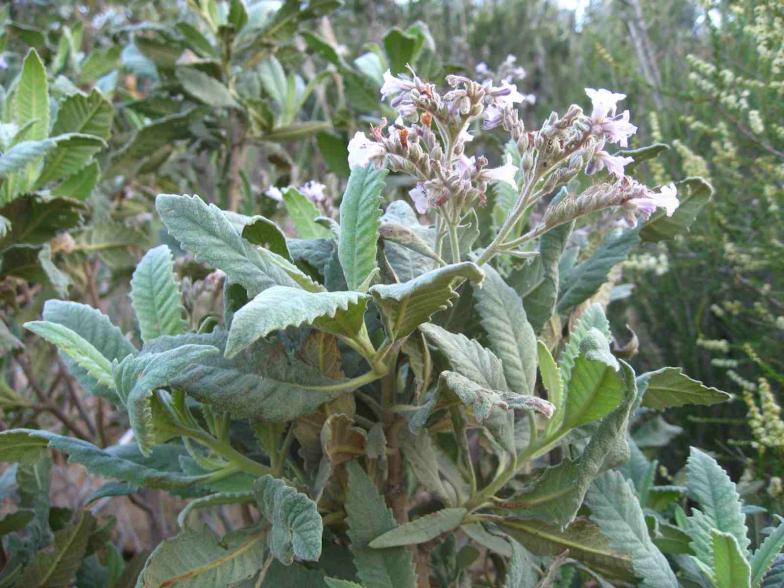
By the time I got to my next campsite, mares tails were passing overhead, followed by thick dark clouds.  It rained that night “filling the air with the odor of yerba santa”, one of the many pungent plants of the chaparral.  


The next two days I hiked up the south flank of the San Rafael Mountains, the highest of the three ranges.  I continued to see the same patterns -- Riparian Woodland in drainage bottoms giving way to Foothill Woodland and then chaparral moving upslope into drier habitats.  But there were new indicators appearing with increasing frequency -- conifers.  Coulter pine and big-cone Douglas fir were the first, soon joined by white fir, sugar pine and incense cedar -- trees indicative of cooler wetter habitats at higher elevations.
California incense cedar.

Sure enough I awoke to frost, with hoarfrost needles on grass stalks and “socks washed yesterday hanging frozen on line”.  Later in the day “snowflakes started to fall” and as the cover of conifers increased going up the trail, the snowfall got heavier.  The trees were beautiful frosted with snow, especially the incense cedars.  At the crest (5800 feet above sea level) I  “bivouaced under small oaks -- rainfly with poncho as vestibule” and noted:  “This seems to be a regular blizzard -- in April?  No Fair!”

In the morning I was “awakened by a cheerful bird singing madly somewhere in the brush.”  The sun came out as I put on my frozen pants and boots and optimistically headed off along the crest enjoying great views and majestic Douglas firs and incense cedars.  I hiked down into the canyon of the Sisquoc River, reached the bottom and got my rainfly set up just before the rain and hail started.  Enjoying a dinner of cookies I wrote “April showers bring May flowers.  This is a welcome storm even though it makes backpacking a little unpleasant.”

Continuing down the Sisquoc the next day I reached the Sisquoc Falls, spectacular in this dry country -- “3 or 4 large falls in a row, the largest 50-75 feet high” -- but by then it had been raining and hailing for an hour so I kept going.  That evening I noted:  “It would be nice to have one or two dry days to end the trip.”

The next day the rain finally stopped and my mood was high going up the south flank of the Sierra Madre, the last of range of my traverse.  It would be a long but gentle hike to my campsite once I reached the crest.  I saw several single-needle pinyons and then junipers soon after -- this was the beginning of pinyon-juniper woodland, a much drier vegetation type here in the rain shadow of the San Rafael Mountains.

At the summit was a fine example of a deterministic relationship between bedrock and vegetation.  Much of the Sierra Madre crest is underlain by the Miocene Branch Canyon and Monterey Formations -- a mix of nearshore and beach sandstones, and marine shales and mudstones.  I saw that the vegetation on the crest was a mosaic of grassland and hard chaparral, clearly correlated with changes in bedrock ... sweet!
Mosaic of grassland and shrubland on Sierra Madre crest; large grassland
is Salisbury Potrero (location of drawing below).  From ArcGIS online.
Areas underlain by sandstone supported chaparral dominated by scrub oak (Quercus dumosa) and bearbrush (Garrya fremontii).  The intervening areas of Monterey shales and mudstones were covered with grassland, including huge potreros (Spanish for field or pasture but used here for large grassy openings in the chaparral).  The explanation was straight-forward.  Fine soils derived from shales retain moisture near the surface and shallow-rooted grasses thrive.  Rockier sites support shrubs that send roots down cracks in the sandstone to trapped water.
Scanning electron micrograph of clay.
Clay particles have high surface area relative
to their small size.  Water adheres easily,
giving clay its absorptive properties.
Fascinating as this was, I came hate the grasslands.  Whenever the dirt road crossed grassland it was unbelievably gooey after four days of rain and snow.  I observed:  “grassland means clay soil which means slippery -- road is impossible to walk on.”  In contrast “in areas where scrub [oak and bearbrush] is present, the soil is rockier and better drained, and one can easily walk on the road.”  I had expected an easy walk but it was a hard trudge most of the way, and my boots had four inches of adobe on the bottoms at times.   I remember well my feelings when after walking through a stretch of scrub oak I would round a bend and see grassland ahead ... bummer!  I was reminded of the words of John Wesley Powell upon entering the Grand Canyon and seeing dangerous Precambrian hard rocks ahead: “The river enters the gneiss!” ... well ... maybe not quite that bad but pretty disappointing.

Finally I arrived at “a bucolic campsite -- Salisbury Potrero -- windmill, old wooden tank, table, fireplace, wood, & me all fenced in by barbed wire sitting in a large cow pasture.” The sky cleared completely, I built a roaring fire, took off my boots with “adobe bricks on the soles” and happily dried out my gear.    
At one point there was a loud cry sounding like “a dog mixed with a rooster” but it did not continue.  Then suddenly I sensed a bright light approaching from behind.  My heart raced and I turned to see “a huge glowing orange light ~ the Moon ... full tonight.  Outstanding!”  The Cuyama Valley to the north and the sparsely-vegetated Caliente Range beyond were spectacular and ghostly in the moonlight.  Two owls hooted back and forth, and Orion and his dogs marched off below the horizon.   I stayed up most of the night feeling very fortunate to be on Earth.


Transect across Transverse Ranges showing vegetation types, 1976.  Click to view.


Literature Cited
Hornafius, JS.  1985.  NEOGENE TECTONIC ROTATION OF THE SANTA-YNEZ RANGE, WESTERN TRANSVERSE RANGES, CALIFORNIA, SUGGESTED BY PALEOMAGNETIC INVESTIGATION OF THE MONTEREY FORMATION.  J Geophys Res 90:2503-2522.

Nicholson, C; Sorlien, CC; Atwater, T; Crowell, JC; Luyendyk, BP.   1994.  MICROPLATE CAPTURE, ROTATION OF THE WESTERN TRANSVERSE RANGES, AND INITIATION OF THE SAN-ANDREAS TRANSFORM AS A LOW-ANGLE FAULT SYSTEM.  Geology 22:491-495.

Onderdonk, NW.  2007.  Vertical-axis rotation controlled by upper crustal stress based on force balance analysis: A case study of the western Transverse Ranges of California.  Tectonophysics 436:1-8.

Thursday, December 15, 2011

Blog Crawl Gems

This Week's Treasures

First, an entertaining post by Thoughtomics:  “Yeti Crabs grow bacteria on their hairy claws”.  It seems Yeti crabs do their mysterious “dance” to provide nutrients to methane- and sulfur-metabolizing bacteria living on their claws.  So why would the crabs do this? ... to grow food.  [This makes me wonder why they are considered symbionts.  Are cattle symbiotic with humans?]  Included are several short videos of Yeti crabs “feeding” bacteria with their curious claw-waving, eating bacteria, and possibly fighting or mating.

Small Things Considered also posted about symbiosis and sulfur-oxidizing bacteria:  "A Wormful of Bugs".  Paracatenula is a flat worm that has no mouth nor gut but rather a sack filled with H2S-metabolizing bacteria that provide its food.  I won’t give away the rest of the story, it is much better told by Moselio Schaechter.  Symbiotic relationships with sulfur oxidizing bacteria are widespread, involving diverse organisms including ciliates, arthropods, mollusks, a variety of worms, and even an archeon ... and of course Yeti crabs.   And there are more wonderful surprises ahead I’m sure.

The Artful Amoeba has an interesting post about the hazards of air-borne Red Tide -- the Red Tide Tickle -- as well as some natural history of the blooms and the dinoflagellates involved.  The post ends with an inexplicable video of a dinoflagellate waving its flagella while Billy Holiday sings Lover-man, oh where can you be.

Moving to the geological ... surely the most puzzling post of the week was by Sandatlas, with photos of the crater-like Makhtesh Ramon in Israel.  The mystery is in the middle of the “crater” where there are outcrops of  columnar sandstone.  Columnar sandstone???  ... bizarre enough that readers quickly responded with comments and hypotheses, but still no explanation.  Surely there must be one ... ??

In "Why Sugar Makes Us Sleepy (And Protein Wakes Us Up)", Jonah Lehrer of The Frontal Cortex describes research on the effects of sugar vs protein on the neuropeptide orexin, the lack of which can make us tired and slow our metabolism, among other things.  And yes -- sugar ingestion results in decreased activity of orexin neurons, while protein stimulates them.  Now that we better understand the mechanisms underlying the drawbacks of refined sugar, maybe it will be easier to turn down that quick-but-short-lived energy boost for something more lasting.  Reach for the almonds!

Finally, way back on November 29 Botany Photo of the Day featured a black bear feasting on dandelions (Taraxacum officinale); dandelions are known to be tasty treats for bears (is there an orexin story here too?).


Tuesday, December 13, 2011

Virtual Field Trip: Indus-Tsangpo Suture Zone in Ladakh, India

Tibetan Buddhist monks in Ladakh sound dungchen (long horns) over
the Indus River valley early in the morning, as India and Asia collide.
Plate tectonics “textbooks” (traditional and online) commonly use the collision of India and Asia to illustrate continental-continental convergence -- understandably, as this is a dramatic example of the geological processes and resulting landscapes.  The Himalayas, pushed up for at least 40 million years by ongoing continental convergence, extend for 2900 km(1800 mi) along the collision zone and rise abruptly from the plains of the Indian subcontinent to spectacular heights.  Though more subtle, I found views from the valley of the Indus River in Ladakh even more awe-inspiring as I stood on the continental suture looking east toward Asia and west toward India.
Indus River in Ladakh.  Asia on the left.
Ladakh in northern India; red arrow points to Leh (capital).
The Indus-Tsangpo Suture joining India and Asia is named for the major rivers that flow along it.  The Indus River follows the suture northwest through Ladakh and on to the vicinity of Nanga Parbat (NP in diagram below).  It then leaves the suture zone to flow south through Pakistan to the Arabian Sea.  The Tsangpo River in China follows the suture east but then heads south, becoming the Brahmaputra River in India and Bangladesh.
There was a time when the Indian subcontinent was a large island near Australia, separated from Eurasia by the Tethys Sea.  When Pangea began to break up about 200 million years ago, India headed north covering perhaps as much as 9 cm per year.  Estimates vary, but in any case this was fast continental drift (see recent post re proper use of term), probably faster than any plate movement currently.

About 80 million years ago India was still 6400 km (4000 mi) south of Asia but continuing to speed north.  The intervening Tethys Sea finally disappeared as India and Asia collided; Tethys sediments were plastered onto the margin of the Asian plate as the leading edge of India was subducted under it.  These sediments now stand several miles above sea level in the Himalayas (Tethys Himalayan Sediments in diagram above).  With continental collision, India slowed down to the more sedate rate of about 18 mm per year.  Illustrations left and below courtesy USGS.
International Highway en route to Pakistan.
As India presses against Asia, the Himalayas continue to rise more than one centimeter (0.4 inch) per year.  This is obvious in Ladakh where the roads are either falling off the steep active slopes or about to.
Road closure on the International Highway (soon opened).
 
Travel was terrifying at times and I was glad our driver kept a photo of H H the Dalai Lama above the rearview mirror.
The landscapes in the suture zone are striking.  Within the enormous rain shadow of the Himalayas, the slopes are very dry and support little or no vegetation.
Holy Fish Pond near Leh.


In broader parts of the Indus River valley one finds in the bottom a narrow green zone of crops, trees and even marshes, supported by irrigation off the Indus.
The monasteries with their simple blocky bold exteriors seemed very much a part of the harsh rugged mountain landscapes.

Inside however, the environment was very different -- another world that was easy to find mystical.  Once my eyes were accustomed to the dimmer light, I saw walls and ceilings covered with elaborate colorful paintings surrounding a glowing sculpture of the Buddha or Padmasambhava.  Always there was the sound of chanting and the smell of incense.

Ladakh is on the western edge of the Tibetan Plateau.  Ladakhis are Tibetan in culture and speak a Tibetan dialect.  Ladakh became part of India in 1846 when it was incorporated into the state of Jammu and Kashmir, but it maintained considerable autonomy as well as close relations with Tibet -- until access to Tibet was cutoff by China.  Even so, Tibetan Buddhism continues to thrive in Ladakh.
This monastery is supported by contributions
from a group of Buddhists in Japan.
Mantras and devotional designs on mani stones, Ladakh.