|
| Sun sets on the House Range, west central Utah. Thanks to Mike Nelson for photo and info. |
Last month I wrote about
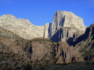
my stay in the House Range, a large mass of rock that started as sediments in a Cambrian sea. Now 500 million years later, they stand nearly 10,000 ft above sea level. On the steep west face the layers are obvious. On the opposite side we see gentle slopes that disappear below the surface of the valley to the east.
 |
| Steep west face, with the "well-defined stratification" observed by Capt. JH Simpson in 1859. Because the crest looked like structures, he called these mountains the House Range. |
 |
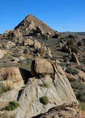
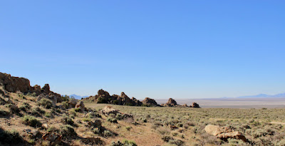
| Road leading to the east side of the House Range. Note the gentle slopes. The pale rock in the draw on the right is not sedimentary. |
Pioneering geologist Grove Karl Gilbert visited the House Range in the early 1870s, as part of GM Wheeler's Surveys West of the One Hundredth Meridian. The asymmetry of the uplift blew his mind. "... the beds exhibit in cross-section but
a single direction of dip" (italics mine). He had expected something like the Appalachian ranges, whose structure was considered typical of all mountains. "... it was only with the accumulation of difficulties that I reluctantly abandoned the idea." (Gilbert 1875)
 |
| Gilbert's cross-section through the House Range (1875). |
Of course surprises were to be expected; geology was still a young science. For example consider orology—the science of mountains (now orogenesis). In Gilbert's time, geologists struggled to explain how mountains formed even in a very general way. Their theories ranged from crustal wrinkling as the Earth cooled to fiery forces underground.
Gilbert admitted he was far from understanding orology in the "Basin Range System" (now Basin and Range Province). But after studying so many ranges he could shed some light on the subject. He suspected the House Range was bounded on the west by a steep normal fault, which had tilted strata downward to the east. And whatever caused this uplift must have been operating on a grand scale, for he had seen similar structures over a huge area.
 |
| The Basin and Range Province overlaps the Great Basin but is larger, mainly to the south (sources differ on boundaries). In the BRP, ranges generally trend northerly, are bounded by normal or listric faults, and are separated by sediment-filled basins. |
Gilbert also discovered "cross faults" in the House Range. He included one in his diagram of the west face (below), which emphasizes the southerly component of overall dip. In several places, strata have been disrupted by faulting. Gilbert shows this by labeling beds of quartzite ("q", looks like "g") and limestone ("l"). Near Notch Peak the quartzite and limestone are
higher than they are at Dry Pass
to the north, contrary to what we would expect based on dip. Gilbert had no explanation for these faults, except that they probably predated uplift of the House Range (Hintze & Davis 2003).
 |
| Click on image to view displaced quartzite and limestone (Gilbert 1928). |
Today geologists generally agree that Basin and Range orogenesis is due to stretching of the continent, as the Pacific and North American plates grind past each other along transform faults (DeCourten & Biggar 2017; see
Busby's Walker Lane diagram). Extension is thought to have started 30–40 million years ago, and so far has doubled the distance between Salt Lake City and Reno. It continues, as evidenced by earthquakes and precision GPS measurements. As Gilbert suspected, this is orogenesis on a grand scale—from eastern California to central Utah, and from southern Oregon and Idaho to northern Mexico.
Gilbert also was right about the relative age of the cross faults in the House Range (Hintze & Davis 2003). They were part of earlier mountain building (late Jurassic through Cretaceous), when western North America was being compressed as the Farallon plate dove under the west coast. The result was 200+ million years of orogenesis, producing the Sierra Nevada, Rocky Mountains, and the lesser known Sevier orogenic belt (DeCourten & Biggar 2017).
During the Sevier Orogeny strata were shoved eastward, sometimes great distances, along low angle thrust faults (detachments). Seismic exploration has shown that the central House Range is underlain by several shallow-dipping major faults formed by regional, easterly-directed thrusting, most likely during the Sevier Orogeny (Stoeser et al. 1990).
 |
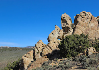
| Non-sedimentary rocks near the base of the House Range's west face. |
Oddly, Gilbert seems to have ignored a prominent geologic feature of the House Range, though he may have hinted at it in one sentence: "The rocks are
almost wholly sedimentary" (italics mine) (Gilbert 1928, p. 74). The topographic map (Plate 31) provides another hint:
 |
| Note "Granite Canyon" northeast of Notch Peak. It's now called Miller Canyon. |
Finally, Gilbert's diagram of the west face shows steeply tilted strata below and just north of Notch Peak, but with no explanation (below; red annotations mine).
 |
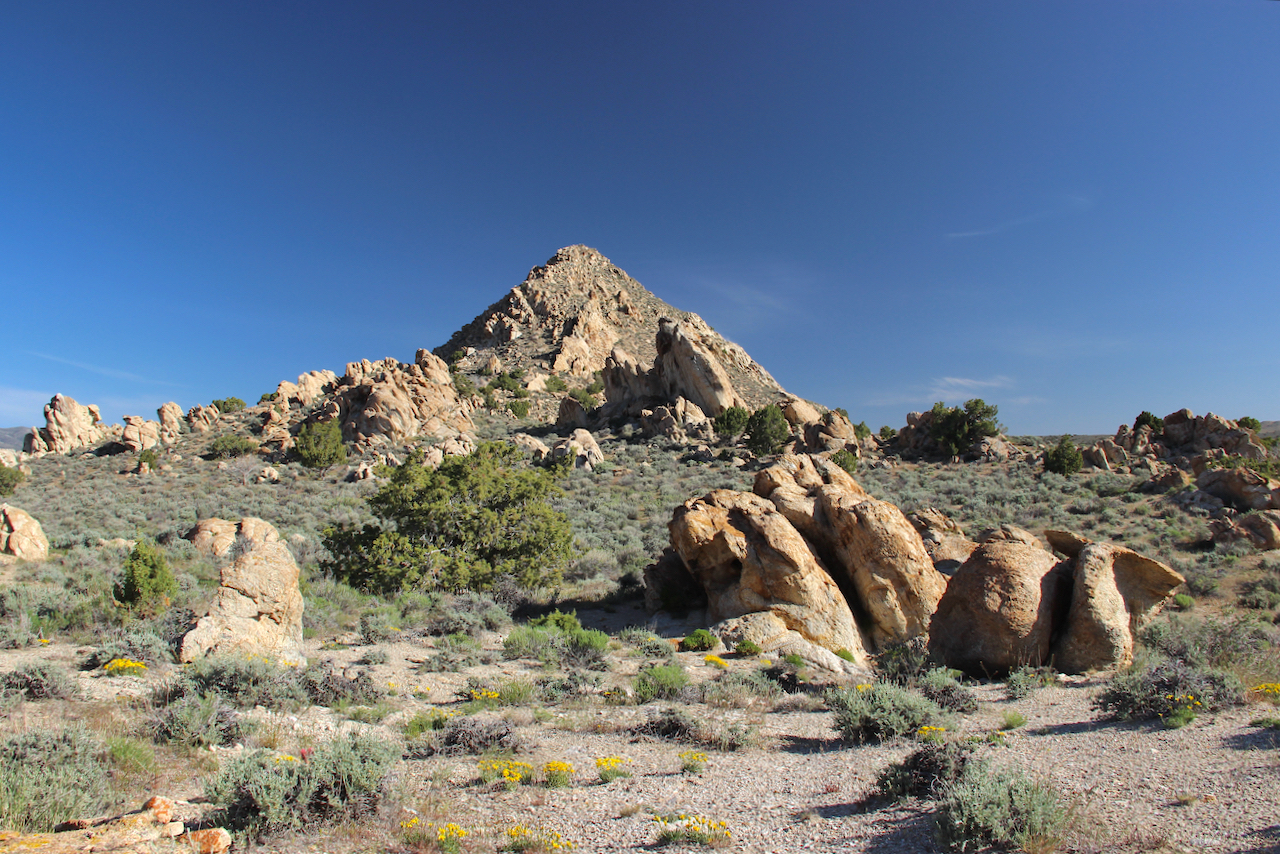
| Are the lower rocks in this photo Gilbert's steeply tilted strata? |
In 1905, the eminent paleontologist Charles Doolittle Walcott came to the "great House Range" to study its fossil-rich rocks, and to establish "the interrelations of the strata and faunas in the North American Cordilleran area". In his 1908 report, he included photographs of exceptional sites so that "geologists and paleontologists who have not had an opportunity to see the sections may get an idea of the completeness of the exposures of the strata in the Cordilleran area." One such site was the House Range.
 |
| Notch Peak and the west face of the House Range. "... an intrusive mass of granite porphyry is intruded into the Cambrian beds on the north side of the peak (left side)." Aside from this caption, Walcott made no mention of the intrusion in his report. |
Being a huge fan of GK Gilbert—such an observant open-minded adventurous geologist!—I have to wonder why he omitted this obvious granitic intrusion in his reports on the House Range. Maybe he just didn't want to struggle with yet another puzzling geologic feature.
But now much of the puzzle has been solved. "The Notch Peak intrusive presents a case study of the whole gamut of magma emplacement ... Seldom can one find in so neat an area the geologic record of such a variety of processes generated by a single intrusive body," wrote Arthur L. Crawford, Director of the Utah Geological and Mineralogical Survey in 1958. No longer do geologists ignore it (e.g. Gehman 1958, Stoeser 1990, DeCourten 2003).
 |
| Notch Peak intrusive viewed from east. Intrusions by definition form underground. If we surface creatures can see them, something must have happened—in this case, uplift of the House Range and erosion. |
The Notch Peak intrusive is composed of quartz monzonite, sometimes called granite (they
differ slightly in composition). It's assumed to be Jurassic in age (dated at 193–143 Ma), is about 3 mi in diameter or 2.5 x 4.5 mi in area, and may be a laccolith. Other features include aplite dikes and sills intruding adjacent sedimentary rocks, zones of pegmatite, crystal-lined cavities, and mineral-rich skarn.
 |
| The beauty of skarn!—from Osgood Mountain intrusive (into carbonates), Nevada. Like Notch Peak skarn, it contains tungsten and molybdenum. James St. John via Flickr. |
Intrusions have created great wealth in Nevada and Utah, in the form of ores. As molten magma ascends and crystallizes, hot fluids are expelled. These circulate and dissolve surrounding rock. If conditions are right, new minerals precipitate out in sufficient quantities to produce ore, where "one or more valuable substances can be mined at a profit." (
Mineral Resources)
If magma intrudes carbonates—limestone or dolomite—it often creates skarn when saline metal-rich fluids alter the host rock to form new minerals. In the House Range, the Notch Peak intrusive had ample opportunity to alter limestone. The resulting skarn contains tungsten and molybdenum in moderate concentrations (Stoeser 1990).
 |
| Head of Miller Canyon: "FEDERAL MINING CLAIM ... ABSOLUTELY NO PROSPECTING ALLOWED". |
Note
Here's a simple timeline for the House Range. For dates, check this geologic time scale.
Paleozoic Era, Cambrian Period: Marine sediments accumulate to great thickness off the coast of Laurentia.
Later Mesozoic Era: Sevier Orogeny deforms sedimentary rocks in the area of the future House Range. Notch Peak quartz monzonite intruded into sedimentary rocks during Jurassic Period.
Cenozoic Era, Tertiary Period (continuing to today?): Continental extension with block faulting uplifts the House Range. Erosion sets in, eventually exposing the Notch Peak intrusive.
Souces
DeCourten, F. 2003. The Broken Land; adventures in Great Basin geology. U Utah Press.
DeCourten, F. 2022. The Great Basin Seafloor. University of Utah Press. Supplemental Field Guide (PDF) available online.
DeCourten, F, and Biggar, N. 2017. Roadside Geology of Nevada. Mountain Press Publishing Co.
Gehman, Jr, HM. 1958. Notch Peak intrusive, Millard County, Utah. Geology, petrogenesis, and economic deposits. UT Mineralogical & Geological Survey Bulletin 62. PDF
Gilbert, GK. 1875. Report upon the Geology of portions of Nevada, Utah, California, and Arizona, examined in the years 1871 and 1872 in Wheeler, GM. Report upon United States Geographical surveys west of the one hundredth meridian v. 3. Washington [D.C.], G.P.O. BHL.
Gilbert, GK. 1928. Studies of Basin Range structure. USGS Professional Paper 153. PDF
Hintze, LF, and Davis, FD. 2003. Geology of Millard County, Utah. UT Geo. Surv. Bull. 133. PDF
Simpson, JH (US Army). 1876. Report of explorations across the great basin of the territory of Utah for a direct wagon-route from Camp Floyd to Genoa, in Carson Valley, in 1859, by Captain J. H. Simpson ...: Making of America Books, U Michigan.
Stoeser, DB, et al. 1990. Mineral resources of the Notch Peak Wilderness Study Area. US Geological Survey Bulletin 1749. GPO. PDF
Walcott, CD. 1908. Cambrian sections of the Cordilleran area, in Cambrian Geology and Paleontology. Smithsonian Misc. Collections 1910, v. 53 no. 5:167–230. BHL