Showing posts with label salt tectonics. Show all posts

Sunday, June 15, 2025

A Restless Region on the Colorado Plateau

Castle Valley, 20 miles east of Moab, UT; Round Mountain rises from the valley floor on the right.
The Colorado Plateau is a thick block of crust in the Four Corners area of the American Southwest, an immense stack of sedimentary rock. It's remarkably stable, remaining a region of geological calm even when severe deformation was underway right next to it—uplift and faulting of the Rocky Mountains to the east, and stretching and breaking of the Basin and Range Province to the west. This is why the Plateau's sedimentary rocks are largely horizontal, like the deposits they once were (source).

This is not to say the landscapes are boring. In fact they're spectacular—sweeping vistas with colorful roughhewn features. For the last 10 million years the Plateau has been rising, invigorating streams and accelerating erosion. The result is a seemingly endless collection of buttes, arches, rimrock, fantastical spires, deep winding canyons, and more.

The Colorado Plateau covers c. 130,000 sq mi; note complex topography in adjacent areas (source unknown).
Valley of the Gods near Bluff, UT; vertical and horizontal erosional features are common on the Colorado Plateau.
Entrenched meander of the San Juan River, cut through horizontal strata; Goosenecks State Park.
Looking down Castle Valley. Is this a standard Colorado Plateau landscape? Bryant Olsen photo.
Castle Valley appears to be dominated by vertical and horizontal features, as is typical on the Colorado Plateau. Is it another example of recent uplift and erosion? Only partly. Its story is much more complicated—repeated flooding, prolonged deposition, unusual deformation, weird intrusions, and finally ... collapse.

About three hundred million years ago, not far east of today's Castle Valley, the great Uncompahgre Range was rising. At the same time the Paradox Basin was subsiding along the range's base, and filling with sediments eroded off the mountains. Critical to the Castle Valley story, seas repeatedly flooded the Basin (1). Then whenever sea level dropped, the saltwater left behind evaporated and deposited evaporites, including lots of salt (halite). At least 29 such cycles took place over a period of at least 8 million years. The result was extensive deposits of evaporites at least 4000 ft thick—the Paradox Formation (2).
Ancestral Rocky Mountains c. 300 million years ago; darker blobs are major ranges; Castle Valley location approximate (modified from Soreghan et al. 2009).
Being evanescent creatures, it's difficult for us to think of geologic structures as ephemeral. But the rock record clearly shows that they are. Even mountains have lifetimes. The great Uncompahgre Range is now gone, razed by erosion. The Paradox Basin also disappeared, filled to overflowing with sediments and then deeply buried. But in a sense both are still with us. Uncompahgre sediments are widely displayed in colorful rocks across the Colorado Plateau. And the Paradox Basin maintains a ghostly presence—dramatic, but difficult to explain.

After deposition of the last Paradox evaporites, the region was inundated by tropical seas—source of the impressive layers of limestone, sandstone, siltstone and shale that line Plateau drainages. Then about 200 million years ago, when the supercontinent Pangaea started to come apart, there was a shift to terrestrial deposits—dune sand, volcanic ash, and sediments from rivers, lakes, and inland seas. Under this immense "lithic layer cake" lay the Paradox salt, deeply interred but not dead (source).

Salt is a strange kind of sedimentary rock. Sediments such as sand and mud can be compressed to form dense rocks, but salt remains nearly unchanged under pressure. It's weaker and less dense than the rock around it, but also plastic—with properties of both solids and liquids. It can flow to escape from its "stressful surroundings", deforming any rocks in its way (source). Deformation can occur at the scale of landscapes, and the old Paradox Basin has many fine examples: fins and arches of the Fiery Furnace, closely-spaced meanders on the Colorado River, and at least seven parallel northwest-trending valleys, including Castle Valley.
Dotted elongate blobs are parallel northwest-trending valleys. Blue circle marks intriguing overlap of Castle and Spanish Valleys with La Sal Mountains (3). Modified from Doelling 1985.
Castle Valley begins at the base of the northern La Sal Mountains and extends northwest about 12 miles. It's a broad valley, to 2 miles wide. The southwest wall is capped by a nearly continuous outcrop of the erosion-resistant Wingate Sandstone, known as Porcupine Rim. On the other side of the valley, the wall is less continuous but equally dramatic—carved into mesas, buttes, rimrock and spires.
Porcupine Rim—Jurassic Wingate Sandstone caps southwest wall of Castle Valley.
Northeast side of Castle Valley; strata tilting away from valley center visible at arrow.
Geologists find Castle Valley intriguing. The floor is much broader than would be expected for its little streams, and quite flat. Rock layers on both sides of the valley tilt down away from the valley center (more easily seen on the northeast side, photo above). Most exciting is what lies beneath the surface. Wells drilled in the center of the valley revealed a long steep-sided bed of salt to 1000 feet thick! Castle Valley must be a salt anticline, an elongate convex uplifted fold cored by salt. On this geologists agree. But as to how it formed and what happened to it ... that's another matter.
Castle Valley (Google Earth). But where's the anticline?! Valley walls hint at what happened.
The diagram below shows a common explanation for salt anticlines. In the top panel, flowing salt accumulates to form a convex fold, pushing up overlying rock layers. Castle Valley salt is thought to have flowed and formed an anticline 300 to 200 million years ago (Ornduff 2006, Trudgill 2011).
Salt anticline in cross section; at the time of the top panel, Castle "Valley" would have been a long ridge.
Now the Castle Valley anticline is mostly gone. The second and third panels in the diagram show a possible demise, but first, a major disturbance very close by needs to be considered—uplift of the La Sal Mountains about 28–25 million years ago (3).

The La Sals are not a mountain range but rather clustered peaks. They're similar to volcanoes except that magma never reached the surface. Pioneering geologist AC Peale called them "eruptive mountains of a peculiar type ... igneous and yet non-volcanic". Recent studies indicate that magma stopped just 1–3 miles below the surface, making them shallow intrusions, specifically laccoliths.
La Sal Mountains rise 8000+ feet above the Colorado Plateau—a major disturbance! (source)
La Sal high country: La Sal Peak (right) is intruded trachyte; Castle Mountain (left) is still capped with sedimentary rock (Ross 1998).
Now we're faced with another question. If magma never reached the surface, why are the La Sal "intrusions" visible? Instead of being 1–3 miles below the surface, their tops stand over a mile above the Plateau. The likely answer is the recent uplift and erosion of the Colorado Plateau mentioned at the beginning of this post.

Starting about ten million years ago, both the Colorado Plateau and the Basin and Range Province (to the west) have been rising. But while the latter was stretched and faulted, forming its eponymous basins and ranges, the Plateau remained a single block. Eventually it rose about kilometer higher than the Basin and Range. Why? That's a puzzle not yet solved (source). In any case, streams were steepened and invigorated, and erosion sped up enough to reveal the La Sal laccoliths.

Recent uplift and erosion probably explain the demise of the Castle Valley anticline as well. Erosion and/or faulting of overlying rock would have exposed the salt to water. Being salt, it of course dissolved. When enough was removed, rock layers at the crest fractured and collapsed, creating a breached anticline. But others think differently. Regional extension may have been the cause, perhaps related to ongoing extension in the Basin and Range Province. Or as Naqi et al. (2016) safely concluded, "formation of the salt valleys might be attributed to multiple factors (i.e., extensional forces, salt dissolution, and internal salt flow) rather than a single mechanism."
A salt anticline's demise may start with salt dissolution, followed by collapse of rock layers at the crest.
Breached anticline; dashed line shows former continuity across crest (Grabau 1920, A Textbook of Geology).

Let's visit!

Castle Valley is a great destination for geotrippers. Enough remains of the anticline to see and appreciate what happened. The tilted rock layers of the flanks are now the valley walls. Imagine them reaching higher and arching across the broad floor. Consider the depth of the valley below the now-imaginary crest and think about how much salt and rock must have been removed! Then look toward the head of the valley, at the dark hill rising from the floor. That's Round Mountain—a little relative of the La Sal intrusions. It was exposed when the anticline was breached and deeply eroded.

Castle Creek Road (paved) runs the length of the valley, providing easy access. Spires, buttes and mesas on the northeast side can be reached from several parking areas. Round Mountain is a short distance south of Castle Valley Road via a rough eroded 2-track; I parked just off the paved road and walked. Tour the southwest side via the Porcupine Rim trail—highly recommended, though maybe not on weekends and holidays.
Castleton Tower is a short hike from Castle Valley Road.
La Sals on left, Round Mountain on right, rabbitbrush in foreground.
En route to Round Mountain, Porcupine Rim beyond.
Looking up Castle Valley from Porcupine Rim, La Sal Mountains on horizon; redrockrubi.
Refreshing shade, courtesy uplift and erosion of the Colorado Plateau.

Notes in addition to links in post

(1) Cyclicity of Paradox deposition is well documented, but the cause is debated. Glaciation seems to be most popular, specifically sea level change with alternating glacial and interglacial periods. Other possibilities include rise of the Uncompahgre Range and climate change. Trudgill (2011) concluded that glaciation-driven changes in sea level was the main cause; tectonics and/or climate change may have made lesser contributions.

(2) In my reading, I found a range of estimates for Paradox deposition: 29 or 33 cycles over 8 to 15 million years, producing evaporites 4000, 6000 or 8000 ft thick (Ornduff et al. 2006, Trudgill 2011, USGS).

(3) Geologists have long wondered whether the La Sal Mountain intrusions and salt anticlines such as Castle Valley are related. Thomas Harrison, who surveyed the Paradox Basin area in 1926, discussed the possibility in his report (1927):
"It is interesting to know that igneous intrusive rocks of very considerable importance are closely associated with the saline anticlines. The laccolithic La Salle Mountains occupy an area on and between two parallel anticlines ... A small isolated igneous stock [Round Mountain] surrounded by gypsum occurs in the Castle Valley salt [anticline]."

Harrison noted that salt anticlines were thought to be associated with lines of weakness dating from Precambrian time. Their uplift was followed by subsidence, and massive accumulation of sediments. Perhaps this "heavy load" generated heat that "liquefied rocks within the zone of fracture, resulting in the [magma] which formed the laccolith, and the Castle Valley stock" [Round Mountain].

Today's geologists may chuckle at the idea of a "heavy load" of sediments melting igneous rock below. In contrast, "lines of weakness dating from Precambrian time" are taken seriously. Many northwest-trending faults cut basement rocks in the Paradox Basin area. Ross (1998) concluded that "the locations of the La Sal Mountains intrusive centers along the trend of subsurface faults ... suggest that the faults were avenues of weakness for the ascent of magma in the upper crust. This is especially true for the northern and southern clusters of peaks [which coincide with salt anticlines]".

Sources

Doelling, HH. 1985. Geology of Arches National Park. Utah Geological Survey, to accompany Map 74. PDF

Harrison, TS. 1927. Colorado–Utah Salt Domes. Am. Assoc. Petroleum Geologists 11:111–133.

Ornduff, RL, Wieder, RW, Futey, DG. 2006. Geology Underfoot in Southern Utah. Mountain Press Publishing. For salt anticlines see Vignette 29, A Sea of Fins; for La Sal Mountains see Vignette 32, Intruders in a Sedimentary Domain.

Ross, ML. 1998. Geology of the Tertiary intrusive centers of the La Sal Mountains, Utah; influence of preexisting structural features on emplacement and morphology, in Laccolith complexes of southeastern Utah; time of emplacement and tectonic setting. USGS Bull. 2158: 61-83. PDF

Snyder, NP. 1996. Recharge area and water quality of the valley-fill aquifer; Castle Valley, Grand County, Utah. Report of Investigation 229. Utah Geological Survey. PDF

Soreghan, GS, et al. 2009. Hot fan or cold outwash? Hypothesized proglacial deposition in the upper Paleozoic Cutler Formation, western tropical Pangea. J. Sed. Res. 79:495-522.

Trudgill, BD. 2011. Evolution of salt structures in the northern Paradox Basin: controls on evaporite deposition, salt wall growth and supra-salt stratigraphic architecture. Basin Research 23:208–238. https://onlinelibrary.wiley.com/doi/10.1111/j.1365-2117.2010.00478.x

US Geologic Survey. Mid 2000s. Geologic Provinces of the United States: Colorado Plateau Province. Internet Archive WayBackMachine.

Wednesday, February 26, 2025

Upheaval Dome, the most peculiar structural feature in southeast Utah

Severely contorted innards of Upheaval Dome.
Last September I visited two anomalous features on the generally orderly Colorado Plateau. The first was a cluster of igneous peaks in a sedimentary setting, to be the subject of a later post. I'm starting with the second—a large round hole in the ground. I thought it would be simpler.

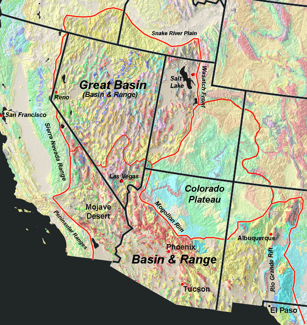
The Colorado Plateau covers c. 130,000 sq mi in the Four Corners region in the southwest USA. For the last six million years it has been slowly rising, and yet it's remarkably stable, with limited deformation (NPS). Its wonderful landscapes are largely erosional, dominated by horizontal and vertical features. No wonder Upheaval Dome stands out.

Valley of the Gods shows the horizontal/vertical nature of the Colorado Plateau.

The remarkably round structure center left is Upheaval Dome (Google Earth; annotations added).
"Upheaval Dome" may seem an inappropriate name for a hole. However the rock layers surrounding it are indeed tilted, and though there's no top, geologists agree this is a dome. But what heaved it up is another matter. Wildly different theories have been debated for at least a century.

A decapitated dome with tilted strata encircling highly contorted rock; UGS photo, annotations added.
I would have loved to read the thoughts of the first geologists to peer over the rim! Surely they were surprised. But it appears this dome wasn't described until 1927, by which time it was already known to geologists—as Christmas Canyon Dome.

In the summer of 1926, petroleum geologist Thomas Harrison surveyed the area between the Colorado and Green Rivers, known to be underlain by a thick layer of salt. Elsewhere in the world buried salt created reservoirs for petroleum. Maybe this salt did too.

In his report Harrison explained that many of the domes he examined were gentle folds deserving further exploration. However there was a dramatic exception: "one discovered by Marland [Oil Co.] geologists shows a remarkable and very unusual development. This is the Christmas Canyon Dome." Harrison described a "sharp and highly distorted crest" and a "trough which closely and completely circumvents it" but that was all (1).

How could anyone look at Upheaval Dome and limit themselves to a one sentence description?! Perhaps Harrison didn't visit it himself, relying instead on discussions with Ben Parker of Marland Oil, who supplied a map and diagram.

Ben Parker's diagram of Christmas Canyon Dome; note steepness of deformed strata.

Harrison was not the only geologist working between the Green and Colorado Rivers in 1926. Edwin McKnight of the US Geological Survey was there too—mapping topography, describing and mapping rock units, investigating geologic structures, and assessing potential for manganese, oil and gas, among other things. After finishing in early summer of the next year, he promptly prepared a preliminary report. But the final report was delayed "by the assignment of the writer to other projects." Geology of Area between Green and Colorado Rivers was finally published in 1940, by which time Christmas Canyon Dome had become Upheaval Dome (2).

McKnight devoted five pages to Upheaval Dome, "the most peculiar structural feature in southeast Utah". He described it from the center outward. An interior conical dome, circular at the base, is surrounded by a ringlike syncline (narrow valley) and, beyond that, a circular ridge about a half mile wide. "The complete diameter of the affected area is 3 miles."

From map accompanying McKnight's report; Upheaval Dome is the tightly concentric red contour lines, 100 vertical feet apart (3).
The slopes of the interior dome were steep, generally 40–60º. But they ended prematurely, and the dome's summit was gone. Instead a large hole revealed spectacularly contorted innards. Here, McKnight couldn't hide his excitement:

"The White Rim member does not occur in place but appears as huge up-ended blocks the size of a house in the highly disturbed area of jagged pinnacles at the center of the dome. Surrounding this is the Moenkopi, very much crumpled and dissected by numerous gullies. The Shinarump [now part of the Chinle] forms a jagged fringe to the Moenkopi, its huge tilted triangular blocks sticking up like the teeth of a saw." [names refer to rock layers]

Huge tilted triangular block of the Shinarump sticking up like the tooth of a saw.
Just as amazing, though not so dramatic visually, are the rock layers immediately beyond the outer rim. They're horizontal! Intense deformation had been highly localized.
From McKnight's cross-section, labeled arrows added; note horizontal layers beyond the dome, and question marks inside it.
McKnight attributed the rise of Upheaval Dome to the thick layer of buried salt below, the one that drove Harrison's search for petroleum. It was deposited 300 million years ago in the great Paradox Sea, an inland sea sometimes connected to the ocean, sometimes not. When sea level dropped sufficiently, it was sucked dry by evaporation leaving thick salt deposits. Then the sea returned. There were on the order of 29 such cycles over a period of 15 million years, producing 6000 vertical feet of salt. With burial under younger sediments, it turned to rock.
Extent of the great Paradox Sea; courtesy Jack Share.
Salt is a sedimentary rock but an odd one—plastic and able to flow. It can move underground, accumulate and ooze upward, and deform overlying rock. Given the abundance of salt in the area, McKnight thought salt uplift the likely explanation for Upheaval Dome (4).

"Because of the known occurrence of thick salt under the Upheaval Dome, the writer prefers to consider this feature a salt dome. The rock in the center of the dome is greatly broken, mashed, and squeezed, as if it had been plastically kneaded ... The massive sandstones on the axis of the peripheral syncline also appear to have been deformed plastically and do not show the breaking and shattering that would be expected had they been deformed rapidly and near the surface. ... Every indication points to slow deformation under thick cover ..." (italics added).

Uplift is only part of the story behind today's Upheaval Dome. For millions of years after it rose, younger sediments were deposited over it, eventually becoming a cover of rock something like a mile thick (UGS). Then about six million years ago the Colorado Plateau began to rise. Streams were steepened and invigorated, enabling rapid erosion (NPS). Thousands of vertical feet of rock were removed, along with the summit of Upheaval Dome.

Upheaval Dome, revealed by erosion. Photo by Doc Searls.
The "salt theory" is fascinating, but it has problems. For example no remnants of salt have been found in the area of the dome (UGS). And seismic survey and drill holes have shown Paradox salt to be 1500 ft below the surface, i.e., well below the dome (Fillmore 2011). So the salt theory was modified. Perhaps Upheaval Dome is a salt diapir—created by a blob of salt that rose and was pinched off from its source below. Subsequent erosion removed it along with overlying rock, explaining the lack of salt remnants. But if this really is a salt diapir, it's the weirdest one ever, unlike any other in the world (Ornduff et al. 2006).

Fortunately there's another way to create a decapitated dome with highly contorted rocks and markedly localized deformation. And it can be done in less than a minute instead of 20 million years.

From NPS Upheaval Dome Trail Guide, 1993.
Perhaps c. 170 million years ago a meteorite slammed into this very spot. In the first tenth of a second, it would have greatly compressed the surface, and then sent a shock wave radiating outward, excavating a giant crater. This was followed by collapse of the crater rim and rebound of the compressed core, creating a dome of deformed rock. As in the salt theory, subsequent deposition buried the rebounded dome; then erosion removed the rock cover and top of the dome, exposing the contorted rocks inside. (Today's hole is NOT the impact crater, whose remnants were removed by erosion. But the two are easily confused.)

For years evidence had been accumulating in support of meteorite impact (e.g. Kriens et al. 1999). But there was a problem. No altered rocks singularly diagnostic of meteorite impact had been found. So the salt-meteorite debate raged on.

Then in 2008, Buchner and Kenkman proclaimed that impact origin for the "Sphinx of Geology" (Upheaval Dome) had been confirmed. They examined 120 thin sections of rock from the outer edge of the ring syncline and found shocked quartz, which only forms in meteorite impacts and nuclear explosions! Actually, the "vast majority" of the quartz grains in the rocks did not exhibit shock features. But they found two that did. These tiny "smoking guns" were said to be unequivocal evidence of meteorite impact.

The world of information adapted. Wikipedia declared meteorite impact the accepted theory. The Utah Geologic Survey announced that Utah's Belly Button, once considered an "outie" is now an "innie". My favorite southern Utah geo guides—Ornduff and pals—argued persuasively against salt, noting that "the most recent studies point to the meteorite theory".
As of 2024, the National Park Service wisely remains non-committal.
Yet there's still a problem. In addition to shocked quartz, Upheaval Dome has rock layers that clearly were tilted slowly, on the order of millions of years. So another possibility must be considered—perhaps a meteorite impact caused a salt diapir! (Daly & Kattenhorn 2010; Gessaman et al. 2015).

But I'm stopping here, having dwelt long enough on how Upheaval Dome might have formed. For me, the mystery doesn't diminish its chaotic and awesome beauty. In fact, it enhances it.
What hath God wrought?

Notes

(1) Harrison concluded that at Christmas Canyon Dome "beds have been too highly buckled and faulted" to justify exploration for oil.

(2) Thanks to the Utah Geologic Survey for supplying me with papers by early geologists, and for trying to solve the mystery of "Upheaval Dome" (the name). If you know its source, please Comment below.

(3) McKnight took pains to explain the unusual contour lines of Upheaval Dome: "The general shape of the dome and surrounding syncline is depicted with fair accuracy on plate 3, but because the information on which this part of the map is based was not detailed enough for mathematical representation of such features as the exact structural depth and configuration of the syncline and the exact closure on the central dome, the structure contours within the involved area have been dotted."

(4) As further evidence of salt deformation, McKnight noted that "Upheaval Dome closely approximates the theoretical form for salt domes under certain conditions", citing Nettleton, LL. 1934. Fluid mechanics of salt domes. Am. Assoc. Petr. Geol. Bull. 18: 175-1204.


Sources

The amount of information (and speculation) available for Upheaval Dome is truly overwhelming! These are sources I found useful.

Buchner, E. & Kenkmann, T. (2008) Upheaval Dome, Utah, USA: impact origin confirmed. Geology, 36, 227–230.

Daly, RG, and Kattenhorn, SA. 2010. Deformation styles At Upheaval Dome, Utah imply both meteorite impact and subsequent salt diapirism. 41st Lunar and Planetary Science Conference. PDF

Fillmore, R. 2011. Geological Evolution of the Colorado Plateau of Eastern Utah and Western Colorado. Includes lengthy discussion of competing theories.

Geesaman, PJ, et al. 2015. New evidence for long-term, salt-related deformation at Upheaval Dome, SE Utah. Abstract and slides.

Harrison, TS. 1927. Colorado–Utah Salt Domes. Am. Assoc. Petroleum Geologists 11:111–133.

Kriens, BJ, et al. 1997. Structure and kinematics of a complex impact crater, Upheaval Dome, southeast Utah. USGS.

McKnight, TS. 1940. Geology of area between Green and Colorado rivers, Grand and San Juan Counties, Utah. USGS Bull. 908.  [Upheaval Dome p 124–128]

National Park Service (NPS). Stretching of the Basin and Range and Lifting of the Colorado Plateau. Accessed Feb 2025.

Ornduff, RL, et al. 2006. Geology Underfoot in Southern Utah. Mountain Press. Vignette 28, "At the Mystery's Core", is about Upheaval Dome.

Share, Jack. 2011 (May 29). The Enigma of Upheaval Dome: Diapiric Salt or Ground Zero.

Utah Geologic Survey. Utah's Belly Button, once considered an "outie" is now an "innie". [UD is one of  many wonderful Utah GeoSites offered online, great for planning roadtrips.]

Friday, August 3, 2012

Paradox Exposed

Sparky is awestruck by the Onion Creek salt diapir.
Onion Creek is short little creek, flowing less than 10 miles before entering the Colorado River northeast of Moab, Utah.  It was named for its fragrance, most notable at Stinking Spring.  The drainage was not always so short.  Fisher Creek, which flows off the north side of the La Sal Mountains, used to turn and continue west along this route.  Then about 3 million years ago, it was blocked by a rising dome of salt.
Modern-day Fisher Creek flows northeast through Cottonwood Canyon to the Dolores River, leaving Onion Creek to drain the area to the west.  Base map from ArcGIS Online (click to view details).

Salt tectonics, aka halokinesis

Salt has played a prominent role in the spectacular scenery of southeast Utah and adjacent Colorado.  It has moved around underground, enough to produce surface features such as domes, ridges and valleys.  This is the phenomenon of “salt tectonics”, but it isn't necessarily associated with the more common type of tectonics -- movement of crustal plates.  In fact, salt can migrate and change the landscape even in areas of tectonic quiescence.  Perhaps it’s better to use the term "halokinesis" -- “a fine word” as Ole Nielsen pointed out in his fine post on Salt Tectonics.  Halokinesis also was featured at Evelyn Mervine’s Geology Word of the Week last summer.  (She briefly discussed psychic halokinesis -- moving salt with one’s mind -- but we won’t go there in this post!)

Halokinesis happens because salt doesn’t compact, in contrast with most sediments.  Sand, silt, etc. become more dense under pressure, due to loss of pore space, but the crystalline structure of salt means there is little pore space to lose.  While other strata increase in density as sediment accumulates above, a salt layer becomes relatively more buoyant.  Under pressure, it can become plastic and flow, initially laterally but then upward as well, due to greater buoyancy.  If the salt layer is sufficiently thick, it will change the landscape.
Cross-section through the Salt Valley anticline (uplift) north of Arches National Park, Utah, pushed up by moving salt.  The crest was breached, forming a valley.  Modified from Fillmore 2010.
Salt is highly soluble and will disappear quickly if groundwater gets to it.  Salt anticline valleys are uplifts that later collapsed when the underlying salt was dissolved (diagram above, photo below).
Paradox Valley, a collapsed salt anticline in southwest Colorado.
Photo by Geotripper; for details, see his Yellow Line Fever.

Paradox Formation (Pennsylvanian)

There is no shortage of underground salt in southeast Utah and southwest Colorado.  This was the Paradox Basin 300 million years ago, an extensive downwarp that developed southwest of the Uncompahgre Uplift of the Ancestral Rocky Mountains.  Seawater periodically flooded restricted basins, followed by evaporation and deposition of evaporites. The cycle was repeated many times producing thick beds of evaporites, mostly salt, that would be come the Paradox Formation.
Ancestral Rocky Mountains showing Paradox Basin and Uncompahgre Uplift; after Trudgill 2011. 
Salt anticlines (uplifts) are especially common in the vicinity of the Colorado - Utah state line, where the Paradox Formation is thickest (below, after Gutiérrez 2004).


Onion Creek salt diapir

The Onion Creek salt diapir is located about 17 air miles east-northeast of Moab, Utah, just south of the Fisher Towers.  Here the migrating Paradox Formation gathered into a blob, creating a dome on the surface.  The uplift subsequently collapsed, revealing underlying evaporites.  The exposure is about 2 miles in length and 3/4 mile across.
Pale area lower center is the Paradox Formation along Onion Creek.  From Google Earth, click to view details.
Portion of the Geologic map of the Fisher Towers quadrangle (Doelling 2002).  The Paradox Formation (IPp, light purple) is in the lower right quadrant.  Click to view.
This is a halokinetic feature we all can enjoy, as a decent dirt road runs through it.  The visuals are spectacular!  Then there is the memorable fragrance of Onion Creek, best appreciated at Stinking Spring, which reeks of sulfuric acid.
Looking east into the Onion Creek salt diapir.  From here, the road quickly drops down to the canyon bottom.
Scenic drive through Paradox strata, Onion Creek on left.
Deformed rocks of the Paradox Formation.
Rocks of the Paradox Formation along Onion Creek include gypsum, anhydrite and darker shales from the cap rock of the diapir.  Salt was the most abundant mineral originally, but it was dissolved and carried off by groundwater, leaving the resistant cap rock collapsed and deformed.

Right:  hints of sulfur in cap rock.  Both gypsum and anhydride contain sulfur.  This explains the aroma of Stinking Spring, where sulfur-reducing bacteria produce hydrogen sulfide gas.  For more on cap rock minerals, see the recent post by Sandatlas on Sulfur, gypsum, and hydrocarbons.

Below:  Section through a salt diapir showing sulfur-rich cap rock.  From Damon Mound at Geocaching, no source given.
Rising salt is powerful enough to deform the rigid rocks it moves into, causing fractures and folding.  Sloping beds of the Cutler Formation, tilted by the salt diapir, are often visible on the north side of Onion Valley (see photo at beginning of post).
Looking west down Onion Creek.  Tilted red Cutler strata are visible on the right side of the valley in the distance.  In the center of the photo is a large block that has slid down from the left.
The Onion Creek salt diapir is young, only 2-3 million years old, and there is evidence that there was a pulse of activity just 250,000 years ago.  Apparently the 300-million-year-old Paradox salt hasn't stopped moving, and is going to continue to affect the landscapes of southeast Utah.

Fisher Valley
Heading east, the Onion Creek road leaves the drainage bottom and follows narrow ridges up to Fisher Valley.  This basin contains over 400 feet of fill, deposited after the salt dome dammed Fisher Creek.  After driving through the tortured strata along Onion Creek, the flat landscape is striking!

Fisher Valley has all the amenities -- flat land, water and arable alluvial soil.  Combine this with great scenery and you have a lovely place for a ranch (note center pivot and ag fields in aerial photo above, about halfway through post).  But the Fisher Valley of today is not long for this world, for little Onion Creek is steadily eroding headward, excavating the basin. Given no more interference from halokinesis, it will reach Fisher Creek in less than a mile, and connect it once again with the Colorado River, ending its three-million-year-long diversion.
Headwaters of Onion Creek, looking southeast; tip of La Sal Mountains on horizon.  Click photo to view fields of Fisher Valley Ranch in distance -- little Onion Creek is going to take them all!

For additional information:

For more information on the Onion Valley salt diapir, including how to get there, see the Utah Geological Survey's Geosights page.

For detailed descriptions of strata, structure and history of the diapir and surrounding area:
Doelling, H.H.  2002.  Geologic map of the Fisher Towers quadrangle, Grand County, Utah.  Utah Geological Survey.  22 p., 2 pl.  Available at http://geology.utah.gov/maps/geomap/7_5/pdf/m-183.pdf

For thorough and interesting discussions of salt structures of the Colorado Plateau, including the Onion Creek diapir:
Fillmore, Robert. 2011. Geological evolution of the Colorado Plateau of eastern Utah and western Colorado. Salt Lake City: University of Utah Press.

Evelyn Mervine's post on halokinesis includes a glimpse at the power of underground salt. In an exploratory well in Louisiana, Texaco drilled through an underground salt mine (oops!), allowing water in.  It dissolved the salt, of course, causing all kinds of havoc -- the Jefferson Salt Mine disaster.

Salt and sediment:  A brief history of ideas at Hindered Settling is an interesting account of the history of salt tectonics.

While planning my trip to the Paradox Basin last spring, I put together a post about it: Field Trip Plans -- the Land of Paradoxes.

Other literature cited:

Gutiérrez, F.  2004.  Origin of the salt valleys in the Canyonlands section of the Colorado Plateau Evaporite-dissolution collapse versus tectonic subsidence.  Geomorphology 57: 423–435.

Trudgill, B.D.  2011.  Evolution of salt structures in the northern Paradox Basin: controls on evaporite deposition, salt wall growth and supra-salt stratigraphic architecture.  Basin Research 23: 208-238.