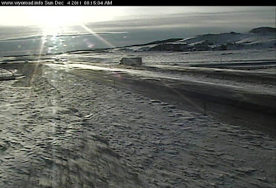
 A few days ago the first arctic air mass of the season arrived in southeast Wyoming, all the way from Siberia with not much opportunity to warm up en route. Suddenly our mild autumn became bitterly cold with lows in the minus 20s F (minus 30s C).
 You know it’s cold when it takes the fluorescent light bulbs a few minutes to reach full brightness in the morning, and the well-insulated dog curls up tight by the wood stove. Time to plug in the car, seal off the bedrooms, split lots of wood ... and of course write (don’t miss the wonderful post, Why Blog, at Small Things Considered).
Air masses are giant homogenous packets of air -- up to a thousand miles in horizontal extent -- that develop over parts of the earth with fairly stable conditions, including both marine and continental regions. Meteorologist Jeff Haby provides thorough descriptions of air mass types; fortunately there are only four to six, depending on the classification:
mT= Maritime Tropical
mP= Maritime Polar
cP = Continental Polar
cT = Continental Tropical
A = Arctic
H = Highland
 |
| Courtesy Steve Horstmeyer. |
Note that no air masses develop at mid-latitudes -- conditions are not sufficiently stable.
The characteristics of air masses are directly related to where they form. For example a maritime topical air mass is warm and wet, with high dew points. mTs are responsible for most of the thunderstorm activity in the US, as they move north from the tropics.
Arctic air masses develop over the North Pole, northern Canada and Siberia, a very cold region.
“Due to a near lack of winter solar radiation, abundant surface snow - ice cover and the continuous emission of radiation from the Earth's surface the air will progressively become colder and colder. Temperatures can reach -30 ° F to -60 ° F.” (Jeff Haby)
The air is frigid and there is very little moisture. These air masses are especially stable, and generally will hang out in the upper latitudes getting good and cold, but when conditions are right they move south. If over-the-pole jet stream flow develops, bitterly cold air from Siberia moves down through Canada to the US. Steve Horstmeyer explains this nicely in a short video at his weather blog. There are popular names for this phenomenon: Arctic Express, Arctic Outbreak.
 |
| Trucker on I-80 rides the Arctic Express into Laramie, Wyoming, USA. |
Even after traveling all the way to southeast Wyoming, the arctic air mass is still quite cold. Before it arrived we were having highs in the low 40s F (ca 4.5 C). Now our highs are in the minus single digits. The usual pattern of daily temperature change is gone. It can be minus 25 F in the evening and only minus 2 F early the next morning. Yesterday the daytime temperature went up and down, up and down for no obvious reason. As the air mass leaves, temperatures will warm no matter what time of day it is.
Really cold air especially likes to settle here in the basin, and it can be 10 to 15 degrees F colder in town than on the summit to the east, 1500 feet higher. Everyone complains of course but look around! The bitter cold and very still conditions create beauty: frost-decorated vegetation, ice ferns on the river, sparkling stars and a brilliant moon.


12/14/22 9:32pm Sahuarita, AZ
ReplyDeleteBeautiful ice pictures! Are the "stars" on a windshied?
But as a bona-fide cold wuss, I'll just wait here under my several layers incl two of down.