 |
| Camping in a Paleozoic sea in the House Range (#notvanlife). |
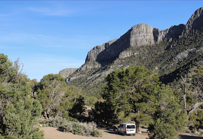
Last May I visited part of the great Paleozoic Sea that covered much of today's Great Basin for hundreds of millions of years. My plan was to commune with Tiktaalik during the Devonian period, as he transitioned (foolishly?) to life on land. But I missed him by about 100 million years. Instead I dwelt in the House Range—a 12,000 ft stack of Cambrian rock in the desert of west central Utah.
It was a geologist's dream—a mystical contemplation of two dramatically different landscapes in the same place but 500 million years apart. And once again I found myself in the company of ghosts (1).
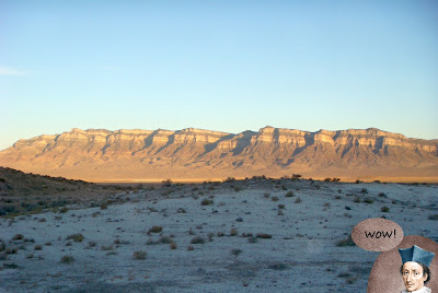
In the summer of 1859, Capt. James H. Simpson of the US Army Corps of Topographical Engineers was leading his expedition back across the Great Basin, looking for a shorter alternative to the wagon route they had established earlier that year. On July 23 they crossed a "thirsty mountain range" (no trees) near today's Nevada/Utah state line. From the crest, Simpson looked east to a "range of mountains, quite remarkable on account of its well-defined stratification and the resemblance of portions of its outline to domes, minarets, houses, and other structures." He named it the House Range.
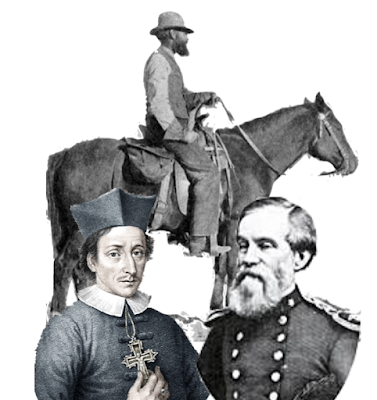 |
| Clockwise from lower right: JH Simpson, Nicolas Steno, GK Gilbert. |
 |
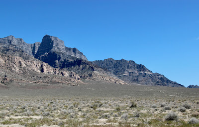
| House Range from the west. |
Simpson had become extremely cautious about traversing unknown territory. He would first send ahead a small "guide party" to locate the next available water; one man was to come back with directions. However when the expedition was crossing White Valley (now Tule Valley) west of the House Range, no one from the guide party returned! Simpson wrote in his journal, "Begin to feel very uneasy, and have, therefore, directed Sergeant Barr, Private Collamer, and Sanchez, the Mexican, to examine the country ... and see if we can get our wagons to water." If they met the guide party, a man would return to the expedition "and report the facts."
Sargeant Barr reappeared at 11 pm, after riding 40 miles. He had found a note to Capt. Simpson "stuck in a cleft-stick near a rush pond" explaining there was water 10 miles beyond to the east. But Simpson didn't trust a note with vague directions. They continued on but only as far as the rush pond. Later that day Simpson scanned the House Range with his "reconnoitering glass" and spotted two men coming toward them. It was Collamer assisting a member of the guide party, who had been two days without food and forced to walk when his horse gave out.
After camping at the rush pond, they followed "the old Mormon road" to the mouth of a canyon in the House Range. Simpson was much impressed. "The bluffs at the entrance of this cañon are tremendously high and massive; that on the right very high, probably 1,500 feet, and like a dome. Call the cañon therefore, Dome Cañon".
The going was easy except for a minor steep section near the crest. Two miles beyond, they camped at a site with much grass and "a fine cold spring of good water". The next day they met the rest of the guide party, recovering at a water hole east of the House Range after several days without food and water. No wonder Simpson considered the Great Basin first and foremost a land of many mountains and little water (Simpson 1876).
 |
| Great Basin during mid to late Cambrian time; trilobites not to scale :) |
How different it was 500 million years ago! At that time, there was nothing but water—an immense sea—and no mountains in sight. Instead, material for making mountains was accumulating on the seafloor.
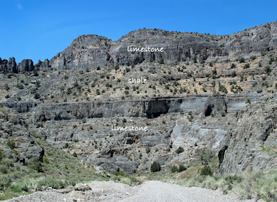
This was the time of the colossal Sauk Transgression, when global sea level rose enough to inundate most of Laurentia, predecessor of North America. The area that would become today's House Range lay in shallow warm water on the continental shelf. The beds of sand, silt, mud, and muck that accumulated to great thickness (2) are now layered rock far above the sea—Simpson's "well-defined stratification".
I agree with Simpson. The House Range struck me as conspicuously and thoroughly layered, from the thick formations exposed on the west face to finely-banded rocks like those at my campsite.
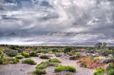 |
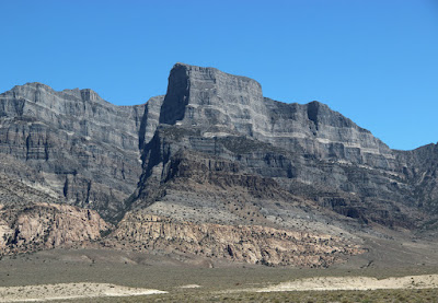
| Stratified west face of the House Range. "Spring Storm in the Great Basin" by Larry Crist. |
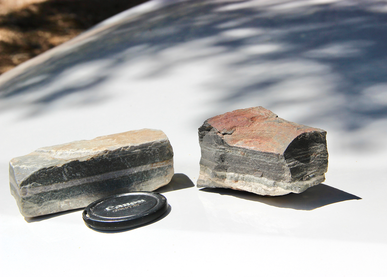 |
| Mementos. |
In the presence of so much stratification, how could I not think of the great Nicolas Steno?! In the mid 1600s, Steno spent a lot of time looking at layered rocks in the mountains of Italy. We would call him a geologist, but at that time, the discipline of geology didn't exist. He had only his observations, smarts, and common sense to help him understand God's work (3).
Steno observed that layered rocks were made of sediments, which had accumulated in horizontal layers, for example on lake bottoms and stream beds. He concluded that even after being turned to rock, the layers would remain horizontal unless something drastic happened. This is Steno's law of original horizontality, a basic principle of geology.
 |
| House Range from the west (source; modified). |
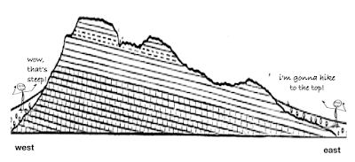 |
| Simplified cross-section through the House Range, showing eastward dip of strata. |
Steno was familiar with tilted rock layers, and knew this was not their original state. “I have seen that the earth is composed of layers superimposed on each other at an angle to the horizon.” However, “… strata either perpendicular to the horizon or inclined to it, were at one time parallel to the horizon.” In other words the Earth has changed since God's creation.
About 300 years later, another geologist—Grove Karl Gilbert—was faced with explaining strata that were tilted in an unexpected way, for example, in the House Range. In the early 1870s, he was studying the Basin Range System (4) while part of Lieut. Geo. M. Wheeler's "Surveys West of the One Hundredth Meridian" (1875). Gilbert planned his travels to maximize the number of mountain ranges he crossed. He was astonished by what he found. "The study of these cross-sections, both in the field and afterward, has led the writer to change materially his preconceived ideas in respect to the structure of the mountains ..."
In his report, Gilbert devoted three pages to this puzzle. "In the great majority of the ranges I have just described ... the beds exhibit in cross-section but a single direction of dip" (italics mine). These were not the symmetrical anticlines he had been trained to expect. "The labors of the Pennsylvania geologists have rendered so familiar the structure of the Appalachians, that it has been by many accepted as typical of all mountains ... Indeed, I entered the field with the expectation of finding in the ridges of Nevada a like structure, and it was only with the accumulation of difficulties that I reluctantly abandoned the idea."
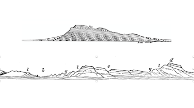 |
| GK Gilbert's diagrams of the House Range. Top, cross-section looking north; bottom, west face. |
A full explanation eluded Gilbert, yet felt he had seen enough that "some light, at least, may be thrown on it". "We may say, without fairly entering the field of speculation, that the forces which have been concerned in the upheaval of the basin ranges have been uniform in kind over large areas; that whatever may have been their ultimate sources and directions, they have manifested themselves at the surface as simple agents of uplift, acting in vertical, or nearly vertical, planes ..." (5).
In the 150 years that have passed, geologists have made great progress in understanding Basin and Range uplifts. The region has been stretching for something like 30 million years, enough to double the distance between Salt Lake City and Reno. In a nutshell, extension has fractured the crust, uplifting blocks along steep faults (DeCourten & Biggar 2017). The result is an extensive system of parallel ranges, often faulted on one side, and generally trending northerly. The House Range is a fine example.
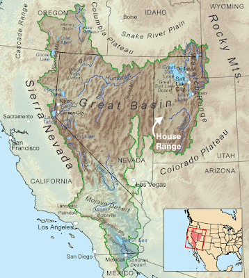 |
| Great Basin map (source; House Range added). |
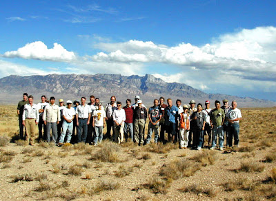 |
| International Subcommission on Cambrian Stratigraphy at the House Range, 1999. James St. John photo. |
 |
| View west down Dome Canyon from near the crest of the House Range; strata are carbonates. |


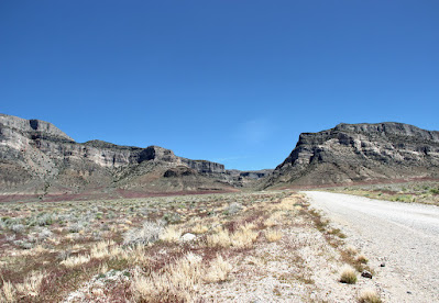 |
| Looking east from Tule Valley toward the mouth of Marjum Canyon. |
 |
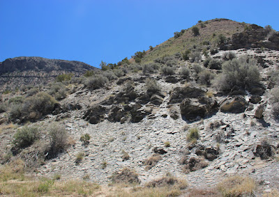
| Remnants of a Cambrian sea in Marjum Canyon. |
 |
| This shale is gray, but it reflects light so well that my camera couldn't capture the true shade. |


 |
| High point is Notch Peak, 9,658 ft asl. |
 |
| Pale pinkish tan outcrops at base are a granitic intrusion (subject of a future post). |
 |
| Surprise! Water in Tule Valley!! |
Notes
(1) Like Sherman Alexi, "I don't believe in ghosts. But I see them all the time."
(2) How did so much sediment accumulate in shallow water? Current thinking is that the seafloor subsided under the weight of the thick sediments (DeCourten 2022).
(3) Steno, a devout Catholic, found that his discoveries sometimes conflicted with the Old Testament. He concluded that the Bible was not to be taken literally, that it was an imperfect work of Man. In contrast, science could perfect our understanding of God's work.
(4) In his 1875 report, Gilbert introduced "Basin Range System" (today's Basin and Range Province) to avoid the drainage criteria of the Great Basin. The two areas overlap but are not the same.
(5) Gilbert's discussion of his struggle to explain Basin and Range uplifts is fascinating. See "Report upon United States Geographical surveys west of the one hundredth meridian" v. 3, pp. 40–42 (Structure of Ridges.)
Sources
DeCourten, F. 2022. The Great Basin Seafloor. University of Utah Press. Supplemental Field Guide (PDF) available online.
DeCourten, F, and Biggar, N. 2017. Roadside Geology of Nevada. Mountain Press Publishing Co.
Gilbert, GK. 1875. Report upon the Geology of portions of Nevada, Utah, California, and Arizona, examined in the years 1871 and 1872 in Wheeler, GM. Report upon United States Geographical surveys west of the one hundredth meridian v. 3. Washington [D.C.], G.P.O. Biodiversity Heritage Library.
Hintze, LF, and Davis, FD. 2003. Geology of Millard County, Utah. Utah Geo. Surv. Bull. 133.
Hintze, LF, and Robison, RA. 1987. The House Range, western Utah: Cambrian Mecca. GSA Centennial Field Guide—Rocky Mountain Section; v. 2: 257–260.
Simpson, JH (US Army). 1876. Report of explorations across the great basin of the territory of Utah for a direct wagon-route from Camp Floyd to Genoa, in Carson Valley, in 1859, by Captain J. H. Simpson ...: Making of America Books, U Michigan.
Steno, N. 1671. The Prodromus to a dissertation concerning solids naturally contained within solids. Laying a foundation for the rendering a rational account both of the frame and the several changes of the masse of the Earth, as also of the various productions in the same. [English translation]
What a fun adventure...and beautiful scenery, too!
ReplyDelete