 |
Angry Finger, one of many. Gods were nowhere to be seen.
|
 |
More angry fingers, on right and distant left (source).
|
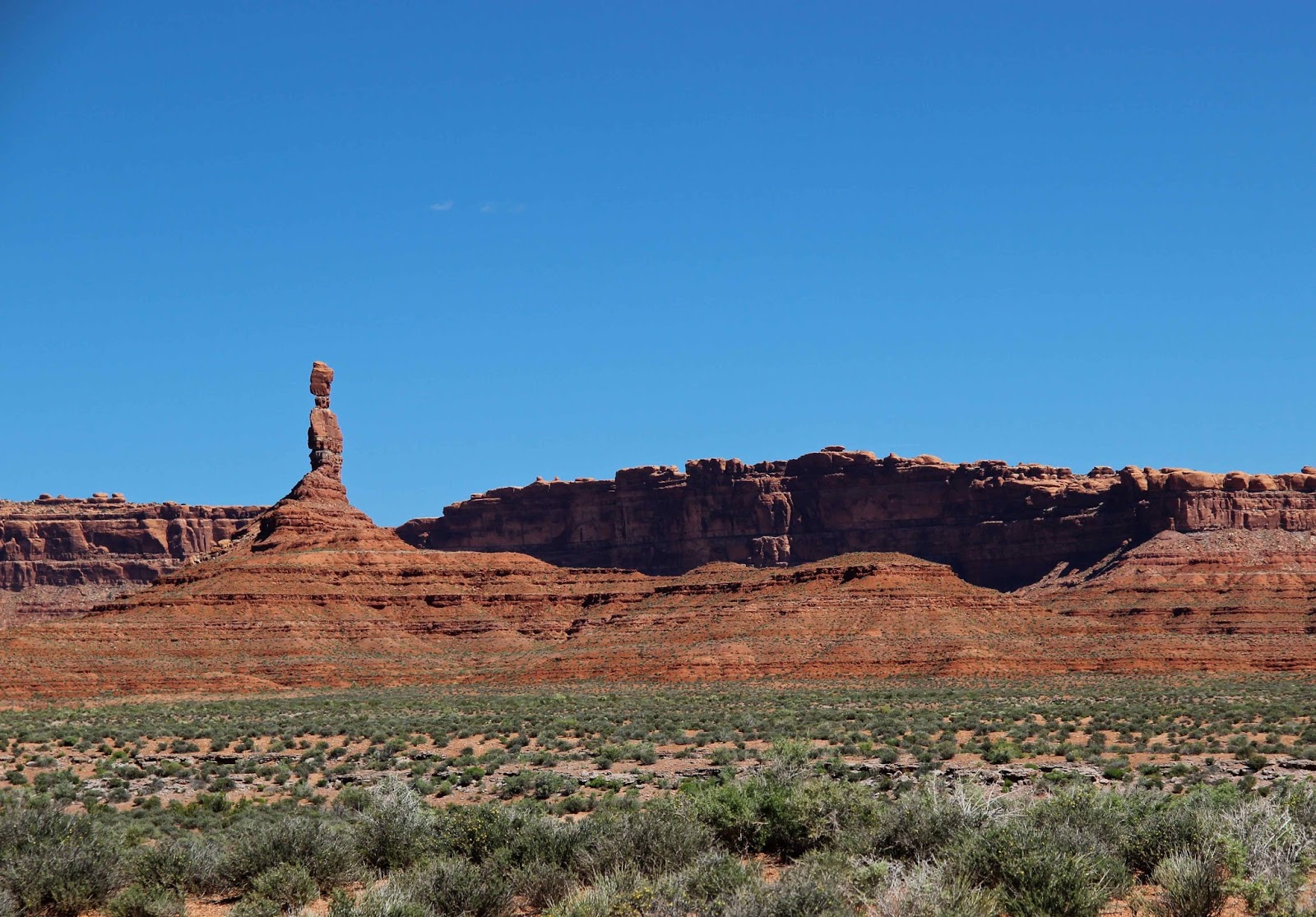
We're in the habit of naming rock outcrops that have suggestive shapes. There are plenty here, thanks to the erosion-resistant Cedar Mesa sandstone, which provides protective caps for softer Cutler rocks. Santa Claus, Rudolph, a rooster, a setting hen, a bell, a battleship, seven sailors, and De Gaulle and his troops all reside in the Valley of the Gods, which prompted the question: “where are the gods?” Then I came upon the Lady in the Bathtub and was really puzzled.
 |
That's the Lady in the Bathtub?!
|
Turned out my perspective was wrong, as I had driven in from the west. I needed to go a little farther, and a little further around the bend. There she was … a Cedar Mesa beauty luxuriating in a Cutler bathtub.


More interesting to me was the curious feature in the rock layers near the base of her bathtub – this is the geo-challenge (I have no answer at this point).

These are typical lower Cutler beds, with alternating layers of mudstone, sandstone and limestone. Was there a depression in the surface where the sand and limy sediments were deposited? Or was the underlying layer deformed later? Any modern-day examples?
Sources (in addition to links in post)
Fillmore, Robert. 2011. Geological evolution of the Colorado Plateau of eastern Utah and western Colorado. Salt Lake City: University of Utah Press.
Soft-sediment deformation related.to compaction. It looks like a preserved channel that downcut previous layers along the right side. However the left side shows displament of contacts along a fault above this side of the channel. The beds look to have been deformed by this faulting. Perhaps the displacement is a result of compaction of the sediments in this old channel?
ReplyDeleteVery interesting, thanks. I totally missed the fault, which looks pretty obvious now! So channel cutting, deposition in channel, compaction, faulting at a later time (continues through sandstone layer above) with more deformation in the process?
DeleteThere's a lot of fracturing in this area, attributed to Laramide folding, eg in Comb Ridge and Raplee anticline nearby. So maybe that's the cause of the displacement ... fun to think about anyway.
I fully concur with John's interpretation. It seems to be a channel scour-and-fill feature modified by compaction. It would be good to know the lithologies of the various beds, and the scale, and to some extent the perspective. I initially saw the apparent offset in the overlying beds but wondered if it could be a perspective trick (left side of the "bathtub" closer to the camera than the right side) but looking at the shadows and the position directly above the left edge of the channel feature, I think it's a real fault.
ReplyDeleteIt would be nice to know the specific lithologies because typical channel-fill material is sandstone or gravel, which isn't very compactable material compared to shale or some other lithologies. That makes me wonder why there would be enough compaction to affect the overlying beds. One idle thought occurs to me that, if these rocks were laid down in an arid environment(?), the channel could have been cut first (storm, flash flood), then abandoned and accumulated some evaporites (salt, gypsum) prior to the final filling event by the sediments of the overlying bed. Subsequent solution of the evaporites would then accomodate collapse of the overlying beds. Nice photos of nice rocks!
—Howard Allen
Interesting. The Cutler environment was thought to be arid, and there's plenty of salt deformation in the area (Paradox Formation is not far below the Cutler). I believe the deformed strata are mainly mudstone, with sandstone and thin limestone above. Thanks, Howard!
DeleteThat is an incredibly beautiful part of the country. It's been many years since I've been through there, and I'm feeling like I'd like to visit it again soon. Thanks for sharing the beauty and the great information!
ReplyDelete